Sharon Heights in Menlo Park in San Mateo County, California — The American West (Pacific Coastal)
St. Denis Church and Cemetery
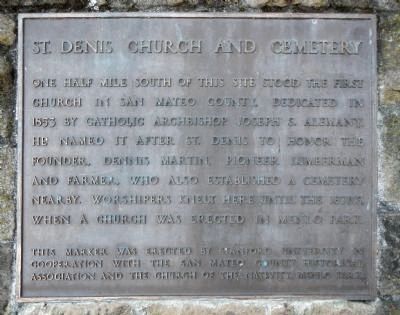
Photographed by Barry Swackhamer, March 20, 2014
1. St. Denis Church and Cemetery Marker
Erected by Stanford University in cooperation with the San Mateo County Historical Association and the Church of the Nativity, Menlo Park.
Topics. This historical marker is listed in this topic list: Religion & Religious Structures. A significant historical year for this entry is 1853.
Location. 37° 25.228′ N, 122° 13.086′ W. Marker is in Menlo Park, California, in San Mateo County. It is in Sharon Heights. It is at the intersection of Sand Hill Road and Sand Hill Circle, on the left when traveling west on Sand Hill Road. Touch for map. Marker is at or near this postal address: 2951 Sand Hill Road, Menlo Park CA 94025, United States of America. Touch for directions.

Regionally, this marker is in California’s San Francisco Bay Area, in Silicon Valley, and on the Coast
this page online
Other nearby markers. At least 8 other markers are within 3 miles of this marker, measured as the crow flies: Independence Hall (approx. 1.9 miles away); Pioneer Hotel (approx. 1.9 miles away); Town of Searsville (approx. 1.9 miles away); Ancient Ohlone Villages (approx. 2 miles away); Development of Motion Pictures (approx. 2.1 miles away); A Road Well Traveled (approx. 2.2 miles away); First Saw Mill (approx. 2.3 miles away); Papua New Guinea Sculpture Garden (approx. 2½ miles away).
More about this marker. This marker is located on a small, 'business park' portion of Sand Hill Road that parallels, on the south side, the main Sand Hill Road.
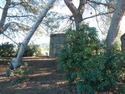
Photographed by Barry Swackhamer, March 16, 2014
2. St. Denis Church and Cemetery Marker
Credits. This page was last revised on January 21, 2026. It was originally submitted on March 21, 2014, by Barry Swackhamer of Brentwood, California. This page has been viewed 1,057 times since then and 75 times this year. Last updated on January 20, 2026, by James King of San Miguel, California. Photos: 1, 2. submitted on March 21, 2014, by Barry Swackhamer of Brentwood, California. • Devry Becker Jones was the editor who published this page.
