
Aiken in Aiken County, South Carolina — The American South (South Atlantic)
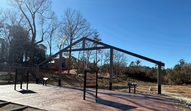
A View toward Aiken

The Solution
Engineers of the Charleston to Hamburg railroad built an Inclined Plane just like this to overcome the steep slope down to Hamburg.
What Exactly Is an Inclined Plane?
An inclined plane is a simple machine that connects a lower elevation to a higher elevation with a sloping surface - in other words it's a ramp!
Inclined planes or ramps help us to move objects from one elevation to another.
A Natural Bottle Neck
The Inclined Plane created a bottle neck on the Charleston to Hamburg railroad. Often passengers had to wait for hours or even overnight for their turn to ride down to Hamburg. At that time, there was no Town of Aiken, just a small crossroads. Soon taverns and inns began to spring up to provide services to folks stuck in waiting.
"There is always a scuffle amongst these landlords for the patronage of the passengers. when the Cars arrived there was a fellow present bowing and inviting the passengers—'Gentlemen will you walk to Major Marshe's? It was the first time I had ever seen strangers invited to a tavern in that manner."
- James Davidson, an earlier traveler to Aiken
Did You Know?
Inclined
this page online
[Captions:]
The trade-off is the object must travel a longer distance than if it was picked straight up. The more gradual the slope, the less effort is needed.
The sloping surface — the tracks — supports the weight of the object — the train. This reduces the amount of force it takes to move up hill.
A typical trip from Charleston to Aiken in 1837 was $6.75.
The Belmont Inclined Plane on the Philadelphia and Columbia Railroad near Philadelphia, PA.
Erected 2022 by the City of Aiken and the Hitchcock Woods Foundation with additional support from the Aiken Land Conservancy and Aiken Streetscapes.
Topics and series. This historical marker is listed in these topic lists: Industry & Commerce • Railroads & Streetcars. In addition, it is included in the Baltimore and Ohio Railroad (B&O) series list. A significant historical year for this entry is 1837.
Location. 33° 33.371′ N, 81° 43.657′ W. Marker is in Aiken, South Carolina,


Regionally, this marker is in Greater Augusta and in the Midlands. It is also in the American South and specifically in the Deep South. Globally, it is in North America, the Western Hemisphere, the Western World, and the Anglosphere. Historically, it finds itself in what was once the territory of the Mississippian Culture, one of the original Thirteen Colonies, one of the Confederate States of America, and the Antebellum South.
Other nearby markers. At least 8 other markers are within walking distance of this marker: Operating the Inclined Plane (here, next to this marker); How Did it all Happen? (here, next to this marker); Powering the Inclined Plane (here, next to this marker); Unearthing the Inclined Plane (a few steps from this marker); Aiken and the Inclined Plane (a few steps from this marker); A View to Hamburg (a few steps from this marker); The Trouble with Aiken's Inclined Plane
Credits. This page was last revised on January 22, 2026. It was originally submitted on January 20, 2026, by Devry Becker Jones of Washington, District of Columbia. This page has been viewed 37 times since then. Photos: 1, 2, 3. submitted on January 20, 2026, by Devry Becker Jones of Washington, District of Columbia.
