Nassau, New Providence, The Bahamas — Caribbean Region (Atlantic Ocean)
The Queen’s Staircase

Photographed by Diane Murphy, January 21, 2026
1. The Queen’s Staircase Marker
Named for Queen Victoria who became queen of the United Kingdom in 1837, the Queen's Staircase was chiselled from solid limestone circa 1830s by free men of African descent. Also known as "The 66 Steps," the staircase was built in the remains of a stone quarry and stands at 31m tall. The steps serve as public access between Fort Fincastle and the city of Nassau. Over time indiscriminate paving has reduced the number of steps to 64.
This iconic site not only serves as a physical connection between the fort community and the city but also as a powerful reminder of the island's past. Today, the Queen's Staircase stands as a popular tourist attraction and a symbol of resilience, highlighting the enduring spirit of the Bahamian people.
Erected 2024.
Topics. This historical marker is listed in this topic list: Forts and Castles. A significant historical year for this entry is 1837.
Location. 25° 4.376′ N, 77° 20.251′ W. Marker is in Nassau, New Providence. It is on Greenwich Street north of Prison Lane, on the right when traveling north. Touch for map. Touch for directions.

Regionally, it is on the Atlantic Ocean, in
this page online
Other nearby markers. At least 6 other markers are within 11 kilometers of this marker, measured as the crow flies: Fort Fincastle (about 120 meters away, measured in a direct line); The Bahamas Memorial Cenotaph (approx. half a kilometer away); Sir George Gamblin Memorial (approx. 0.6 kilometers away); The Bahamas Grant (approx. 0.6 kilometers away); John Watling's Distillery (approx. 1.2 kilometers away); The Caves (approx. 11.4 kilometers away).
Another marker is no longer nearby. Hand-Cut Well (was approx. 1.2 kilometers away but has been replaced with another marker now near it).

Photographed by Diane Murphy, April 2024
2. The Queen’s Staircase Marker
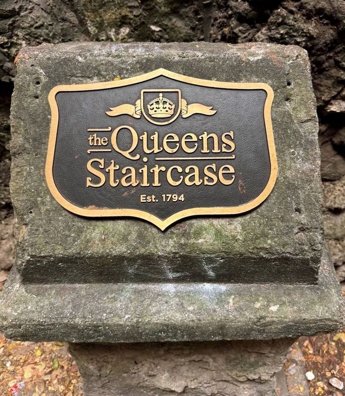
Photographed by Diane Murphy, April 1, 2024
3. The Queen’s Staircase Tablet
Credits. This page was last revised on February 2, 2026. It was originally submitted on January 21, 2026, by Diane Murphy of Saint Cloud, Florida. This page has been viewed 74 times since then. Photos: 1, 2, 3. submitted on January 21, 2026, by Diane Murphy of Saint Cloud, Florida. • J. Makali Bruton was the editor who published this page.
