Near Kirvin in Freestone County, Texas — The American South (West South Central)
Caney Baptist Church
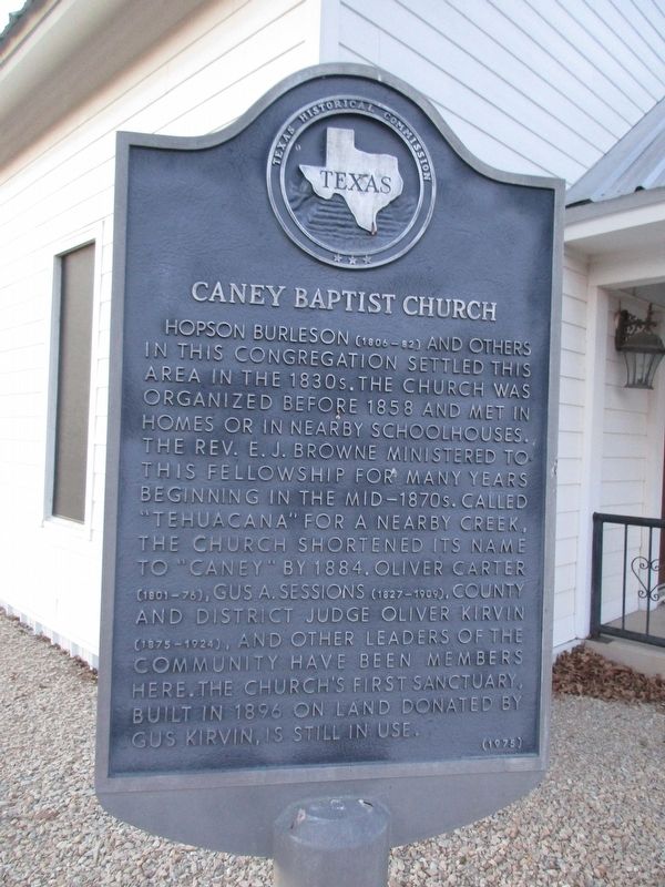
Photographed by Jeff Leichsenring, January 19, 2026
1. Caney Baptist Church Marker
Erected 1975 by Texas Historical Commission. (Marker Number 9866.)
Topics. This historical marker is listed in this topic list: Religion & Religious Structures. A significant historical year for this entry is 1858.
Location. 31° 48.026′ N, 96° 18.042′ W. Marker is near Kirvin, Texas, in Freestone County. It is on Farm to Market Road 833 half a mile east of Farm to Market Road 80, on the right when traveling west. Touch for map. Marker is at or near this postal address: 438 FM 833, Kirvin TX 75848, United States of
this page online

Regionally, this marker is in the Prairies & Lakes Region. It is also in the American South. Globally, it is in North America, a Gulf of Mexico state, the Western Hemisphere, the Western World, and the Anglosphere. Historically, it finds itself in what was once New Spain, the Republic of Texas, one of the Confederate States of America, and the Antebellum South.
Other nearby markers. At least 8 other markers are within 5 miles of this marker, measured as the crow flies: Sessions Cemetery (approx. 2.4 miles away); Site of Woodland College for Boys (approx. 2.7 miles away); Woodland Cemetery (approx. 2.7 miles away); Woodland Heritage (approx. 2.7 miles away); Shiloh Primitive Baptist Church and School (approx. 3 miles away); Homesite and Burial Place of General Joseph Burton Johnson (approx. 4.1 miles away); Grange Hall Community (approx. 4.8 miles away); Shanks Cemetery (approx. 5.1 miles away). Touch for a list and map of all markers in Kirvin.
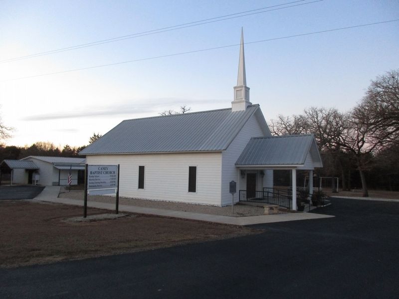
Photographed by Jeff Leichsenring, January 19, 2026
2. Caney Baptist Church and marker
Credits. This page was last revised on January 23, 2026. It was originally submitted on January 21, 2026, by Jeff Leichsenring of Garland, Texas. This page has been viewed 38 times since then. Photos: 1, 2. submitted on January 21, 2026, by Jeff Leichsenring of Garland, Texas. • James Hulse was the editor who published this page.
