Midtown - Downtown in Columbia in Richland County, South Carolina — The American South (South Atlantic)
City Hall
1875
| — | This building is a City of Columbia Historic Landmark | — |

Erected by City of Columbia.
Topics. This historical marker is listed in this topic list: Government & Politics. A significant historical year for this entry is 1875.
Location. 34° 0.541′ N, 81° 2.23′ W. Marker is in Columbia, South Carolina, in Richland County. It is in Midtown - Downtown. It is on Main Street south of Laurel Street, on the left when traveling north. Touch for map. Marker is at or near this postal address: 1737 Main St, Columbia SC 29201, United States of America. Touch for directions.

Regionally, this marker is in the Midlands. It is also in the American South and specifically in the Deep South. Globally, it is in North America, the Western Hemisphere, the Western World, and the Anglosphere. Historically, it finds itself in what was once the territory of the Mississippian Culture, one of the original Thirteen Colonies, one of the Confederate States of America, and the Antebellum South.
Other nearby markers. At least 8 other markers are within walking distance of this marker: The Walls Came Tumbling Down (a few
this page online
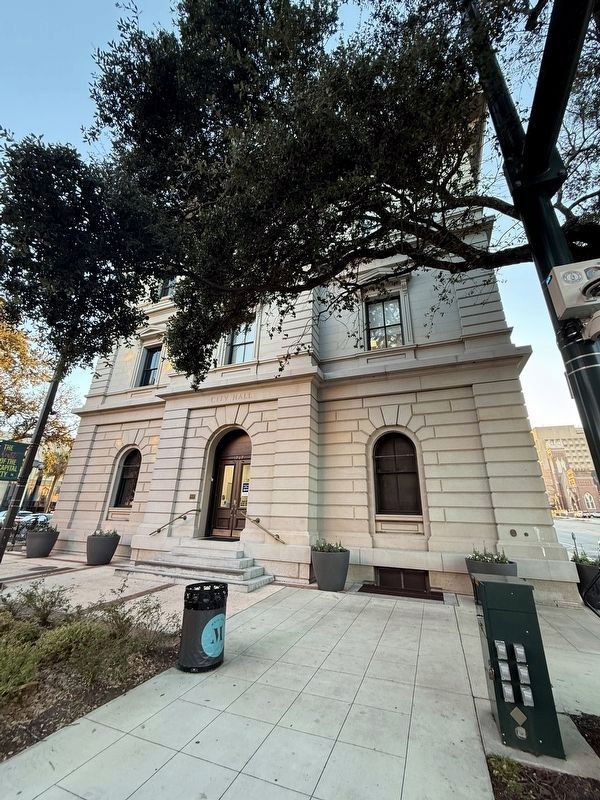
Photographed by Devry Becker Jones (CC0), January 16, 2026
2. Columbia City Hall
National Register of Historic Places Nomination Form
Click for more information.
Click for more information.
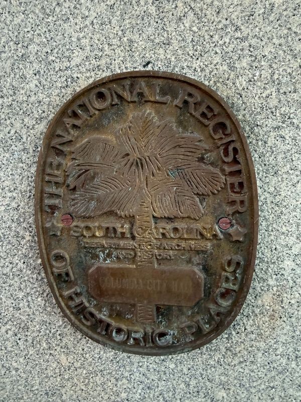
Photographed by Devry Becker Jones (CC0), January 16, 2026
3. National Register of Historic Places plaque for Columbia City Hall
of Historic Places
Columbia City Hall

Photographed by Brian Scott, July 25, 2011
4. Columbia City Hall
Laurel Street Facade
Laurel Street Facade

Credits. This page was last revised on January 24, 2026. It was originally submitted on January 23, 2026, by Devry Becker Jones of Washington, District of Columbia. This page has been viewed 24 times since then. Photos: 1, 2, 3. submitted on January 23, 2026, by Devry Becker Jones of Washington, District of Columbia. 4. submitted on December 26, 2011, by Brian Scott of Anderson, South Carolina. 5. submitted on January 23, 2026, by Devry Becker Jones of Washington, District of Columbia.
