Midtown - Downtown in Columbia in Richland County, South Carolina — The American South (South Atlantic)
Getting to Know Your Neighbors
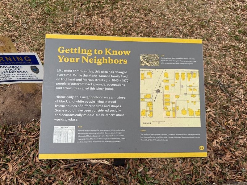
Like most communities, this area has changed over time. While the Mann-Simons family lived on Richland and Marion streets [ca. 1843 - 1970], people of different backgrounds, occupations and ethnicities called this block home.
Historically, this neighborhood was a mixture of black and white people living in wood frame houses of different sizes and shapes. Some would have been considered socially and economically middle-class, others more working-class.
[Captions:]
Left
Federal Census records offer large amounts of information about a community. According to the 1900 Census, people living on this block of Marion Street were almost evenly men and women, black and white. They made their livings as washerwoman, cooks, porters, carpenters, merchants and unskilled laborers.
Left
This detail from the 1872 bird's eye map of Columbia depicts this block during the Reconstruction era [1866 - 1876]. Image courtesy of the Library of Congress
Above
The Sanborn Fire Insurance Company's 1919 map shows how much the neighborhood had developed by the early 20th century. Image courtesy of South Caroliniana Library, University of South Carolina, Columbia
Erected by Historic
this page online
Topics. This historical marker is listed in this topic list: Settlements & Settlers. A significant historical year for this entry is 1843.
Location. 34° 0.738′ N, 81° 2.079′ W. Marker is in Columbia, South Carolina, in Richland County. It is in Midtown - Downtown. It is on Marion Street north of Richland Street, on the right when traveling north. Touch for map. Marker is at or near this postal address: 1407 Richland St, Columbia SC 29201, United States of America. Touch for directions.

Regionally, this marker is in the Midlands. It is also in the American South and specifically in the Deep South. Globally, it is in North America, the Western Hemisphere, the Western World, and the Anglosphere. Historically, it finds itself in what was once the territory of the Mississippian Culture, one of the original Thirteen Colonies, one of the Confederate States of America, and the Antebellum South.
Other nearby markers. At least 8 other markers are within walking distance of this marker: Time to Collect the Rent (a few steps from this marker); From Historic House to Modern Museum (a few steps from this marker);
Credits. This page was last revised on January 24, 2026. It was originally submitted on January 24, 2026, by Devry Becker Jones of Washington, District of Columbia. This page has been viewed 28 times since then. Photos: 1, 2. submitted on January 24, 2026, by Devry Becker Jones of Washington, District of Columbia.
