Camp Shelby in Forrest County, Mississippi — The American South (East South Central)
Dispensary
Interwar & World War II
| — | 1935 | — |
Photographed by James Hulse, January 3, 2026
1. Dispensary Marker
Captions
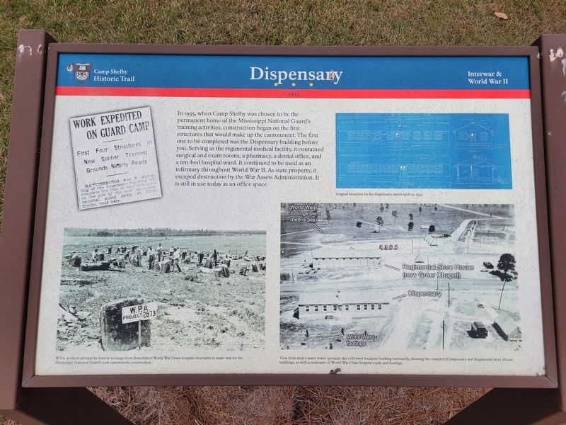
(Photo #1) W.P.A. workers attempt to remove footings from demolished World War I base hospital structures to make way for the Mississippi National Guard's new cantonment construction.
(Photo #2) Original blueprint for the Dispensary, dated April 25, 1935.
(Photo #3) View from atop a water tower (present-day cell tower location) looking eastwardly, showing the completed Dispensary and Regimental Store House buildings, as well as remnants of World War I base hospital roads and footings.
Erected by Camp Shelby Historic
this page online
Topics. This historical marker is listed in this topic list: War, World II. A significant historical date for this entry is April 25, 1935.
Location. 31° 11.961′ N, 89° 13.454′ W. Marker is in Camp Shelby, Mississippi, in Forrest County. It is at the intersection of Jackson Ave W and Forrest Ave W, on the left when traveling north on Jackson Ave W. The marker is located near the grounds of the Mississippi Armed Forces Museum at Camp Shelby. Touch for map. Marker is in this post office area: Hattiesburg MS 39401, United States of America. Touch for directions.

Regionally, this marker is in the Pine Belt. It is also in the American South, specifically in the Deep South, and in the Piney Woods. Globally, it is in North America, a Gulf of Mexico state, the Western Hemisphere, the Western World, and the Anglosphere. Historically, it finds itself in what was once New Spain, the territory of the Mississippian Culture, one of the Confederate States of America, and the Antebellum South.
Other nearby markers. At least 8 other markers are within walking distance of this marker: Store House/Greer Chapel (within shouting distance of

Photographed by James Hulse, January 3, 2026
2. Dispensary and Marker
The view of the marker and building from the street.
More about this marker. The marker and the Mississippi Armed Forces Museum are located at the historic Camp Shelby, an active Mississippi National Guard military installation. The museum is open to the public, but appropriate identification is required for access.
Credits. This page was last revised on January 27, 2026. It was originally submitted on January 24, 2026, by James Hulse of Medina, Texas. This page has been viewed 40 times since then. Photos: 1, 2. submitted on January 25, 2026, by James Hulse of Medina, Texas.
