Arthurtown in Columbia in Richland County, South Carolina — The American South (South Atlantic)
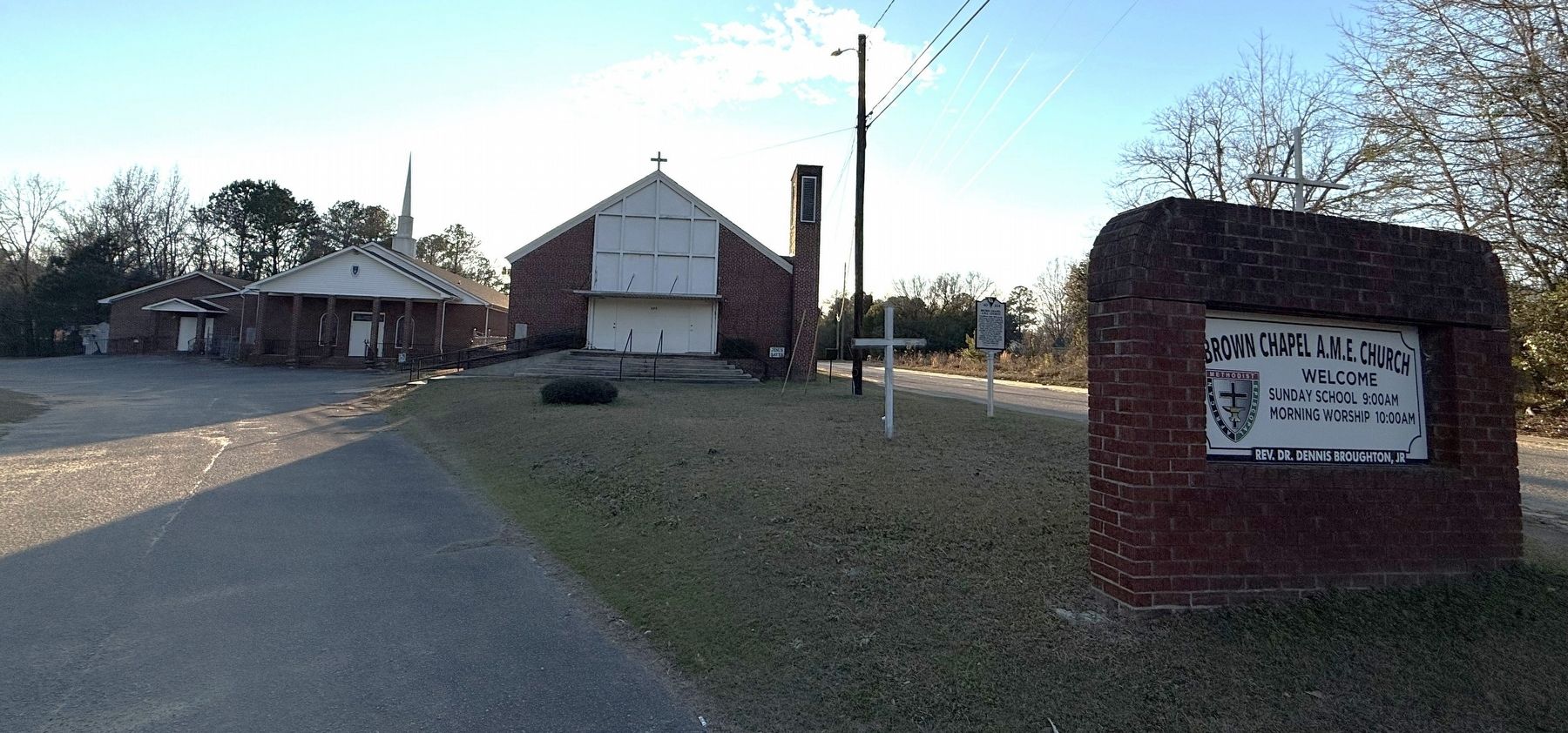
Brown Chapel A.M.E. Church

Tradition holds that early members of Brown Chapel African Methodist Episcopal (A.M.E.) Church worshipped under a brush arbor. The church formally organized by the 1880s. Congregants built their first house of worship at this site around 1895 on land previously owned by the Tolliver family. Bronw Chapel was initially part of the A.M.E. Church's Columbia District and later joined the Lancaster District.
Brown Chapel A.M.E. was founded to serve African American residents of the Arthurtown community. Members built a larger church at this site in 1914. It was replaced in 1958 by a brick building that still stands. In 1959 Brown Chapel acquired nearby Arthurtown Elementary School and used it as an education building and daycare center. It no longer stands. The current educational building dates to 1981 and the church to 2005.
Erected 2023 by South Carolina Department of Archives and History, sponsored by Brown Chapel A.M.E. Church. (Marker Number 40-224.)
Topics and series. This historical marker is listed in these topic lists: African Americans • Education • Religion & Religious Structures. In addition,
this page online
Location. 33° 57.603′ N, 81° 0.199′ W. Marker is in Columbia, South Carolina, in Richland County. It is in Arthurtown. It is on Barnes Street west of Zion Avenue, on the left when traveling west. Touch for map. Marker is at or near this postal address: 811 Barnes St, Columbia SC 29201, United States of America. Touch for directions.

Regionally, this marker is in the Midlands. It is also in the American South and specifically in the Deep South. Globally, it is in North America, the Western Hemisphere, the Western World, and the Anglosphere. Historically, it finds itself in what was once the territory of the Mississippian Culture, one of the original Thirteen Colonies, one of the Confederate States of America, and the Antebellum South.
Other nearby markers. At least 8 other markers are within 2 miles of this marker, measured as the crow flies: The "Columbiad" Cannon (approx. one mile away); African-American Heroes of the 371st Regiment (approx. 1.1 miles away);

Another marker is no longer nearby. Friday’s Ferry (was approx. 1.6 miles away but has been confirmed missing).
Credits. This page was last revised on January 25, 2026. It was originally submitted on January 25, 2026, by Devry Becker Jones of Washington, District of Columbia. This page has been viewed 32 times since then. Photos: 1, 2, 3. submitted on January 25, 2026, by Devry Becker Jones of Washington, District of Columbia.
