
Johnson City in Washington County, Tennessee — The American South (East South Central)
Johnson City
Incorporated - December 1, 1869

Photographed by Mark Parker, January 22, 2026
1. Refurbished Johnson City Marker - New Location
Erected by Tennessee Historical Commission. (Marker Number 1A 93.)
Topics and series. This historical marker is listed in this topic list: Settlements & Settlers. In addition, it is included in the Tennessee Historical Commission series list. A significant historical year for this entry is 1782.
Location. 36° 18.926′ N, 82° 21.169′ W. Marker is in Johnson City, Tennessee, in Washington County. It is at the intersection of Buffalo Street and Tipton Street on Buffalo Street. Touch for map. Marker is at or near this postal address: 119 Buffalo Street, Johnson City TN 37604, United States of America. Touch for directions.

Regionally, this marker is in East Tennessee and
this page online
Other nearby markers. At least 8 other markers are within walking distance of this marker: East Tennessee & Western North Carolina Depot (within shouting distance of this marker); James Hobart Stanton (about 300 feet away, measured in a direct line); Rich-R-Tone Records (about 300 feet away); Summers Hardware (about 400 feet away); Main Street (about 500 feet away); Passing the Torch (approx. 0.2 miles away); Johnson City Post Office (approx. 0.2 miles away); State Flag (approx. 0.2 miles away). Touch for a list and map of all markers in Johnson City.
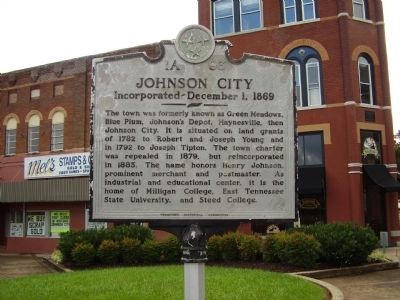
Photographed by Stanley and Terrie Howard, September 27, 2009
2. Johnson City Marker - Old Location
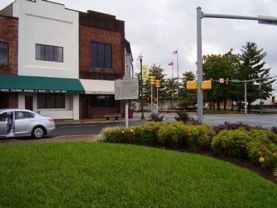
Photographed by Stanley and Terrie Howard, September 27, 2009
3. Johnson City Marker

Photographed by Mark Parker, January 22, 2026
4. Johnson City Marker at Buffalo and Tipton Streets
Credits. This page was last revised on January 26, 2026. It was originally submitted on September 30, 2009, by Stanley and Terrie Howard of Greer, South Carolina. This page has been viewed 1,606 times since then and 98 times this year. Last updated on January 26, 2026, by Mark Parker of Hickory, North Carolina. Photos: 1. submitted on January 26, 2026, by Mark Parker of Hickory, North Carolina. 2, 3. submitted on September 30, 2009, by Stanley and Terrie Howard of Greer, South Carolina. 4. submitted on January 26, 2026, by Mark Parker of Hickory, North Carolina. • James Hulse was the editor who published this page.
