Near Clay in Clay County, West Virginia — The American South (Appalachia)
Dundon, West Virginia
Buffalo Creek Recreational Trail
Photographed by Tom Bosse, September 19, 2025
1. Dundon, West Virginia Marker
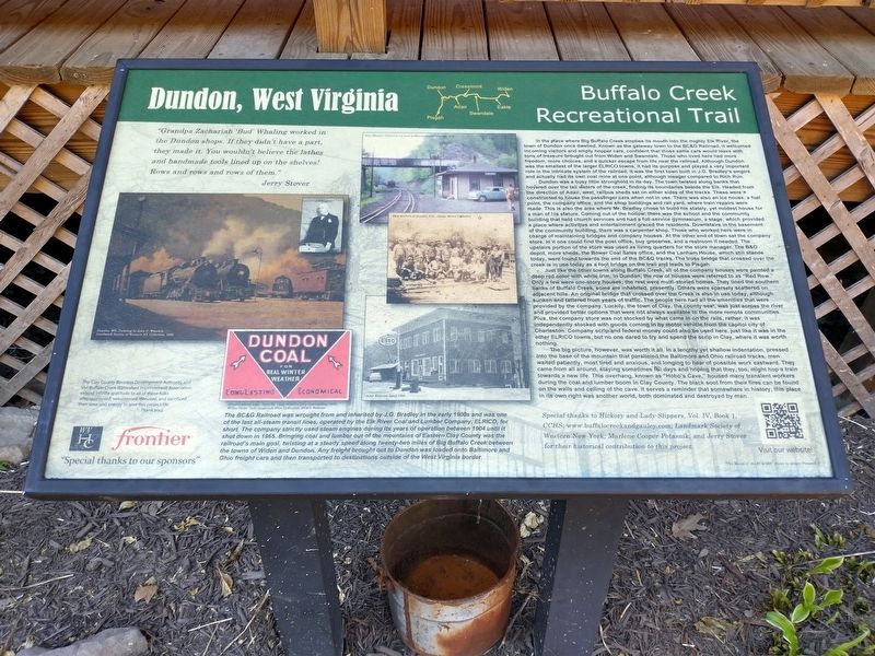
"Grandpa Zachariah 'Bud' Whaling worked in the Dundon shops. If they didn’t have a part, they made it. You wouldn’t believe the lathes and handmade tools lined up on the shelves! Rows and rows and rows of them." Jerry Stover
In the place where Big Buffalo Creek empties its mouth into the mighty Elk River, the town of Dundon once dwelled. Known as the gateway town to the BC&G Railroad, it welcomed incoming visitors and empty hopper cars, confident that those same cars would leave with tons of treasure brought out from Widen and Swandale, those who lived here had more freedom, more choices, and a quicker escape from life near the railroad. Although Dundon was the smallest of the larger ELRICO towns, it had its purpose and played a very important role in the intricate system of the railroad. It was the first town built in J.G. Bradley’s empire and actually had its own coal mine at one point, although meager compared to Rich Run.
Dundon was a busy little stronghold in its day. The town twisted along the banks that hovered over the tail waters of the creek, finding its boundaries beside the Elk. Headed from the direction
this page online

Photographed by Tom Bosse, September 19, 2025
2. Dundon, West Virginia Marker
Marker is located in front of the building to the right of the stairs.
Just like the other towns along Buffalo Creek, all of the company houses were painted a deep red color with white trim. In Dundon, the row of houses were referred to as “Red Row”. Only a few were one-story houses; the rest were multi-storied homes. They lined the southern banks of Buffalo Creek, some are inhabited, presently. Others were sparsely scattered on adjacent hills. An original bridge that crossed over the Creek is also in use today, although sunken and tattered from years of traffic. The people here had all the amenities that were provided by the company. Luckily, the town of Clay, the county seat, was just across the river and provided better options that were not always available to the more remote communities. Plus, the company store was not stocked by what came in on the rails, rather, it was independently stocked with goods coming in by motor vehicle from the capitol city of Charleston. Company scrip and federal money could also be used here, just like it was in the other ELRICO towns, but no one dared to try and spend the scrip in Clay,

Photographed by Tom Bosse, September 19, 2025
3. Dundon, West Virginia Marker
Marker is located in front of the building to the right of the stairs.
The big picture, however, was worth it all. In a lengthy yet shallow indentation, pressed into the base of the mountain that paralleled the Baltimore and Ohio railroad tracks, men waited patiently, most tired and anxious, and longing to hear of possible work eastward. They came from all around, staying sometimes for days and hoping that they, too, night hop a train towards a new life. This overhang, known as “Hobo’s Cave”, housed any transient workers during the coal and lumber boom in Clay County. The black soot from their fires can be found on the walls and ceiling of the cave. It serves a reminder that somewhere in history, this place in its own right was another world, both dominated and destroyed by man.
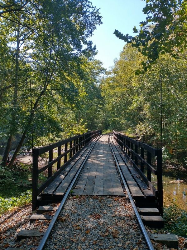
The BGC Railroad was wrought from and inherited by J.G. Bradley in the early 1900s and was one of the last all-steam transit lines, operated by the Elk River Coal and Lumber Company, ELRICO, for short. The company strictly used steam engines during its years of operation between 1904 until it shut down in 1965. Bringing coal and lumber out of the mountains of Eastern Clay County was the railroad’s
Photographed by Tom Bosse, September 19, 2025
4. Tracks used by the BC&G Railroad.
Topics. This historical marker is listed in these topic lists: Railroads & Streetcars • Settlements & Settlers. A significant historical month for this entry is April 1958.
Location. 38° 27.331′ N, 81° 4.071′ W. Marker is near Clay, West Virginia, in Clay County. It is on Buffalo Creek Road north of East Dundon Road, on the left when traveling north. The marker is located at Rail Explorers: Elk River Division. Touch for map. Marker is at or near this postal address: 874 Buffalo Creek Road, Clay WV 25043, United States of America. Touch for directions.

Regionally, this marker is in Greater Charleston Area. It is also in the American South, specifically in the Upper South, in Appalachia, and specifically in Southern Appalachia. Globally, it is in North America, the Western Hemisphere, the Western World, and the Anglosphere. Historically, it finds itself in what was once the territory of the Mississippian Culture.
Other nearby markers. At least 8 other markers are within 2 miles of this marker, measured as the crow flies: Floyd T. Sargent (approx. 0.9 miles away); Old Clay County Courthouse (approx. 0.9 miles away); Clay (approx. 0.9 miles away); Clay County Viet Nam Veterans Memorial (approx. 0.9 miles away); Clay County Korean Veterans Memorial (approx. 0.9 miles away); Clay County WWI & WWII Veterans Memorial (approx. 0.9 miles away); Benjamin L. Stephenson (approx. 0.9 miles away); Union Militias (approx. 1.6 miles away). Touch for a list and map of all markers in Clay.
Also see . . . Buffalo Creek and Gauley Railroad. (Submitted on January 31, 2026, by Tom Bosse of Jefferson City, Tennessee.)
Credits. This page was last revised on February 2, 2026. It was originally submitted on January 31, 2026, by Tom Bosse of Jefferson City, Tennessee. This page has been viewed 105 times since then. Photos: 1, 2, 3, 4. submitted on January 31, 2026, by Tom Bosse of Jefferson City, Tennessee. • Devry Becker Jones was the editor who published this page.
