
Near Avoca in Clay County, West Virginia — The American South (Appalachia)
Adair, West Virginia
Buffalo Creek Recreational Trail
Photographed by Tom Bosse, September 19, 2025
1. Adair, West Virginia Marker
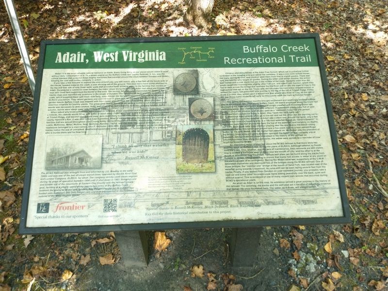
Water: it is the most valuable natural resource on Earth. Every living thing on our planet would cease to exist without daily consumption of it. To a steam engine on the Buffalo Creek and Gauley Railroad, it, too, was the critical element that powered those mighty machines that traveled around the clock between Dundon and Widen, keeping the coal and lumber company in action.
If you take a few minutes to explore the area around you, you will notice, only a few feet off the south side of the tracks, headed towards the creek, a pipe sticking out of the ground. This pipe had a hand pump attached to the top and was one of only three water wells that provided fresh drinking water to the families that resided in Adair. Considered a connector town between the major stops along the railroad, Adair had about six houses. The men who lived here supervised the tracks in this area. The section foreman was responsible for keeping the tracks clean and reported any problems to the shops at Dundon. The families had farm animals, including milk cows, which supplied them with fresh milk daily, even though the dairy at Cressmont sold milk
this page online
When asked why most cemeteries were placed on hillsides, it was explained that if people were not buried on a hillside, the caskets would fill up with water or wash away. Folks who lived in this area, on top of the mountain at Triplett Ridge, and beyond who passed away were most likely buried in the Hamrick Cemetery named after nearby Hamrick’s Run. It was also called Adair Cemetery. Most of the surnames in the cemetery are indicative of families that are spread throughout Clay County today. Some of the names include: Blankenship, Caldwell, Keen, Lewis, McKinney, Miller, Mullins, Neal, Nicholas, Ramsey, Taylor, and Van Kirk. The oldest birthdate
Photographed by Tom Bosse, September 19, 2025
2. Adair, West Virginia Marker
Children attended classes at the Adair Free School, which sat in a shallow hollow northwest of the housing area just below the cemetery. It was a one room school house, like many during its time, and children went there from first to eighth grades. There was only one teacher who taught all grades. During the bitter cold winter months, the school was heated with a coal stove that sat in the middle of the room Students older than 8th grade caught the morning train slightly after 7:00 a.m. and rode it into Dundon, where they had to walk across the bridge that spanned the Elk River and on into the town of Clay to the high school that sat on the hill. Those who did not make the train either skipped school or walked the nearly two and a half mile journey to the top of the hill at Triplett Ridge. If they made it in time, they would catch a school bus that would take them to Clay.
Photographed by Tom Bosse, September 19, 2025
3. Train Wreck on the BC&G Railroad
The spring and summer months brought excitement and seemingly endless outside play to the children who lived along Buffalo Creek. All towns and stops along the creek had shallows in the water where they waded and caught crawfish and minnows. Some had swimming areas. The creek at Adair was different: it possessed a deep hole, full of cool water in which the children (and adults) used as a “swimmin’ hole”. As one person described their experience living in Adair, they “wore the crick bank out”.
Warnings from parents often go in one ear and out the other, but the warning not to play around the top of the waterfall at Adair was a stern one. Around the bend, only a few hundred feet from the housing area, is a 100-foot waterfall known as “Devil’s Sawmill”. It was never reported that anyone fell from the top of the waterfall, and certainly no deaths, but there were close calls from children playing near the site. Notice the bench sitting beside the tracks; this bench was placed here a few years ago for a man named Roger Nutter,
Photographed by Tom Bosse, September 19, 2025
4. Tracks used by the BC&G Railroad.
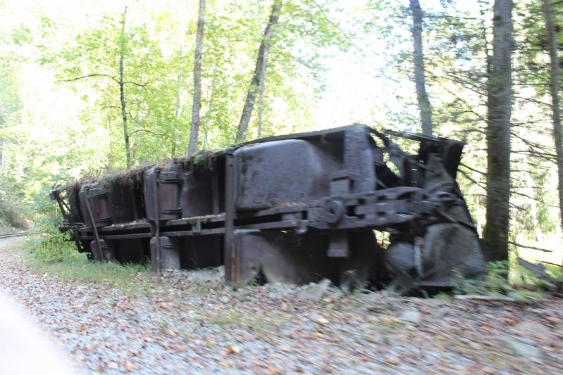
An interesting water-related fact about the BC&G railroad is that there were two working dams on Buffalo Creek during the years of ELRICO. Although tattered by floods from the creek, time weather, and the lack of maintenance, their remnants are still visible. One is located a few miles west of Adair near the mouth of Lilly, and the other is at the mouth of Whetstone near Swandale. Various well sites can be found along the tracks from Dundon to Widen. These were dug to ensure that trains had access to water at any point on the tracks in case of an emergency. During the Widen mine war, supporters of the U.M.W. detonated explosives and destroyed two of the bridges along the BC&G railroad. One of those bridges, the “number one” bridge at the mouth of Sand Fork, was located east of the waterfall going towards Cressmont. Its ruins still can be seen laying several feet from the tracks. Finally, if you walk from Dundon on your eastward journey, you probably saw a coal car and some other inconspicuous items sitting peacefully over the bank, quiet ad without quarrel. This is evidence of one of many violent train wrecks that occurred during BCG’s operational years.
As small as Adair is on the map, its existence served a great purpose in the history of the railroad. The cemetery, the tracks and the well pipe are a handful of remaining evidence that human life once flourished here. The water, as it flows, will always remain.
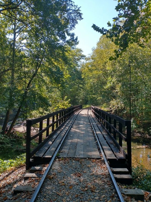
The BGC Railroad was wrought from and inherited by J.G. Bradley in the early 1900s and was one of the last all-steam transit lines, operated by the Elk River Coal and Lumber Company, ELRICO, for short. The company strictly used steam engines during its years of operation between 1904 until it shut down in 1965. Bringing coal and lumber out of the mountains of Eastern Clay County was the railroad’s main goal, twisting at a steady speed along twenty-two miles of Big Buffalo Creek between the towns of Widen and Dundon. Any freight brought out to Dundon was loaded onto Baltimore and Ohio freight cars and then transported to destinations outside of the West Virginia border.
Topics. This historical marker is listed in these topic lists: Railroads & Streetcars • Settlements & Settlers. A significant historical year for this entry is 2015.
Location. 38° 27.378′ N, 81° 0.865′ W. Marker is near Avoca, West Virginia, in Clay County. It is on Hamrick Road (County Road 11/2) south of Triplett Ridge Road (County Road 11), on the left when traveling south. The marker stands near the railroad tracks on the left heading east. Touch for map. Marker is in this post office area: Clay WV 25043, United States of America. Touch for directions.

Regionally, this marker is in Greater Charleston Area. It is also in the American South, specifically in the Upper South, in Appalachia, and specifically in Southern Appalachia. Globally, it is in North America, the Western Hemisphere, the Western World, and the Anglosphere. Historically, it finds itself in what was once the territory of the Mississippian Culture.
Other nearby markers. At least 8 other markers are within 4 miles of this marker, measured as the crow flies: Dundon, West Virginia (approx. 2.9 miles away); Old Clay County Courthouse (approx. 3.7 miles away); Floyd T. Sargent (approx. 3.7 miles away); Clay (approx. 3.7 miles away); Clay County Viet Nam Veterans Memorial (approx. 3.7 miles away); Clay County WWI & WWII Veterans Memorial (approx. 3.7 miles away); Clay County Korean Veterans Memorial (approx. 3.7 miles away); Benjamin L. Stephenson (approx. 3.8 miles away).
Related markers. Click here for a list of markers that are related to this marker.
Also see . . . Buffalo Creek & Gauley Railroad: Map, Roster, Logo, Photos. (Submitted on January 31, 2026, by Tom Bosse of Jefferson City, Tennessee.)
Credits. This page was last revised on February 3, 2026. It was originally submitted on January 31, 2026, by Tom Bosse of Jefferson City, Tennessee. This page has been viewed 48 times since then. Photos: 1, 2, 3, 4. submitted on January 31, 2026, by Tom Bosse of Jefferson City, Tennessee. • Devry Becker Jones was the editor who published this page.
