Matagorda in Matagorda County, Texas — The American South (West South Central)
St. Peter's Baptist Church
Photographed by Dave W, January 31, 2026
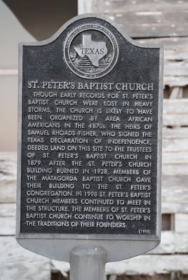
1. St. Peter's Baptist Church Marker
Though early records for St. Peter's Baptist Church were lost in heavy storms, the church is likely to have been organized by area African Americans in the 1870s. The heirs of Samuel Rhoads Fisher, who signed the Texas Declaration of Independence, deeded land on this site to the trustees of St. Peter's Baptist Church in 1879. After the St. Peter's Church building burned in 1928, members of the Matagorda Baptist Church gave their building to the St. Peter's congregation. In 1998 St. Peter's Baptist Church continues to worship in the traditions of their founders.
Erected 1998 by Texas Historical Commission. (Marker Number 12069.)
Topics. This historical marker is listed in these topic lists: African Americans • Religion & Religious Structures • War, Texas Independence. A significant historical year for this entry is 1879.
Location. 28° 41.651′ N, 95° 58.322′ W. Marker is in Matagorda, Texas, in Matagorda County. It is at the intersection of Cedars Street and Austin St W, on the left when traveling north on Cedars Street. Touch for map. Marker is at or near this postal address: 426 Cedars St, Matagorda TX 77457, United States of America. Touch for directions.

Regionally, this marker is in the American South and on the Gulf Coast. Globally, it is in North America, a Gulf of Mexico state, the Western Hemisphere, the Western World, and the Anglosphere. Historically, it finds itself in what was once New Spain, the Republic of Texas, one of the Confederate States of America, and the Antebellum South.
Other nearby markers. At least 8 other markers are within walking distance of this marker: The Culver Home (approx. 0.3 miles away); City of Matagorda (approx. 0.3 miles away); Christ Church (approx. 0.3 miles away); Matagorda Lodge No. 7, A.F. & A.M. (approx. 0.3 miles away); Christ Episcopal Church
this page online
Photographed by Dave W, January 31, 2026
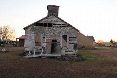
2. St. Peter's Baptist Church Marker
Photographed by Dave W, January 31, 2026
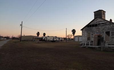
3. St. Peter's Baptist Church Marker
Looking south along Cedar St.
Credits. This page was last revised on February 1, 2026. It was originally submitted on February 1, 2026, by Dave W of Co, Colorado. This page has been viewed 65 times since then. Photos: 1, 2, 3. submitted on February 1, 2026, by Dave W of Co, Colorado. • James Hulse was the editor who published this page.
