
Near Monticello in Jefferson County, Florida — The American South (South Atlantic)
Monticello
Greetings from Jefferson County's
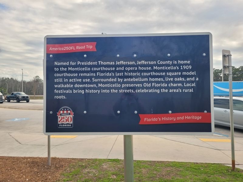
Photographed by James Hulse, January 17, 2026
1. Monticello Marker
Erected by America250FL Road Trip.
Topics. This historical marker is listed in this topic list: Settlements & Settlers. A significant historical year for this entry is 1909.
Location. 30° 26.806′ N, 83° 43.814′ W. Marker is near Monticello, Florida, in Jefferson County. It is on Interstate 10, on the right when traveling west. The marker is located at the I-10 Westbound Rest Stop. Touch for map. Marker is in this post office area: Monticello FL 32344, United States of America. Touch for directions.

Regionally, this marker is in Greater Tallahassee and in North Florida. It is also in the American South and specifically in the Deep South. Globally, it is in the North Atlantic Region, North America, a Gulf of Mexico
this page online
Other nearby markers. At least 8 other markers are within 11 miles of this marker, measured as the crow flies: Florida Honors and Remembers our POW’s and MIA’s (here, next to this marker); a different marker also named Florida Honors and Remembers our POW’s and MIA’s (approx. 0.3 miles away); Ray Charles Childhood Home (approx. 5.6 miles away); The Town of Greenville (approx. 6.1 miles away); Lamont Community (approx. 6.9 miles away); Howard Academy Elementary and Junior High School (Later Howard Academy High School) Second Street (approx. 10 miles away); The Girardeau House (approx. 10.4 miles away); Livingston Place (approx. 10.4 miles away). Touch for a list and map of all markers in Monticello.

Photographed by James Hulse, January 17, 2026
2. Monticello Marker - Reverse Side

Photographed by James Hulse, January 17, 2026
3. Monticello Marker
The view of the marker at the rest stop
Credits. This page was last revised on February 10, 2026. It was originally submitted on February 8, 2026, by James Hulse of Medina, Texas. This page has been viewed 63 times since then. Photos: 1, 2, 3. submitted on February 10, 2026, by James Hulse of Medina, Texas.
