Salado in Bell County, Texas — The American South (West South Central)
West Salado Cemetery
Photographed by Keith Peterson, February 2, 2008
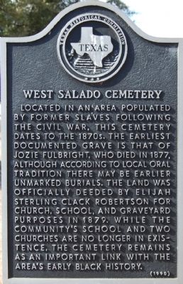
1. West Salado Cemetery Marker
Located in an area populated by former slaves following the Civil War, this cemetery dates to the 1870s. The earliest documented grave is that of Jozie Fulbright, who died in 1877, although according to local oral tradition there may be earlier unmarked burials. The land was officially deeded by Elijah Sterling Clack Robertson for church, school, and graveyard purposes in 1879. While the community's school and two churches are no longer in existence, the cemetery remains as an important link with the area's early black history.
Erected 1990 by Texas Historical Commission. (Marker Number 5761.)
Topics. This historical marker is listed in these topic lists: African Americans • Cemeteries & Burial Sites. A significant historical year for this entry is 1877.
Location. 30° 57.484′ N, 97° 32.181′ W. Marker is in Salado, Texas, in Bell County. It is on West Village Road, on the right when traveling west. Touch for map. Marker is in this post office area: Salado TX 76571, United States of America. Touch for directions.

Regionally, this marker is in Central Texas. It is also in the American South. Globally, it is in North America, a Gulf of Mexico state, the Western Hemisphere, the Western World, and the Anglosphere. Historically, it finds itself in what was once New Spain, the Republic of Texas, and one of the Confederate States of America.
Other nearby markers. At least 8 other markers are within walking distance of this marker: Fowler House (approx. 0.2 miles away); W.R. Berry Carriage House (approx. 0.4 miles away); In Honor of Our Veterans (approx. 0.4 miles away); Alice Gray Hamblen (approx. 0.4 miles away); Boles-Aiken Log Cabin (approx. half a mile away); The Writer's Cabin (approx. half a mile away); Reverend Moses Hampton Denman (approx. half a mile away); M. H. Denman Cabin (approx.
this page online
Photographed by Keith Peterson, February 2, 2008
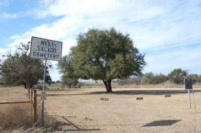
2. West Salado Cemetery
Credits. This page was last revised on November 22, 2020. It was originally submitted on March 29, 2010, by Keith Peterson of Cedar Park, Texas. This page has been viewed 1,493 times since then and 78 times this year. Photos: 1, 2. submitted on March 29, 2010, by Keith Peterson of Cedar Park, Texas. • Kevin W. was the editor who published this page.
