Campobello in Campobello Island, New Brunswick — The Atlantic Provinces (North America)
Summer Activities
Photographed by Beverly Pfingsten, July 18, 2009
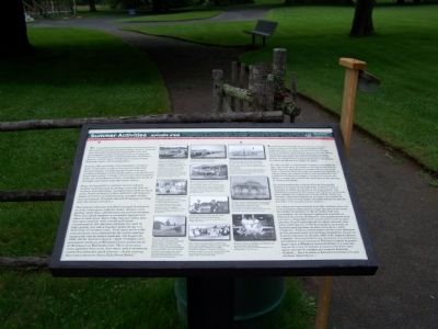
1. Summer Activities Marker
The Campobello hotels welcomed socializing between their guests and the summer cottage owners. Summer colonists and hotel guests exchanged visits and participated in hotel activities such as excursions aboard the company's small steamboats, field days, dances, and the use of tennis and croquet courts, billiards tables and bowling alleys.
During 1881 and 1882, the Campobello Company built a hotel pier, roads to Glensevern Lake and Raccoon Beach, a bridge across Glensevern and another at Eastern Pond, bridle paths, and the Friar's Head observatory. Cottage owners were encouraged to make use of the hotel services, including the rental of carriages and horses from the hotels' livery.
Many of Campobello's summer visitors enjoyed outdoor pastimes such as sailing, canoeing, fishing, walking, and picnicking. Arrangements could be made at the hotels or locally to hire sailboats and skippers. Indoor activities included reading, musical recitals, and card games (Franklin Roosevelt enjoyed working with his stamp collection.)
The summer colonists socialized amongst themselves as well, exchanging visits for meals, dinners,
this page online
Topics. This historical marker is listed in these topic lists: Entertainment • Sports. A significant historical year for this entry is 1881.
Location. 44° 52.598′ N, 66° 57.518′ W. Marker is in Campobello, New Brunswick, in Campobello Island. It can be reached from NB-774 (New Brunswick Route 774). Marker is in Campobello International Park. Touch for map. Marker is at or near
Photographed by Beverly Pfingsten, July 18, 2009
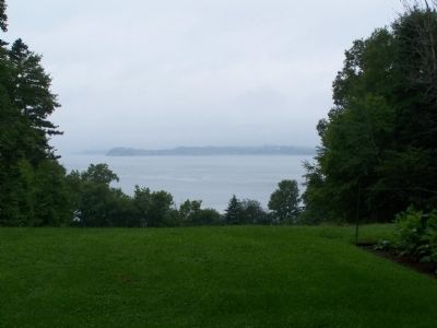
2. Summer boating Activities were held on the bay.

Regionally, this marker is in Charlotte County and the Fundy Isles. It is also in the Maritimes and in Atlantic Canada. Globally, it is in the North Atlantic Region, North America, the Western Hemisphere, the Western World, and the Anglosphere. Historically, it finds itself in what was once a British colony, the Viceroyalty of New France, and Acadia.
Other nearby markers. At least 8 other markers are within walking distance of this marker: Campobello's Resort Hotels (here, next to this marker); The Summer Colony (here, next to this marker); James and Sara Roosevelt Cottage (here, next to this marker); President Franklin Delano Roosevelt (within shouting distance of this marker); Roosevelt Campobello Park (about 210 meters away, measured in a direct line); Passamaquoddy Tidal Power Project (approx. one kilometer away); Mulholland Point / La Pointe Mulholland (approx. one kilometer away); Passamaquoddy Tribe / La Tribu Passamaquoddy (approx. one kilometer away). Touch for a list and map of all markers in Campobello.
Credits. This page was last revised on February 12, 2026. It was originally submitted on December 13, 2009, by Bill Pfingsten of Bel Air, Maryland. This page has been viewed 1,210 times since then and 56 times this year. Last updated on February 12, 2026, by Carl Gordon Moore Jr. of North East, Maryland. Photos: 1, 2. submitted on December 13, 2009, by Bill Pfingsten of Bel Air, Maryland. • Devry Becker Jones was the editor who published this page.
