Near Hallettsville in Lavaca County, Texas — The American South (West South Central)
St. Mary's Parish

Photographed by Dave W, February 14, 2026
1. St. Mary's Parish Marker
Considered the oldest rural Catholic parish in Texas, St. Mary's was settled before the Texas War for Independence by such pioneers as James Brown, who was killed in the siege of the Alamo. First church edifice for St. Mary's was built in 1840 under influence of missionary Fathers George Haydon and Edward A. Clarke, who also opened school for the settlement.
This was one of ten churches comprising Texas' first diocese (Galveston) at its formation in 1847. Many priests' and sisters' vocations have come from this historic parish.
Erected 1971 by State Historical Survey Committee. (Marker Number 5063.)
Topics. This historical marker is listed in these topic lists: Religion & Religious Structures • Settlements & Settlers • War, Texas Independence. A significant historical year for this entry is 1840.
Location. 29° 26.877′ N, 96° 59.804′ W. Marker is near Hallettsville, Texas, in Lavaca County. It is on Farm to Market Road 340 0.1 miles south of Louis Sitka, on the left when traveling north. Touch for map. Marker is at or near this postal address: 1648 FM340, Hallettsville TX 77964, United States of America.
this page online

Regionally, this marker is in the American South and on the Gulf Coast. Globally, it is in North America, a Gulf of Mexico state, the Western Hemisphere, the Western World, and the Anglosphere. Historically, it finds itself in what was once New Spain, the Republic of Texas, one of the Confederate States of America, and the Antebellum South.
Other nearby markers. At least 8 other markers are within 4 miles of this marker, measured as the crow flies: Arthur Henry Vollentine (approx. 0.2 miles away); Brown School (approx. 0.6 miles away); Vysehrad School (approx. 1.6 miles away); The Lay-Bozka House (approx. 3 miles away); William Smothers (approx. 3.1 miles away); Richardson Chapel United Methodist Church (approx. 3.1 miles away); Stacy School (approx. 3.1 miles away); American Legion Hudgeons Post 230 (approx. 3.2 miles away). Touch for a list and map of all markers in Hallettsville.
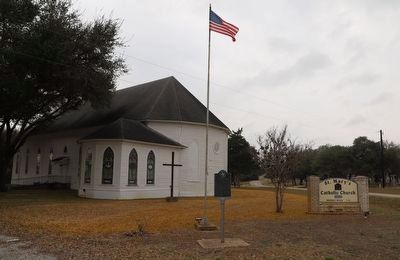
Photographed by Dave W, February 14, 2026
2. St. Mary's Parish Marker
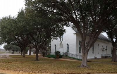
Photographed by Dave W, February 14, 2026
3. St. Mary's Parish Marker
Credits. This page was last revised on February 15, 2026. It was originally submitted on February 15, 2026, by Dave W of Co, Colorado. This page has been viewed 61 times since then. Photos: 1, 2, 3. submitted on February 15, 2026, by Dave W of Co, Colorado. • James Hulse was the editor who published this page.
