Yoakum in Lavaca County, Texas — The American South (West South Central)
Hope Baptist Church
Photographed by Dave W, February 14, 2026
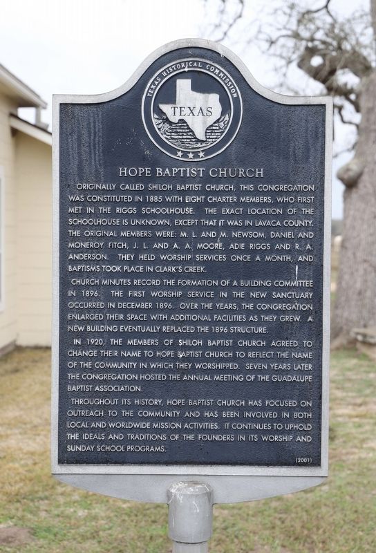
1. Hope Baptist Church Marker
Originally called Shiloh Baptist Church, this congregation was constituted in 1885 with eight charter members, who first met in the Riggs Schoolhouse. The exact location of the schoolhouse is unknown, except that it was in Lavaca County. The original members were: M. L. and M. Newsom, Daniel and Moneroy Fitch, J. L. and A. A. Moore, Adie Riggs and R. A. Anderson. They held worship services once a month, and baptisms took place in Clark's Creek.
Church minutes record the formation of a building committee in 1896. The first worship service in the new sanctuary occurred in December 1896. Over the years, the congregation enlarged their space with additional facilities as they grew. A new building eventually replaced the 1896 structure.
In 1920, the members of Shiloh Baptist Church agreed to change their name to Hope Baptist Church to reflect the name of the community in which they worshipped. Seven years later the congregation hosted the annual meeting of the Guadalupe Baptist Association.
Throughout its history, Hope Baptist Church has focused on outreach to the community and has been involved in both local and worldwide mission activities. It continues to uphold the ideals and traditions of the founders in its worship and Sunday school programs.
Erected 2001 by Texas Historical Commission. (Marker Number 12822.)
Topics. This historical marker is listed in this topic list: Religion & Religious Structures. A significant historical year for this entry is 1885.
Location. 29° 13.076′ N, 97° 0.003′ W. Marker is in Yoakum, Texas, in Lavaca County. It is on County Road 413 0.1 miles north of County Road 414, on the right when traveling east. Touch for map. Marker is at or near this postal address: 152 Co Rd 413, Yoakum TX 77995, United States of America. Touch for directions.

Regionally, this marker
this page online
Other nearby markers. At least 8 other markers are within 8 miles of this marker, measured as the crow flies: The United Methodist Church of Hope (about 400 feet away, measured in a direct line); Nancy Shows (approx. 4.8 miles away); Hebron Community (approx. 4.9 miles away); County Line School, Church, and Cemetery (approx. 5.3 miles away); Terryville (approx. 5½ miles away); Ezzell School (approx. 7½ miles away); William E. Summers (approx. 7½ miles away); Andrew Kent (approx. 7.7 miles away). Touch for a list and map of all markers in Yoakum.
Photographed by Dave W, February 14, 2026
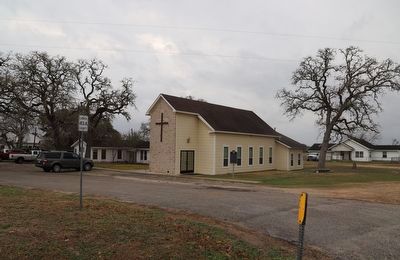
2. Hope Baptist Church Marker
Credits. This page was last revised on February 15, 2026. It was originally submitted on February 15, 2026, by Dave W of Co, Colorado. This page has been viewed 58 times since then. Photos: 1, 2. submitted on February 15, 2026, by Dave W of Co, Colorado. • James Hulse was the editor who published this page.
