Near Yoakum in DeWitt County, Texas — The American South (West South Central)
County Line School, Church, and Cemetery
Photographed by Dave W, February 14, 2026
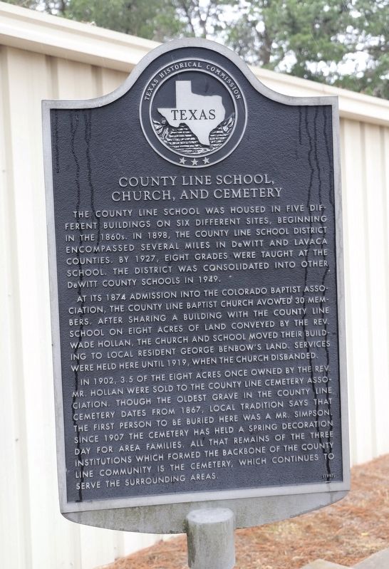
1. County Line School, Church, and Cemetery Marker
The County Line School was housed in five different buildings on six different sites, beginning in the 1860s. In 1898, the County Line School District encompassed several miles in De Witt and Lavaca counties. By 1927, eight grades were taught at the school. The district was consolidated into other De Witt County schools in 1949.
At its 1874 admission into the Colorado Baptist Association, the County Line Baptist Church avowed 30 members. After sharing a building with the County Line School on eight acres of land conveyed by the Rev. Wade Hollan, the church and school moved their building to local resident George Benbow's land. Services were held here until 1919, when the church disbanded.
In 1902, 3.5 of the eight acres once owned by the Rev. Mr. Hollan were sold to the County Line Cemetery Association. Though the oldest grave in the County Line Cemetery dates from 1867, local tradition says that the first person to be buried here was a Mr. Simpson. Since 1907 the cemetery has held a spring decoration day for area families. All that remains of the three institutions which formed the backbone of the County Line community is the cemetery, which continues to serve the surrounding areas.
Erected 1997 by Texas Historical Commission. (Marker Number 11848.)
Topics. This historical marker is listed in these topic lists: Education • Religion & Religious Structures • Settlements & Settlers. A significant historical year for this entry is 1898.
Location. 29° 12.089′ N, 97° 5.124′ W. Marker is near Yoakum, Texas, in DeWitt County. It is on Farm to Market 682 0.2 miles south of County Road 284, on the right when traveling south. Touch for map. Marker is at or near this postal address: 6316 FM 682, Yoakum TX 77995, United States of America. Touch for directions.

Regionally, this marker is in the
this page online
Other nearby markers. At least 8 other markers are within 7 miles of this marker, measured as the crow flies: Terryville (approx. 2.9 miles away); Nancy Shows (approx. 3.9 miles away); Hebron Community (approx. 3.9 miles away); Hope Baptist Church (approx. 5.3 miles away); The United Methodist Church of Hope (approx. 5.3 miles away); Ruins of Brushy Creek Church (approx. 6.4 miles away); First Methodist Church of Yoakum (approx. 6.4 miles away); St. Joseph Catholic Cemetery (approx. 6.4 miles away). Touch for a list and map of all markers in Yoakum.
Photographed by Dave W, February 14, 2026
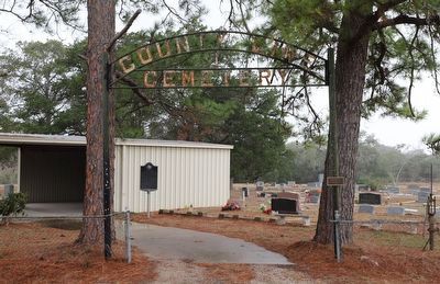
2. County Line School, Church, and Cemetery Marker
Photographed by Dave W, February 14, 2026
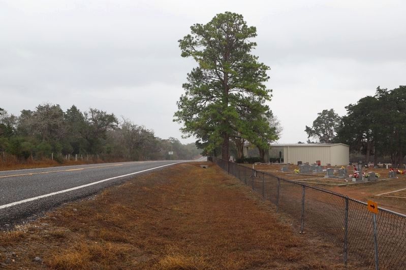
3. County Line School, Church, and Cemetery Marker
Looking southeast along FM 682.
Credits. This page was last revised on February 15, 2026. It was originally submitted on February 15, 2026, by Dave W of Co, Colorado. This page has been viewed 60 times since then. Photos: 1, 2, 3. submitted on February 15, 2026, by Dave W of Co, Colorado. • James Hulse was the editor who published this page.
