Chester in Windsor County, Vermont — The American Northeast (New England)
Chester
Photographed by Steve Stoessel, February 14, 2026
1. Chester Marker
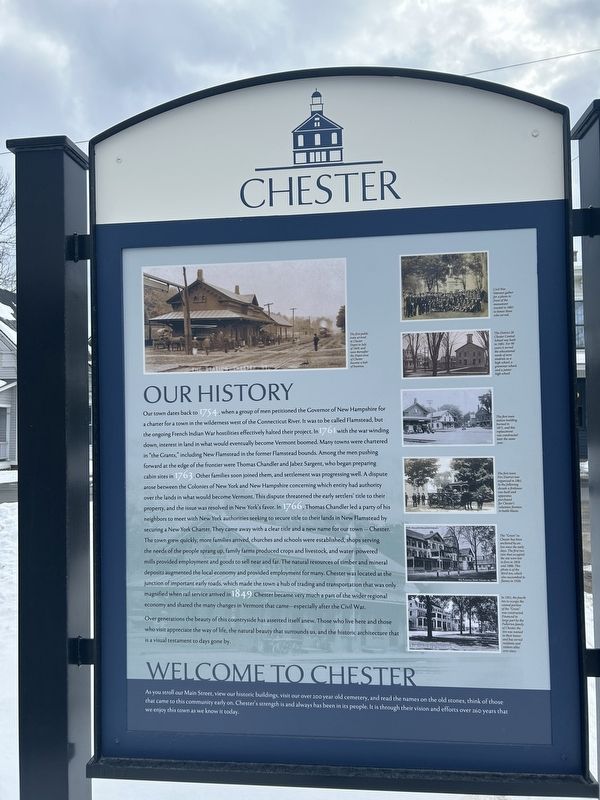
Our History
Our town dates back to 1754, when a group of men petitioned the Governor of New Hampshire for a charter for a town in the wilderness west of the Connecticut River. It was to be called Flamstead, but the ongoing French Indian War hostilities effectively halted their project. In with the war winding down, interest in land in what would eventually become Vermont boomed. Many towns were chartered in "the Grants," including New Flamstead in the former Flamstead bounds. Among the men pushing forward at the edge of the frontier were Thomas Chandler and Jabez Sargent, who began preparing cabin sites in 1763. Other families soon joined them, and settlement was progressing well. A dispute arose between the Colonies of New York and New Hampshire concerning which entity had authority over the lands in what would become Vermont. This dispute threatened the early settlers' title to their property, and the issue was resolved in New York's favor. In 1766, Thomas Chandler led a party of his neighbors to meet with New York authorities seeking to secure title to their lands in New Flamstead by securing a New York Charter.
this page online
Over generations the beauty of this countryside has asserted itself anew. Those who live here and those who visit appreciate the way of life, the natural beauty that surrounds us, and the historic architecture that is a visual testament to days gone by.
Welcome to Chester
As you stroll our Main Street, view our historic buildings, visit our over 200 year-old cemetery, and read the
Photographed by Steve Stoessel, February 14, 2026
2. Chester Marker
[Photo Captions, top to bottom ]:
- Civil War Veterans gather for a photo in front of the monument erected in 1885 to honor those who served.
- The District 20 Chester Central School was built in 1881. For 90 years it served the educational needs of area students as a high school, a grammar school, and a junior high school.
- The first train station building burned in 1871, and this replacement was constructed later the same year.
- The first town Fire District was organized in 1861. In the following decade a firehouse was built and apparatus purchased for Chester's volunteer firemen to battle blazes.
- The "Green" in Chester has been anchored by an Inn since the early days. The first two inns that occupied the site were lost to fires in 1858 and 1888. This photo is of the third inn, which also succumbed to flames in 1920.
- In 1921, the fourth inn to occupy the central portion of the "Green" was constructed. Financed in large part by the Fullerton family of Chester, the inn was named in their honor and has served residents and visitors alike ever since.
Topics. This historical marker is listed in this topic list: Settlements & Settlers. A significant historical year for this entry is 1754.
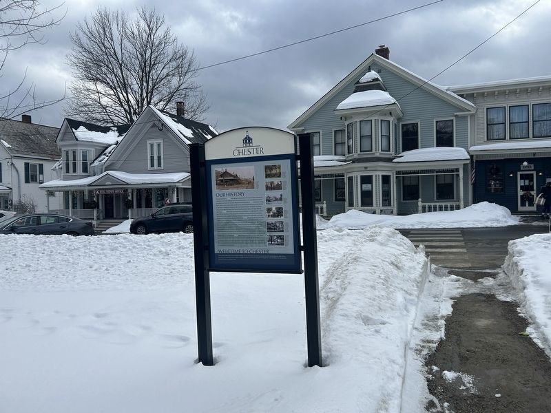
Location. 43° 15.867′ N, 72° 35.931′ W. Marker is in Chester, Vermont, in Windsor County. It is at the intersection of Main Street (Vermont Route 11) and The Common, on the left when traveling west on Main Street. Touch for map. Marker is at or near this postal address: 218 Main St, Chester VT 05143, United States of America. Touch for directions.

Regionally, this marker is in Vermont’s Connecticut River Valley and in the Green Mountains. It is also in the American Northeast and in New England. Globally, it is in North America, the Western Hemisphere, the Western World, and the Anglosphere. Historically, it finds itself in what was once the Vermont Republic.
Other nearby markers. At least 8 other markers are within walking distance of this marker: Merritt Austin Edson (a few steps from this marker); Chester Civil War Memorial (within shouting distance of this marker); Chester Academy / District No. 20 Central School (within shouting distance of this marker); Chester Vietnam Conflict Monument (within shouting distance of this marker); Chester World War I and II and Korean Conflict Monument (within shouting distance of this marker); This Tablet and the Clock in the Tower (approx. ¼ mile away); Chester Depot (approx. half a mile away); North Chester (approx. 0.8 miles away). Touch for a list and map of all markers in Chester.
Also see . . . The New Hampshire grants (Wikipedia).
The New Hampshire Grants or Benning Wentworth Grants were land grants made between 1749 and 1764 by the colonial governor of the Province of New Hampshire, Benning Wentworth. The land grants, totaling about 135 (including 131 towns), were made on land claimed by New Hampshire west of the Connecticut River, territory that was also claimed by the Province of New York. The resulting dispute led to the eventual establishment of the Vermont Republic, which later became the U.S. state of Vermont.(Submitted on February 16, 2026, by Steve Stoessel of Niskayuna, New York.)
Credits. This page was last revised on February 16, 2026. It was originally submitted on February 16, 2026, by Steve Stoessel of Niskayuna, New York. This page has been viewed 71 times since then. Photos: 1, 2. submitted on February 16, 2026, by Steve Stoessel of Niskayuna, New York.
