Santa Fe in Santa Fe County, New Mexico — The American Mountains (Southwest)
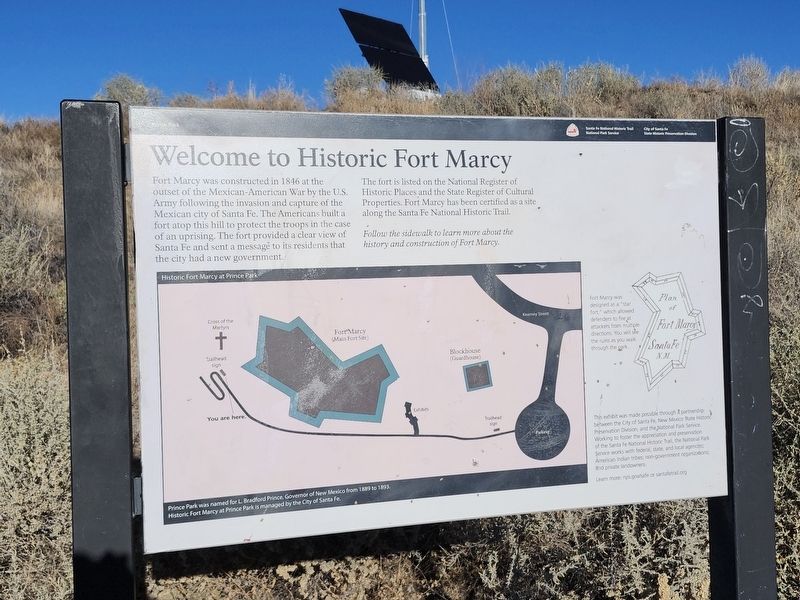
Welcome to Historic Fort Marcy
Prince Park
Santa Fe National Historic Trail
| — | National Park Service | — |
Photographed by J. Makali Bruton, December 13, 2025
1. Welcome to Historic Fort Marcy Marker
Fort Marcy was constructed in 1846 at the outset of the Mexican-American War by the U.S. Army following the invasion and capture of the Mexican city of Santa Fe. The Americans built a fort atop this hill to protect the troops in the case of an uprising. The fort provided a clear view of Santa Fe and sent a message to its residents that the city had a new government.
The fort is listed on the National Register of Historic Places and the State Register of Cultural Properties. Fort Marcy has been certified as a site along the Santa Fe National Historic Trail.
Follow the sidewalk to learn more about the history and construction of Fort Marcy.
Fort Marcy was designed as a "star fort" which allowed defenders to fire at attackers from multiple directions. You will see the ruins as you walk through the park.
This exhibit was made possible through a partnership between the City of Santa Fe, New Mexico State Historic Preservation Division, and the National Park Service. Working to foster the appreciation and preservation of the Santa Fe National Historic Trail, the National Park Service works with federal, state, and
this page online
Learn more: nps.gov/safe or santafetrail.org
Erected by National Park Service, U.S. Department of the Interior; City of Santa Fe; State Historic Preservation Division.
Topics. This historical marker is listed in these topic lists: Forts and Castles • War, Mexican-American. A significant historical year for this entry is 1846.
Location. 35° 41.367′ N, 105° 55.974′ W. Marker is in Santa Fe, New Mexico, in Santa Fe County. It is on Commemorative Walkway north of Paseo de Peralta, on the right when traveling north. Touch for map. Marker is at or near this postal address: 617 Paseo De Peralta, Santa Fe NM 87501, United States of America. Touch for directions.

Regionally, this marker is in Northern New Mexico. It is also in the American Southwest, in the Mountain West, and on the Santa Fe Trail Corridor. Globally, it is in North America, the Rocky Mountains, the Western Hemisphere, the Western World, and the Anglosphere. Historically, it finds itself in what was once New Spain, the territory of the Ancestral Puebloans,
Photographed by J. Makali Bruton, December 13, 2025
2. Welcome to Historic Fort Marcy Marker
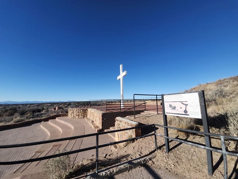
The marker is next to the Cross of the Martyrs.
Other nearby markers. At least 8 other markers are within walking distance of this marker: To the Future (a few steps from this marker); 1985 (a few steps from this marker); 1982 (a few steps from this marker); 1976 (a few steps from this marker); 1960 (a few steps from this marker); 1945 (a few steps from this marker); 1926 (a few steps from this marker); 1912 (a few steps from this marker). Touch for a list and map of all markers in Santa Fe.
Credits. This page was last revised on March 11, 2026. It was originally submitted on February 16, 2026, by J. Makali Bruton of Washington, District of Columbia. This page has been viewed 63 times since then. Photos: 1, 2. submitted on February 16, 2026, by J. Makali Bruton of Washington, District of Columbia.
