Near Mountain Springs in Clark County, Nevada — The American Mountains (Southwest)
Potosi
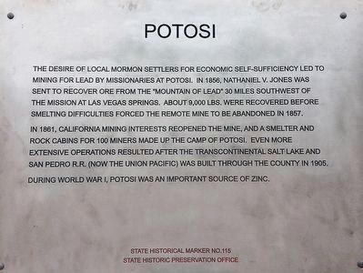
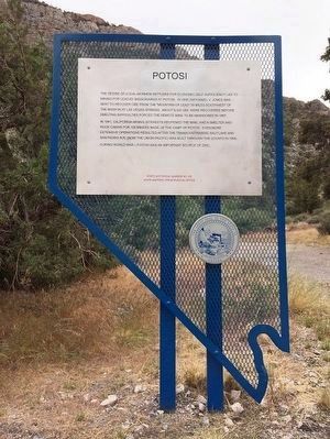
In 1861 California mining interests reopened the mine, and a smelter and rock cabins of 100 busy miners made up the mining camp of Potosi. Even more extensive operations resulted after the transcontinental Salt Lake and San Pedro R.R. (now Union Pacific) was built through the county in 1905.
During World War I, Potosi was an important source of zinc.
Erected by State Historic Preservation Office. (Marker Number 115.)
Topics. This historical marker is listed in these topic lists: Churches & Religion • Railroads & Streetcars • Settlements & Settlers. A significant historical year for this entry is 1856.
Location. 36° 0.062′ N, 115° 29.125′ W. Marker is near Mountain Springs, Nevada, in Clark County. Marker is at the intersection of Pahrump Valley Highway (Nevada Route 160 at milepost 19) and Mt. Potosi Canyon Road, on the left when traveling west on Pahrump Valley Highway. Touch for map. Marker is at or near this postal address: 12006 Nevada 160, Las Vegas NV 89161, United States of America. Touch for directions.
Other nearby markers. At least 8 other markers are within 16 miles of this marker, measured as the crow flies. The Old Spanish Trail (approx. 1.4 miles away); a different marker also named Old Spanish Trail (approx. 2.1 miles away); Spring Mountain Ranch (approx. 5 miles away); a different marker also named The Old Spanish Trail (approx. 5.4 miles away); Goodsprings Mining District 1856 - 1957 (approx. 12 miles away); The Pioneer Saloon (approx. 12 miles away); Good's Spring (approx. 12.1 miles away); Sandy Valley (approx. 15.2 miles away).
Also see . . .
1. Potosi - Ghost Town. Lead ore deposits were found high upon a cliff by prospecting Mormons living at the mission at Las Vegas in 1856. (Submitted on April 2, 2010.)
2. Potosi - First Abandoned Mine in Nevada. (Submitted on April 2, 2010.)
Credits. This page was last revised on October 14, 2022. It was originally submitted on March 31, 2010, by Bill Kirchner of Tucson, Arizona. This page has been viewed 1,533 times since then and 56 times this year. Photos: 1, 2. submitted on October 10, 2015, by Trev Meed of Round Mountain, Nevada. 3, 4. submitted on March 31, 2010, by Bill Kirchner of Tucson, Arizona. • Syd Whittle was the editor who published this page.


