
Altstadt in Heidelberg, Baden-Württemberg, Germany — Central Europe
Die Steinbrücke von 1788
⎯⎯⎯
The Stone Bridge of 1788

Photographed by James Hulse, September 22, 2024
1. Die Steinbrücke von 1788 / The Stone Bridge of 1788 Marker

Beinahe hundert Jahre war hier eine gedeckte hölzerne Brücke gestanden. Im Jahre 1784, den 27. Januar, führten ungeheure Eismassen sie hinweg. Kurfürst Carl Theodor befahl, auf dieselbe Stelle eine steinerne zu bauen. Sie wurde in zwei Sommern unter der Staatsverwaltung des Freiherrn von Oberndorf und unter Führung des Landbaumeisters X. Auth durch den Baumeister Math. Maier glücklich erbaut im Jahre 1788, als Sartorius Stadtdirektor und J. Siebenmetzger Bürgermeister waren.
For nearly one hundred years, a covered wooden bridge had stood here. On January 27, 1784, enormous masses of ice swept it away. Elector Carl Theodor ordered that a stone bridge be built on the same site. It was successfully constructed over two summers under the state administration of Baron von Oberndorf and under the direction of the state master builder X. Auth by the builder Math. Maier in the year 1788, when Sartorius was city director and J. Siebenmetzger was mayor.
Topics. This historical marker is listed in this topic list: Notable Buildings. A significant historical date for this entry is January 27, 1784.
Location. 49° 24.807′ N, 8° 42.576′ E.
this page online

Regionally, it is in Europe, the European Union, Atlantic Europe, Central Europe, the Schengen Area, Western Europe, and the Western World. Historically, it finds itself in what was once the Roman Empire and specifically also the Holy Roman Empire.
Other nearby markers. At least 8 other markers are within walking distance of this marker: Alte Brücke / Old Bridge (a few steps from this marker); a different marker also named Alte Brücke / Old Bridge (a few steps from this marker); Reformed Klein-Stipendiaten Haus / Reformed Small Scholarship House (a few steps from this marker); Hochwasser Bedrohten Einst die Stadt / Floods Once Threatened the City (a few steps from this marker); Gottfried Keller (about 90 meters away, measured in a direct line); Dr. Peter Beron (about 90 meters away); Haus Traitteur / House Traitteur (about 120 meters away);
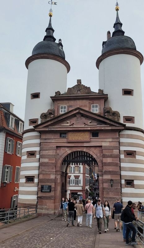
Photographed by James Hulse, September 22, 2024
2. Die Steinbrücke von 1788 / The Stone Bridge of 1788 Marker
The view of the north facing bridge gate with the marker above the gateway passage.

Photographed by James Hulse, September 22, 2024
3. Die Steinbrücke von 1788 / The Stone Bridge of 1788 Marker
The view of the Old Stone Bridge from the south side of the Neckar River.
Credits. This page was last revised on February 18, 2026. It was originally submitted on February 18, 2026, by James Hulse of Medina, Texas. This page has been viewed 30 times since then. Photos: 1, 2, 3. submitted on February 18, 2026, by James Hulse of Medina, Texas.
