Elysian Fields in Harrison County, Texas — The American South (West South Central)
Bethel United Methodist Church
Photographed by Jeff Leichsenring, February 16, 2026
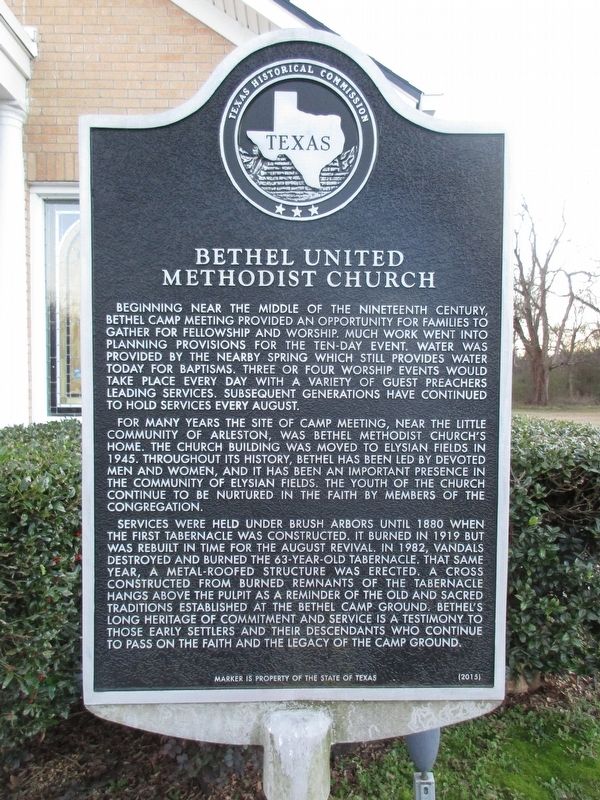
1. Bethel United Methodist Church Marker
For many years the site of camp meeting, near the little community of Arleston, was Bethel Methodist Church’s home. The church building was moved to Elysian Fields in 1945. Throughout its history, Bethel has been led by devoted men and women, and it has been an important presence in the community of Elysian Fields. The youth of the church continue to be nurtured in the faith by members of the congregation.
Services were held under brush arbors until 1880 when the first tabernacle was constructed. It burned in 1919 but was rebuilt in time for the August revival. In 1982, vandals destroyed and burned the 63-year-old tabernacle. That same year, a metal-roofed
this page online
Erected 2015 by Texas Historical Commission. (Marker Number 18256.)
Topics. This historical marker is listed in this topic list: Religion & Religious Structures. A significant historical year for this entry is 1945.
Location. 32° 22.089′ N, 94° 11.138′ W. Marker is in Elysian Fields, Texas, in Harrison County. It is at the intersection of Farm to Market Road 31 and Metcalf Lane (County Road 1410), on the left when traveling west on Road 31. Touch for map. Marker is at or near this postal address: 18271 FM 31, Marshall TX 75672, United States of America. Touch for directions.

Regionally, this marker is in the American South, specifically in the Deep South, and in the Piney Woods. Globally, it is in North America, a Gulf of Mexico state, the Western Hemisphere,

Photographed by Jeff Leichsenring, February 16, 2026
2. Bethel United Methodist Church and marker
Other nearby markers. At least 8 other markers are within 9 miles of this marker, measured as the crow flies: Bailey Anderson (approx. ¼ mile away); Booker T. Washington School (approx. 0.7 miles away); Mt. Zion Cemetery (approx. 4.3 miles away); DeBerry (approx. 4½ miles away); DeBerry Baptist Church (approx. 4.8 miles away); Bell-Fountain Cemetery (approx. 5.1 miles away); Shady Grove Baptist Church (approx. 7½ miles away); Site of Bethany (approx. 8.2 miles away). Touch for a list and map of all markers in Elysian Fields.
Credits. This page was last revised on February 21, 2026. It was originally submitted on February 20, 2026, by Jeff Leichsenring of Garland, Texas. This page has been viewed 47 times since then. Photos: 1, 2. submitted on February 20, 2026, by Jeff Leichsenring of Garland, Texas. • James Hulse was the editor who published this page.
