Conway in Horry County, South Carolina — The American South (South Atlantic)
Horry-Georgetown Tech

Photographed by Charles Wright, February 21, 2026
1. Horry-Georgetown Tech Marker, Side One
The S.C. General Assembly created the state technical college system in 1961 amid growing need for industrial training among S.C. residents. After local leaders petitioned three times for a technical school in Horry County, the state approved creation of the Horry-Marion-Georgetown Technical Education Center in 1964. The school opened on twelve acres of land at this site in 1966.
The original campus headquarters fronting U.S. Hwy. 501 was designed by local architect Harold J. Riddle. The curriculum reflected the needs of local industry and included courses in forestry, golf course management, and park operations. Marion County unaffiliated with the school after a few years, and in 1975 the institution adopted the name Horry-Georgetown Technical College.
Erected 2023 by Horry County Historic Preservation Commission. (Marker Number 26 33.)
Topics. This historical marker is listed in this topic list: Education. A significant historical year for this entry is 1961.
Location. 33° 47.638′ N, 79° 0.079′ W. Marker is in Conway, South Carolina, in Horry County. It is on Victory Lane west of Edward E Burroughs Highway (U.S.
this page online

Regionally, this marker is in South Carolina’s Pee Dee. It is also in the American South, specifically in the Deep South, and on the Eastern Seaboard. Globally, it is in the North Atlantic Region, North America, the Western Hemisphere, the Western World, and the Anglosphere. Historically, it finds itself in what was once the territory of the Mississippian Culture, one of the original Thirteen Colonies, one of the Confederate States of America, and the Antebellum South.
Other nearby markers. At least 8 other markers are within 4 miles of this marker, measured as the crow flies: Coastal Carolina University (approx. 0.6 miles away); Grier’s/Cox’s Ferry (approx. 2.8 miles away); The Steamboat Era on the Waccamaw River (approx. 3.7 miles away); Waccamaw River Water Trail (approx. 3.7 miles away); High Water Mark Hurricane Florence (approx. 3.7 miles away); Centennial Time Capsule (approx. 3.8 miles away); Kingston Church (approx.

Photographed by Charles Wright, February 21, 2026
2. Horry-Georgetown Tech Marker, Side Two
Another marker is no longer nearby. Kingston-Conway / Robert Conway (was approx. 3.8 miles away but has been confirmed missing).

Photographed by Charles Wright, February 21, 2026
3. Horry-Georgetown Tech Marker
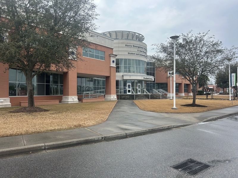
Photographed by Charles Wright, February 21, 2026
4. Horry-Georgetown Tech
Credits. This page was last revised on March 15, 2026. It was originally submitted on February 21, 2026, by Charles Wright of Surfside Beach, South Carolina. This page has been viewed 49 times since then. Photos: 1, 2, 3, 4. submitted on February 21, 2026, by Charles Wright of Surfside Beach, South Carolina. • Bernard Fisher was the editor who published this page.
Editor’s want-list for this marker. A wide shot of the marker in context. • Can you help?
