
Fürth, Bavaria, Germany — Central Europe
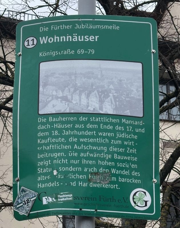
Wohnhäuser
⎯⎯⎯
Residential Buildings
| — | Fürther Jubiläumsmeile | — |
Photographed by Andrew Ruppenstein, February 5, 2026
1. Wohnhäuser / Residential Buildings Marker

Erected 2008 by Geschichtsverein Fürth e.V. (Marker Number 11.)
Topics. This historical marker is listed in these topic lists: Architecture • Industry & Commerce.
Location. 49° 28.68′ N, 10° 59.301′ E. Marker is in Fürth, Bayern (Bavaria). It is at the intersection of Königstraße and Obstmarkt, on the right when traveling south on Königstraße. Touch for map.
this page online

Regionally, it is in Europe, the European Union, Atlantic Europe, Central Europe, the Schengen Area, Western Europe, and the Western World. Historically, it finds itself in what was once the Holy Roman Empire.
Other nearby markers. At least 8 other markers are within walking distance of this marker: Dr. Otto Mayer (within shouting distance of this marker); Wilhelm Königswarter (within shouting distance of this marker); Leopold Ullstein (within shouting distance of this marker); Ehemaliges Wirtshaus zum Roten Roß / The Former Red Horse Inn (within shouting distance of this marker); Rathaus / City Hall (about 90 meters away, measured in a direct line); Ehemalige Gabrielschul / Former Gabriel Schul (about 90 meters away); Ehemaliger Eingang zum israelitischen Schulhof / Former Entrance to the Jewish Community Center (about 150 meters away); Schlacht an der Alte Veste / Battle of the Alte Veste: Kirchenplatz (about 210 meters away). Touch for a list and map of all markers in Fürth.
Photographed by Andrew Ruppenstein, February 5, 2026
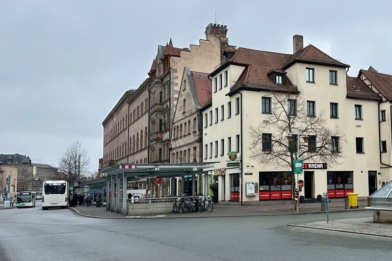
2. Wohnhäuser / Residential Buildings Marker - wide view
The marker is visible here mounted to a pole in front of the tree on the right.
Credits. This page was last revised on February 23, 2026. It was originally submitted on February 23, 2026, by Andrew Ruppenstein of Lamorinda, California. This page has been viewed 54 times since then. Photos: 1, 2. submitted on February 23, 2026, by Andrew Ruppenstein of Lamorinda, California.
