Near Bly in Klamath County, Oregon — The American West (Northwest)
War Doesn't Discriminate

Photographed by Craig Baker
1. Mitchell Monument Marker
A quiet Sunday afternoon, on May 5, 1945 Archie Mitchell, the new pastor of the Christian and Missionary Alliance Church in Bly Oregon took his pregnant wife Eiste and five Bunday school students on a picnic on Gearhart Mountain…
Reverend Mitchell parked the car while his wife and the children headed for the bank of Leonard Creek. He heard his wife call out that they had found something, but before he could reach the group, the object — a downed balloon bomb, called "fago" — exploded.
Shrapnel ripped through the forest, killing 26-year-old Elsie Mitchell and her unborn child, and the five students. The pastor was uninjured except for burns on his hands from trying to quench the flames on his wife's clothing.
Richard "Jumbo" Barnhouse was operating a U.S. Forest Service grader when the carload of picnickers arrived. He heard the explosion and alerted Bly District Ranger Spike Armstrong and timber manager John B. "Jack" Smith to the tragedy that morning. Armstrong and Smith arrived with sheets, blankets, and first aid supplies, unsure what they would find. Smith checked for pulses but found none.
While
this page online
When family members and the community were told what happened, they were instructed to keep quiet so as not to hinder the war effort. Newspaper articles about the tragedy cited "an explosion of undetermined nature" as the cause of death. The silence had its intended effect. Japan didn't hear about the deaths and, seeing little evidence of the fugos effectiveness, deemed the project a failure. The country stopped launching balloons in April 1945.
The six people killed were the only deaths resulting from enemy action on the American mainland during World War II, earning the event a place in history. But to the people of Bly, the explosion was personal.
Sherman Shoemaker, age 11
Dick Patzke, age 14
Elsie Mitchell & baby
Joan Patzke, age 13 (Dick’s little sister)
Edward Engen, age 13
Jay Gifford, age 13
Topics. This
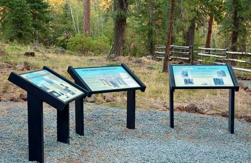
Photographed by Craig Baker
2. Mitchell Monument Markers
Location. 42° 25.906′ N, 120° 51.648′ W. Marker is near Bly, Oregon, in Klamath County. It can be reached from NF-348. Located 11 miles east of Bly, at Mitchell Recreation Area. Touch for map. Marker is in this post office area: Bly OR 97622, United States of America. Touch for directions.

Regionally, this marker is in the High Desert and in Southern Oregon. It is also in the American Mountain West and in the Lewis & Clark Corridor. Globally, it is in North America, in the Cascade Range, on the Ring of Fire, on the Pacific Rim, in the Western Hemisphere, in the Western World, and in the Anglosphere.
Other nearby markers. At least 3 other markers are within 10 miles of this marker, measured as the crow flies: Mitchell Monument (within shouting distance of this marker); Mitchell Monument Shrapnel Tree (within shouting distance of this marker); Balloon Bomb (approx. 9.8 miles away).
More about this marker. The road is sometimes referred to as Forest Service Road 34, or 3400, or NF-348. It is

courtesy USFS
3. Balloon Bomb

courtesy USFS
4. Mitchell Monument Map
Credits. This page was last revised on March 22, 2026. It was originally submitted on February 25, 2026, by Craig Baker of Sylmar, California. This page has been viewed 50 times since then. Photos: 1, 2, 3, 4. submitted on February 25, 2026, by Craig Baker of Sylmar, California.
Editor’s want-list for this marker. Photos of the other interpretive signs. • Can you help?
