
Lowell in Kearney County, Nebraska — The American Midwest (Upper Plains)
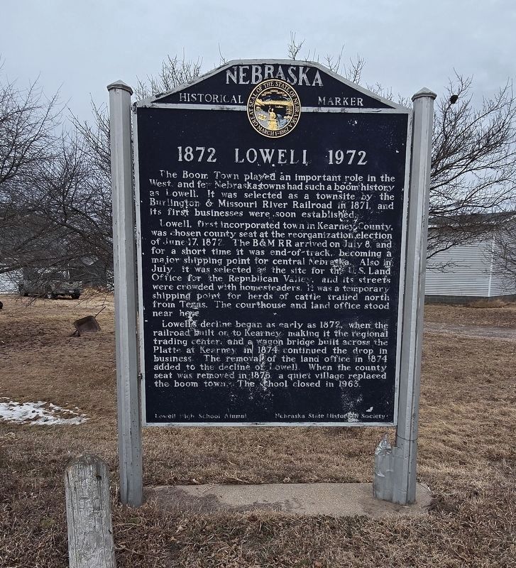
1872 Lowell 1972
Photographed by Susan Van Den Bosch, February 24, 2026
1. 1872 Lowell 1972 Marker
The Boom Town played an important role in the West, and few Nebraska towns had such a boom history as Lowell. It was selected as a townsite by the Burlington & Missouri River Railroad in 1871, and its first businesses were soon established.
Lowell, first incorporated town in Kearney County, was chosen county seat at the reorganization election of June 17, 1872. The B&M RR arrived on July 8, and for a short time it was end-of-track, becoming a major shipping point for central Nebraska. Also in July, it was selected as the site for the U.S. Land Office for the Republican Valley, and its streets were crowded with homesteaders. It was a temporary shipping point for herds of cattle trailed north from Texas. The courthouse and land office stood near here.
Lowell’s decline began as early as 1872, when the railroad built on to Kearney, making it the regional trading center, and a wagon bridge built across the Platte at Kearney in 1874 continued the drop in business. The removal of the land office in 1874 added to decline of Lowell. When the county seat was removed in 1878, a quiet village replaced the boom town. The school
this page online
Erected by Lowell High School Alumni and Nebraska State Historical Society.
Topics and series. This historical marker is listed in these topic lists: Industry & Commerce • Railroads & Streetcars • Settlements & Settlers. In addition, it is included in the Nebraska State Historical Society series list. A significant historical year for this entry is 1872.
Location. 40° 38.852′ N, 98° 50.831′ W. Marker is in Lowell, Nebraska, in Kearney County. It is at the intersection of Lowell Road and Carpenter Road on Lowell Road. Touch for map. Marker is at or near this postal address: 33 Lowell Rd, Minden NE 68959, United States of America. Touch for directions.

Regionally, this marker is in Eastern Nebraska. It is also in the American Midwest, in the Corn Belt, and on the prairies. Globally, it is in North America, the Western Hemisphere, the Western World, and the Anglosphere. Historically, it finds itself in what was once the Louisiana Purchase.
Other nearby markers. At least 8 other markers are within 7 miles of this marker, measured as the crow flies: Boot Hill (approx. 1.1 miles away); Gibbon (approx.

Photographed by Susan Van Den Bosch, February 24, 2026
2. 1872 Lowell 1972 Marker
Credits. This page was last revised on March 1, 2026. It was originally submitted on February 26, 2026, by Susan Van Den Bosch of Almond, Wisconsin. This page has been viewed 67 times since then. Photos: 1, 2. submitted on February 26, 2026, by Susan Van Den Bosch of Almond, Wisconsin. • J. Makali Bruton was the editor who published this page.
