Kearney in Buffalo County, Nebraska — The American Midwest (Upper Plains)
Frontier Forts in Nebraska

Photographed by Susan Van Den Bosch, November 18, 2025
1. Frontier Forts in Nebraska Marker
In the period of westward expansion, the presence of the U.S. Army on the frontier was necessary to protect emigrants and settlers from Indians who were less than enthusiastic about the white intrusion on their lands. Forts were set up as key locations throughout the west, and several of the most important of these posts were located in Nebraska.
As the region became settled and the need for forts diminished, most of these early Army posts were abandoned.
[Captions:]
Fort Atkinson, about 25 miles up the Missouri from modern Omaha was the earliest fort in Nebraska – established in 1819.
Fort Sidney was built in 1867 after peace negotiations failed and Indians continued to harass Platte Valle travelers. The restored commander’s home is open to visitors.
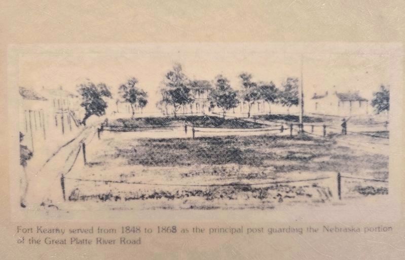
Fort Kearny served from 1848 to 1868 as the principal post guarding the Nebraska portion of the Great Platte River Road.
Fort Hartsuff, now a state historical park, once guarded the eastern part of Nebraska’s Sandhills country.
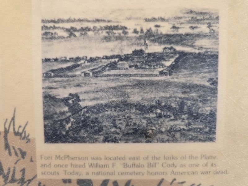
Fort McPherson was located east of the forks of the Platte and once hired William F. “Buffalo Bill” Cody as one of its’ scouts. Today, a national cemetery honors American war dead.
Fort Robinson in the scenic Pine Ridge country of northwest Nebraska was a major army post during the struggle with the Sioux Indians. Today the old fort is a popular state park with many restored historic buildings.
Topics.
this page online
Location. 40° 40.226′ N, 99° 9.436′ W. Marker is in Kearney, Nebraska, in Buffalo County. It can be reached from Interstate 80. This marker is in the Interstate 80 eastbound Kearney Rest Area attached to the outside of the building. Touch for map. Marker is at or near this postal address: 23375 I-80, Kearney NE 68845, United States of America. Touch for directions.

Regionally, this marker is in Central Nebraska and in the Platte River Valley. It is also in the American Midwest, in the Corn Belt, and on the prairies. Globally, it is in North America, the Western Hemisphere, the Western World, and the Anglosphere. Historically, it finds itself in what was once the Louisiana Purchase.
Other nearby markers. At least 8 other markers are within 4 miles of this marker, measured as the crow flies: Kearney-Fort Kearny (within shouting distance of this marker); The Mormon Pioneer Trail / Frontier Mail Carriers (within shouting distance of this marker); The Great Plains (approx. 1.9

Photographed by Susan Van Den Bosch, November 18, 2025
2. Frontier Forts in Nebraska Marker
The Kearney, NE Interstate 80 Eastbound rest area building is seen here. The marker is on the east side of this building.
Photographed by Susan Van Den Bosch, February 24, 2026
3. Fort Kearny
Photographed by Susan Van Den Bosch, February 24, 2026
4. Fort McPherson
Credits. This page was last revised on February 28, 2026. It was originally submitted on November 23, 2025, by Susan Van Den Bosch of Almond, Wisconsin. This page has been viewed 103 times since then and 74 times this year. Last updated on February 26, 2026, by Susan Van Den Bosch of Almond, Wisconsin. Photos: 1, 2. submitted on November 23, 2025, by Susan Van Den Bosch of Almond, Wisconsin. 3, 4. submitted on February 27, 2026, by Susan Van Den Bosch of Almond, Wisconsin. • Devry Becker Jones was the editor who published this page.
Editor’s want-list for this marker. A clear close-up photo of the marker. • Can you help?
