
Portsmouth, Virginia — The American South (Mid-Atlantic)
Sailors and Marines Memorial
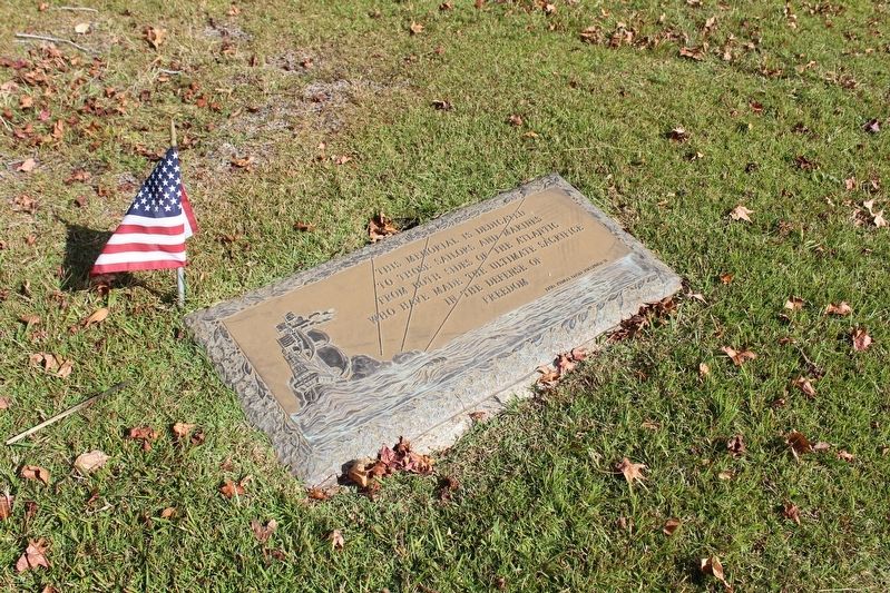
Photographed by Evan Dwyer, October 18, 2025
1. Sailors and Marines Memorial Marker
Naval Medical Center Portsmouth VA
Erected by Naval Medical Center Portsmouth VA.
Topics. This memorial is listed in this topic list: Military.
Location. 36° 50.137′ N, 76° 20.652′ W. Memorial is in Portsmouth, Virginia. It can be reached from Glasgow Street 0.1 miles east of Halifax Avenue, on the right when traveling east. Marker is in the Navy Plot of Evergreen Memorial Park Cemetery. Touch for map. Memorial is at or near this postal address: 3316 High Street, Portsmouth VA 23707, United States of America. Touch for directions.

Regionally, this memorial is in Virginia’s Hampton Roads, specifically in Coastal Virginia, and in the Hampton Roads Metropolitan Area. It is also in the American South, specifically in the Upper South, in the Tidewater, and on the Eastern Seaboard. Globally, it is in the North Atlantic Region, North America, the Western Hemisphere, the Western World, and the Anglosphere.
this page online
Other nearby markers. At least 8 other markers are within 2 miles of this marker, measured as the crow flies: Dale Point (approx. 0.9 miles away); General Lafayette Memorial (approx. 1.3 miles away); A Living Memorial (approx. 1.3 miles away); Portsmouth Light Artillery Monument (approx. 1.3 miles away); Israel Charles Norcom High School (approx. 1.3 miles away); Craney Island (approx. 1.4 miles away); Benedict Arnold at Portsmouth (approx. 1.4 miles away); Key Road School (approx. 1.4 miles away). Touch for a list and map of all markers in Portsmouth.
More about this memorial. The marker features a relief of a sailing ship flying a number of different ensigns. The location of the marker, though, is associated with the World War II era rather than the era of sail, and many British seamen who died while their ships were being repaired in Norfolk are buried nearby along with US veterans who died in service at Portsmouth Naval Hospital.
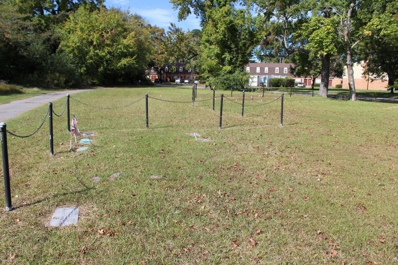
Photographed by Evan Dwyer, October 18, 2025
2. Navy Plot
This view shows the back entrance to Evergreen Memorial Park off Glasgow Street. The marker is off to the right rear of the photographer, but is within this fenced area known as the Navy Plot. The foreign sailors from WWII buried here are in the distance at right, mixed among the short American flags.
Credits. This page was last revised on February 28, 2026. It was originally submitted on February 27, 2026, by Evan Dwyer of Richmond, Virginia. This page has been viewed 46 times since then. Photos: 1, 2. submitted on February 27, 2026, by Evan Dwyer of Richmond, Virginia. • Bernard Fisher was the editor who published this page.
