Schnaittach in Nürnberger Land, Bavaria, Germany — Central Europe
Das Rathaus
Schnaittacher Geschichtsweg
⎯⎯⎯
The Town Hall
Schnaittach Historical Trail
Photographed by James Hulse, February 24, 2026
1. Das Rathaus / The Town Hall Marker

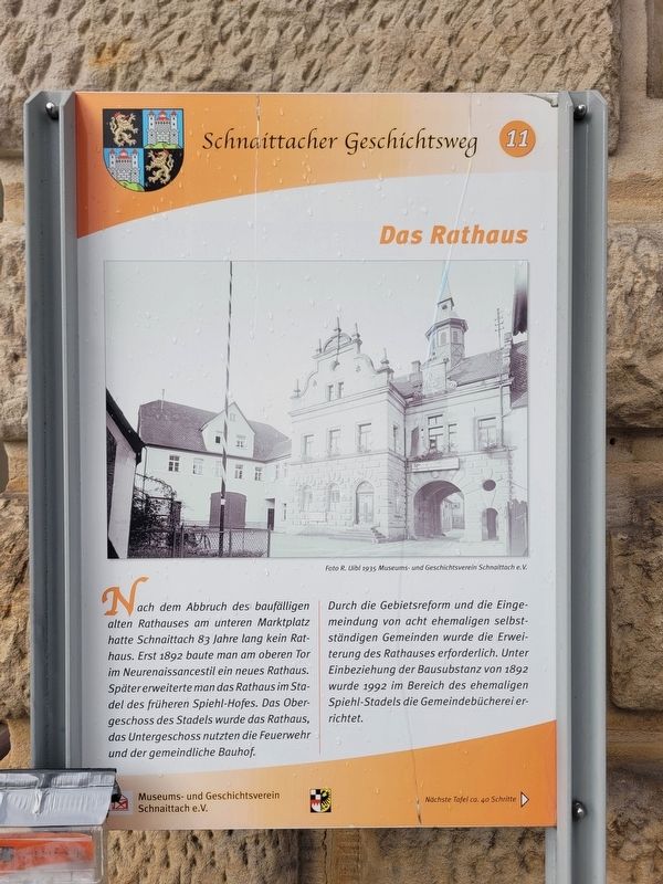
Nach dem Abbruch des baufälligen alten Rathauses am unteren Marktplatz hatte Schnaittach 83 Jahre lang kein Rathaus. Erst 1892 baute man am oberen Tor im Neurenaissancestil ein neues Rathaus. Später erweiterte man das Rathaus im Stadel des früheren Spiehl-Hofes. Das Obergeschoss des Stadels wurde das Rathaus, das Untergeschoss nutzten die Feuerwehr und der gemeindliche Bauhof.
Durch die Gebietsreform und die Eingemeindung von acht ehemaligen selbstständigen Gemeinden wurde die Erweiterung des Rathauses erforderlich. Unter Einbeziehung der Bausubstanz von 1892 wurde 1992 im Bereich des ehemaligen Spiehl-Stadels die Gemeindebücherei errichtet.
Untertitel
(Foto #1) Foto R. Uibl 1935 Museums- und Geschichtsverein Schnaittach e. V.
After the demolition of the dilapidated old town hall at the lower marketplace, Schnaittach had no town hall for 83 years. It was not until 1892 that a new town hall was built at the Upper Gate in the Neo-Renaissance style. Later, the town hall was expanded into the barn (Stadel) of the former Spiehl farm. The upper floor of the barn became the town hall, while the ground floor was used by the fire brigade and the municipal public works yard.
Due to administrative territorial reform and the incorporation of eight formerly independent municipalities, an expansion of the town hall became necessary. In 1992, incorporating the structural fabric from 1892, the municipal library was built in the area of the former Spiehl barn.
Captions
(Photo #1) Photo by R. Uibl, 1935 Museum and Historical Society of Schnaittach (registered association)
Erected by Museum
this page online
Topics. This historical marker is listed in this topic list: Notable Buildings. A significant historical year for this entry is 1892.
Location. 49° 33.571′ N, 11° 20.38′ E. Marker is in Schnaittach, Bayern (Bavaria), in Nürnberger Land. It is on Marktplatz just east of Grabenstraße, on the right when traveling east. Touch for map. Marker is at or near this postal address: Marktpl 1, Schnaittach BY 91220, Germany. Touch for directions.

Regionally, this marker is in German Franconia. Globally, it is in Europe, the European Union, Atlantic Europe, Central Europe, the Schengen Area, Western Europe, and the Western World. Historically, it finds itself in what was once the Holy Roman Empire and also the former West Germany.
Other nearby markers. At least 8 other markers are within walking distance of this marker: Entwicklung zum Markt / Development into a Market Town (within shouting distance of this marker); Der obere Marktplatz / The Upper Market Square (within shouting distance of this marker); Jetta Prager (about 90 meters away, measured in a direct line); Fanny Prager (about 90 meters away); Hannchen Forster (about 90 meters away); Der untere Marktplatz / The Lower Market Square (about 90 meters away); Zum Blauen Löwen / At the Blue Lion (about 120 meters away); Dina Freimann (about 120 meters away). Touch for a list and map of all markers in Schnaittach.
Photographed by James Hulse
2. Das Rathaus / The Town Hall Marker
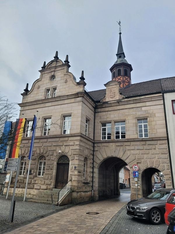
The marker is located at the left side of the building (eastern view).
Photographed by James Hulse, February 24, 2026
3. Das Rathaus / The Town Hall Marker
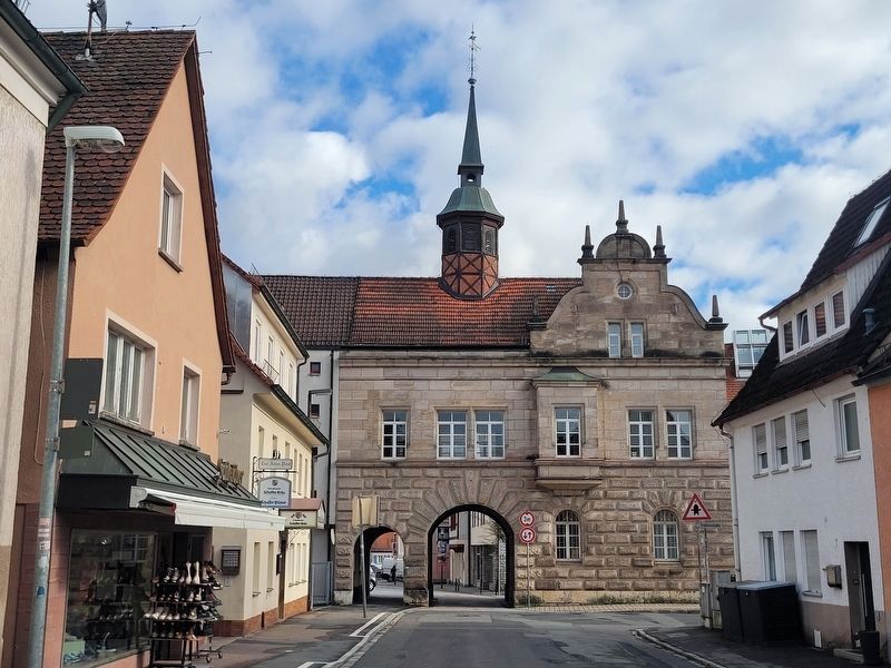
The western view of the historic Town Hall.
Credits. This page was last revised on March 9, 2026. It was originally submitted on February 28, 2026, by James Hulse of Medina, Texas. This page has been viewed 28 times since then. Photos: 1, 2. submitted on March 1, 2026, by James Hulse of Medina, Texas. 3. submitted on March 9, 2026, by James Hulse of Medina, Texas.
