DuPont in Pierce County, Washington — The American West (Northwest)
Going Native with Kinnikinnick
Photographed by Shirley A Stirling, March 1, 2026
1. Going native with kinnikinnick Marker
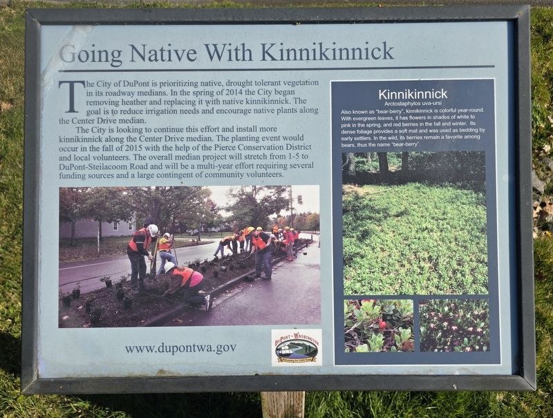
The City of DuPont is prioritizing native, drought tolerant vegetation in its roadway medians. In the spring of 2014 the City began removing heather and replacing it with native kinnikinnick. The goal is to reduce irrigation needs and encourage native plants along the Center Drive median.
The City is looking to continue this effort and install more kinnikinnick along the Center Drive median. The planting event would occur in the fall of 2015 with the help of the Pierce Conservation District and local volunteers. The overall median project will stretch from 1-5 to DuPont-Steilacoom Road and will be a multi-year effort requiring several funding sources and a large contingent of community volunteers.
Arctostaphylos uva-ursi
Erected by City of Dupont.
Topics.
this page online
Location. 47° 6.3′ N, 122° 38.762′ W. Marker is in DuPont, Washington, in Pierce County. It is at the intersection of Center Drive and Civic Drive, on the right when traveling south on Center Drive. Touch for map. Marker is at or near this postal address: 1700 Center Dr, Dupont WA 98327, United States of America. Touch for directions.

Regionally, this marker is in the Puget Sound Region and in Greater Seattle. It is also on the American Pacific Coast, in the Pacific Northwest, and in the Lewis & Clark Corridor. Globally, it is in North America, in the Cascade Range, in the Inside Passage, on the Ring of Fire, on the Pacific Rim, in the Western Hemisphere, in the Western World, and in the Anglosphere.
Other nearby markers. At least 8 other markers are within 7 miles of this marker, measured as the crow flies: Chloe Aurelia Clark (Wilson) (approx. 0.7 miles away); Global War on Terrorism Memorial (approx. 0.9 miles away); Ross Memorial (approx. 0.9 miles away); Boulevard of Remembrance (approx. 1½

Photographed by Shirley A Stirling, March 1, 2026
2. Going native with kinnikinnick Marker
Another marker is no longer nearby. Site of the Medicine Creek Treaty (was approx. 3.8 miles away but has been permanently removed).
More about this marker. The local for the City of Dupont is included on the phone, the marker.
Credits. This page was last revised on March 2, 2026. It was originally submitted on March 2, 2026, by Shirley A Stirling of Lacey, Washington. This page has been viewed 46 times since then. Photos: 1, 2. submitted on March 2, 2026, by Shirley A Stirling of Lacey, Washington. • Devry Becker Jones was the editor who published this page.
