Schnaittach in Nürnberger Land, Bavaria, Germany — Central Europe
Pfarrkirche St. Kunigund
Schnaittacher Geschichtsweg
⎯⎯⎯
Parish Church of St. Kunigund
Schnaittach Historical Trail
Photographed by James Hulse, February 24, 2026
1. Pfarrkirche St. Kunigund / Parish Church of St. Kunigund Marker

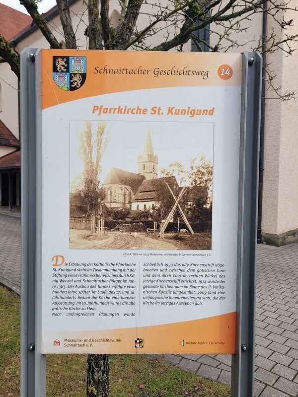
Die Erbauung der katholische Pfarrkirche St. Kunigund steht im Zusammenhang mit der Stiftung eines Frühmessbenefiziums durch König Wenzel und Schnaittacher Bürger im Jahre 1385. Der Ausbau des Turmes erfolgte etwa hundert Jahre später. Im Laufe des 17. und 18. Jahrhunderts bekam die Kirche eine barocke Ausstattung. Im 19. Jahrhundert wurde die alte gotische Kirche zu klein.
Nach umfangreichen Planungen wurde schließlich 1933 das alte Kirchenschiff abgebrochen und zwischen dem gotischen Turm und dem alten Chor im rechten Winkel das jetzige Kirchenschiff errichtet. 1974 wurde der gesamte Kirchenraum im Sinne des II. Vatikanischen Konzils umgestaltet. 2009 fand eine umfangreiche Innenrenovierung statt, die der Kirche ihr jetziges Aussehen gab.
Foto R. Uibl vor 1933 Museums- und Geschichtsverein Schnaittach e. V.
The construction of the Catholic parish church of St. Kunigund is connected with the endowment of an early Mass benefice by King Wenceslaus and citizens of Schnaittach in 1385. The expansion of the tower took place about one hundred years later. During the 17th and 18th
this page online
After extensive planning, the old nave was demolished in 1933, and the present nave was built at a right angle between the Gothic tower and the old choir. In 1974, the entire interior of the church was redesigned in accordance with the Second Vatican Council. In 2009, a comprehensive interior renovation took place, giving the church its current appearance.
Photo by R. Uibl before 1933 Museum and Historical Society of Schnaittach (registered association)
Erected 2011 by Museum and Historical Society of Schnaittach (registered association). (Marker Number 14.)
Topics. This historical marker is listed in this topic list: Religion & Religious Structures. A significant historical year for this entry is 1385.
Location. 49° 33.583′ N, 11° 20.483′ E. Marker is in Schnaittach, Bayern (Bavaria), in Nürnberger Land. It is on Marktplatz just east of Bayreuther Str., on the left when traveling east. Touch for map. Marker is at or near this postal address: Marktpl 17, Schnaittach BY 91220, Germany. Touch for directions.

Regionally,
Photographed by James Hulse, February 24, 2026
2. Pfarrkirche St. Kunigund / Parish Church of St. Kunigund Marker
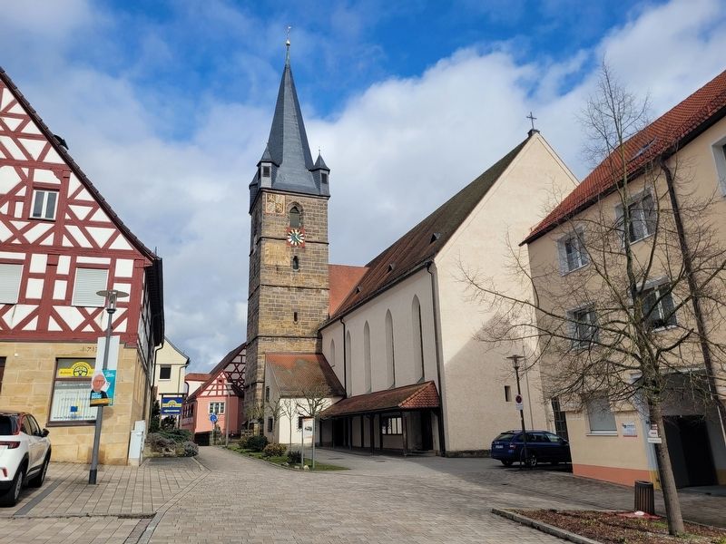
The view of the marker in front of the church.
Other nearby markers. At least 8 other markers are within walking distance of this marker: Der untere Marktplatz / The Lower Market Square (a few steps from this marker); Fanny Prager (within shouting distance of this marker); Jetta Prager (within shouting distance of this marker); Die Mühlgasse / Mill Lane (within shouting distance of this marker); Das Wörler-Anwesen / The Wörler Property (within shouting distance of this marker); Der obere Marktplatz / The Upper Market Square (within shouting distance of this marker); Der Sternwirt / The Star Innkeeper (about 90 meters away, measured in a direct line); Laura Wolf (about 90 meters away). Touch for a list and map of all markers in Schnaittach.
Photographed by James Hulse, February 24, 2026
3. Pfarrkirche St. Kunigund / Parish Church of St. Kunigund Marker
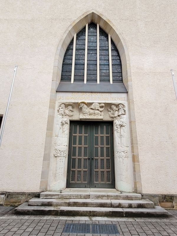
The entrance to the church.
Photographed by James Hulse, February 24, 2026
4. Pfarrkirche St. Kunigund / Parish Church of St. Kunigund Marker
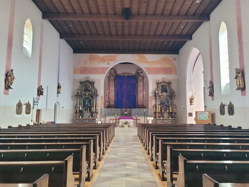
The interior view of the nave and alter.
Photographed by James Hulse, February 24, 2026
5. Pfarrkirche St. Kunigund / Parish Church of St. Kunigund Marker
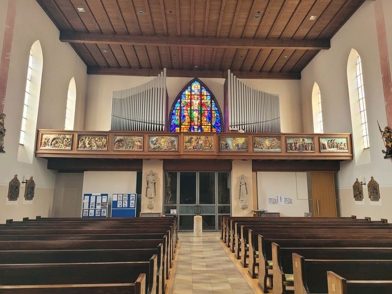
The view of the organ on the second floor above the benches.
Photographed by James Hulse, February 24, 2026
6. Pfarrkirche St. Kunigund / Parish Church of St. Kunigund Marker
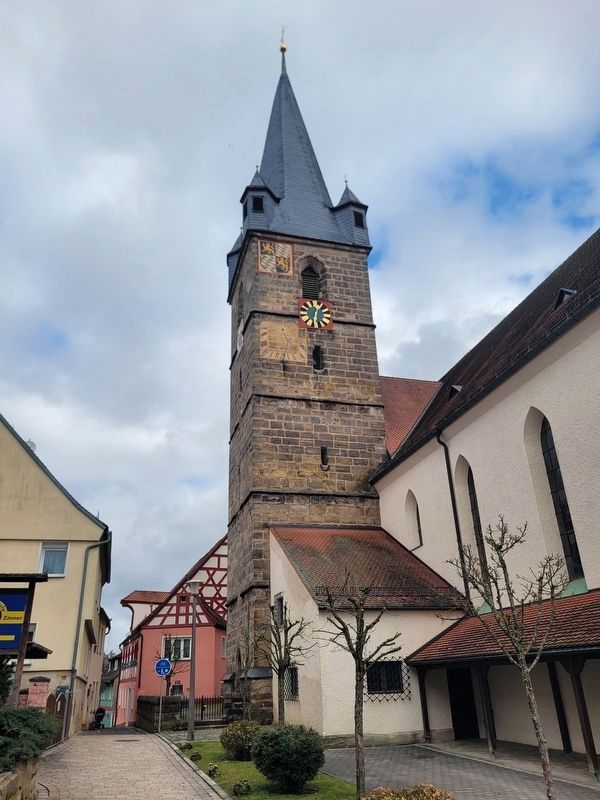
The church bell tower.
Credits. This page was last revised on March 3, 2026. It was originally submitted on March 2, 2026, by James Hulse of Medina, Texas. This page has been viewed 39 times since then. Photos: 1, 2, 3, 4, 5, 6. submitted on March 3, 2026, by James Hulse of Medina, Texas.
