
East Falls Church in Arlington in Arlington County, Virginia — The American South (Mid-Atlantic)
Benjamin Elliott's Coal Trestle
| — | Park History Interpretive Series | — |
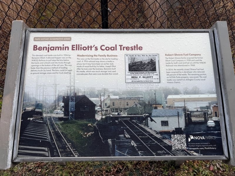
This elevated coal trestle was built in 1926 by Benjamin Elliott. It allowed hopper cars on the W&OD Railway to pull atop the bins below the tracks and unload coal into trucks through openings in the bottom of the rail cars. This was faster than the previous method of loading delivery trucks by hand. The bins could be used as ground storage and for truck loading.
Modernizing the Family Business
This was not the first trestle on the site for loading coal. A 1916 railroad map shows a trestle in place, but it may have been an earlier style made of wood built by his father, Joseph Elliot. After he took over the business, Benjamin built this trestle, which was much stronger and used concrete piers that were more durable than wood.
Robert Shreve Fuel Company
The Robert Shreve family acquired the former Elliott Coal Company in 1938 and used the trestle for both coal and fuel oil until the W&OD Railroad was abandoned in 1968.
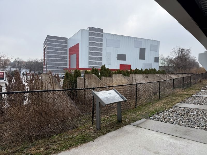
In 2014, the recently closed Shreve Fuel had been acquired by a developer who removed 28 percent of the trestle. The remaining portion, on NOVA Parks property, was saved. The coal trestle was
this page online
[Caption:]
Above: Ad for Elliott Coal. Source: News-Observer, Nov. 17, 1927. Below: Coal trestle (center). The East Falls Church Station is beside the main tracks. It was painted red in the 1960s. Source: NOVA Parks / Photographed by Paul Dolkos in 1966.
Erected 2025 by NOVA Parks.
Topics and series. This historical marker is listed in these topic lists: Industry & Commerce • Railroads & Streetcars. In addition, it is included in the NOVA Parks, and the Washington and Old Dominion (W&OD) Railroad series lists. A significant historical date for this entry is October 17, 1927.
Location. 38° 53.25′ N, 77° 9.786′ W. Marker is in Arlington, Virginia, in Arlington County. It is in East Falls Church. It is on Washington and Old Dominion Trail west of Langston Boulevard (U.S. 29), on the left when traveling west. Touch for map. Marker is at or near this postal address: 6918 Little Falls Rd, Arlington VA 22205, United States of America. Touch for directions.

Regionally, this marker is in the Washington Metropolitan Area and in Northern Virginia. It is also in the American South, specifically
Other nearby markers. At least 8 other markers are within walking distance of this marker: East Falls Church Station (within shouting distance of this marker); East Falls Church (about 600 feet away); Presidential Visit to Falls Church, 1911 (approx. 0.2 miles away); Pearson's Funeral Home (approx. 0.2 miles away); Crossman House (approx. 0.3 miles away); Original Federal Boundary Stone, District of Columbia, Southwest 9 (approx. 0.4 miles away); Benjamin Banneker Park Playground (approx. 0.4 miles away); City of Falls Church Veterans Memorial (approx. half a mile away). Touch for a list and map of all markers in Arlington.
Another marker is no longer nearby. Arlington County / Fairfax County (was about 300 feet away, measured in a direct line but has been permanently removed).
Credits. This page was last revised on March 4, 2026. It was originally submitted on March 4, 2026, by Devry Becker Jones of Washington, District of Columbia. This page has been viewed 38 times since then. Photos: 1, 2. submitted on March 4, 2026, by Devry Becker Jones of Washington, District of Columbia.
