Southwestern Adventist University in Keene in Johnson County, Texas — The American South (West South Central)
Mizpah Gate
Photographed by QuesterMark, February 22, 2026
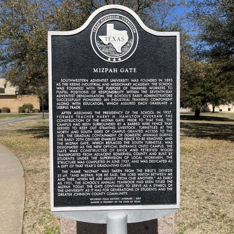
1. Mizpah Gate Marker
Southwestern Adventist University was founded in 1893 as the Keene Industrial and Missionary Academy. The school was founded with the purpose of training workers to fulfill positions of responsibility within the Seventh-Day Adventist denomination. The school’s early administrators successfully pioneered an industrial training component along with education, which assured each graduate a useful trade.
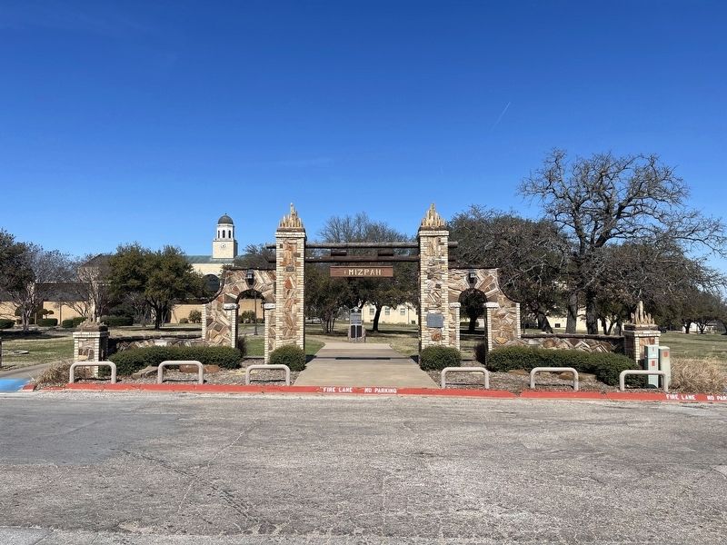
After assuming the presidency of the school in 1937, former teacher Harry H. Hamilton oversaw the construction of the Mizpah Gate. Prior to that time, the campus had been surrounded by a barbed wire fence that served to keep out straying livestock. Turnstiles at the north and south sides of campus granted access to the site. The gradual containment of domestic animals during the early 20th century enabled the fence to be removed, and the Mizpah Gate, which replaced the south turnstile, was designated as the new official entrance onto campus. The gate was constructed of brick and petrified wood transported from adjacent Somervell County and built by students under the supervision of local workmen. The structure was completed
this page online
The name "Mizpah was taken from the Bible’s Genesis 31:49, "And Mizpah; for he said, The Lord watch between me and thee, when we are absent from one another." As early as 1921, the school’s annual yearbook had been titled The Mizpah. Today, the gate continues to serve as a symbol of the university as it has for generations of students and the greater Johnson County community.
Erected 2009 by Texas Historical Commission. (Marker Number 15977.)
Topics. This historical marker is listed in these topic lists: Architecture • Education. A significant historical month for this entry is June 1937.
Location. 32° 23.788′ N, 97° 19.591′ W. Marker is in Keene, Texas, in Johnson County. It is in Southwestern Adventist University. It is at the intersection of Hillcrest Street and South College Drive, on the right when traveling west on Hillcrest Street. Touch for map. Marker is at or near this postal address: 2 Elm St, Keene TX 76059, United States of America. Touch for directions.

Regionally, this marker is in the Prairies & Lakes
Photographed by QuesterMark, February 22, 2026
2. Mizpah Gate and Marker
Other nearby markers. At least 8 other markers are within 5 miles of this marker, measured as the crow flies: Oliver Perry Arnold (approx. 1.9 miles away); Bethany Rest Cemetery (approx. 3.6 miles away); A.A. and Susanna Head Homestead (approx. 3.7 miles away); Pat Cleburne Camp No. 88, U.C.V. (approx. 4.4 miles away); Union Hill Presbyterian Church and Cemetery (approx. 4.4 miles away); Marystown Cemetery (approx. 4.6 miles away); Pioneer Texas Telephones (approx. 4.7 miles away); Church of the Holy Comforter (approx. 4.7 miles away).
Credits. This page was last revised on March 6, 2026. It was originally submitted on March 4, 2026, by QuesterMark of Fort Worth, Texas. This page has been viewed 60 times since then. Last updated on March 5, 2026, by Dave W of Co, Colorado. Photos: 1, 2. submitted on March 4, 2026, by QuesterMark of Fort Worth, Texas. • Devry Becker Jones was the editor who published this page.
