Schnaittach in Nürnberger Land, Bavaria, Germany — Central Europe
Das Velhornschloss
Schnaittacher Geschichtsweg
⎯⎯⎯
Velhorn Palace
Schnaittach Historical Trail

Photographed by James Hulse, February 24, 2026
1. Das Velhornschloss / Velhorn Palace Marker

Auf dem Gelände einer Kalkbrennerei erbaute 1722 Johann Friedrich Anton Velhorn für sich und seine Familie ein repräsentatives Wohnhaus, das so genannte Velhornschloss. Hinter dem Schloss dehnte sich ein Barockgarten aus. Die Velhorn waren kurfürstliche Pflegkommissare im Rothenberger Land. Der oben genannte Johann wurde 1749 geadelt.
Foto R. Uibl 1935 Museums- und Geschichtsverein Schnaittach e. V.
On the site of a lime kiln, Johann Friedrich Anton Velhorn built a representative residence for himself and his family in 1722, the so-called Velhorn Castle. Behind the castle stretched a Baroque garden. The Velhorn family were electoral administrative commissioners (Pflegkommissare) in the Rothenberg region. Johann Friedrich Anton Velhorn was ennobled in 1749.
In 1925 the Caritas Association acquired the entire property and today operates a youth welfare center there. The newer buildings stand on the site of a former brickyard. The administration is located in the castle.
1925 erwarb der Caritas-Verband das gesamte Anwesen und betreibt heute darauf ein Jugendhilfezentrum. Die
this page online
Photo: R. Uibl, 1935. Museum and Historical Society of Schnaittach (registered association)
Erected 2011 by Museum and Historical Society of Schnaittach (registered association). (Marker Number 17.)
Topics. This historical marker is listed in this topic list: Notable Buildings. A significant historical year for this entry is 1722.
Location. 49° 33.653′ N, 11° 20.437′ E. Marker is in Schnaittach, Bayern (Bavaria), in Nürnberger Land. It is at the intersection of Bayreuther Straße and Krankenhausweg, on the left when traveling north on Bayreuther Straße. Touch for map. Marker is at or near this postal address: Bayreuther Str 12, Schnaittach BY 91220, Germany. Touch for directions.

Regionally, this marker is in German Franconia. Globally, it is in Europe, the European Union, Atlantic Europe, Central Europe, the Schengen Area, Western Europe, and the Western World. Historically, it finds itself in what was once the Holy Roman Empire and also the former West Germany.
Other nearby markers. At least 8 other markers
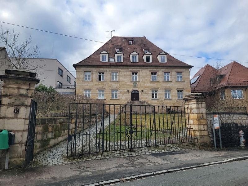
Photographed by James Hulse, February 24, 2026
2. Das Velhornschloss / Velhorn Palace Marker
The view of the building and marker from the street.
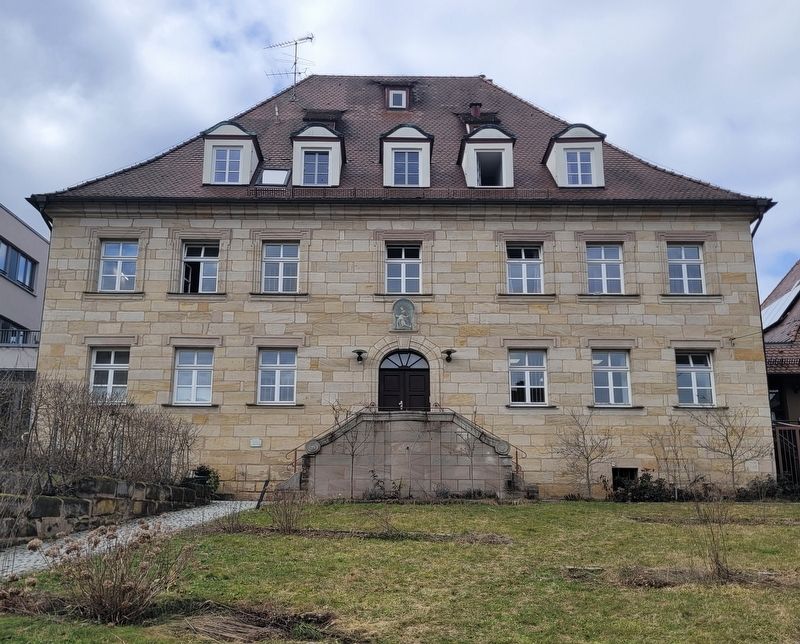
Photographed by James Hulse, February 24, 2026
3. Velhorn Palace
Credits. This page was last revised on March 8, 2026. It was originally submitted on March 6, 2026, by James Hulse of Medina, Texas. This page has been viewed 34 times since then. Photos: 1, 2, 3. submitted on March 7, 2026, by James Hulse of Medina, Texas.
