Schnaittach in Nürnberger Land, Bavaria, Germany — Central Europe
Die Kalvarienberganlage
Schnaittacher Geschichtsweg
⎯⎯⎯
Calvary Hill Complex
Schnaittach Historical Trail
Photographed by James Hulse, February 24, 2026
1. Die Kalvarienberganlage / Calvary Hill Complex Marker

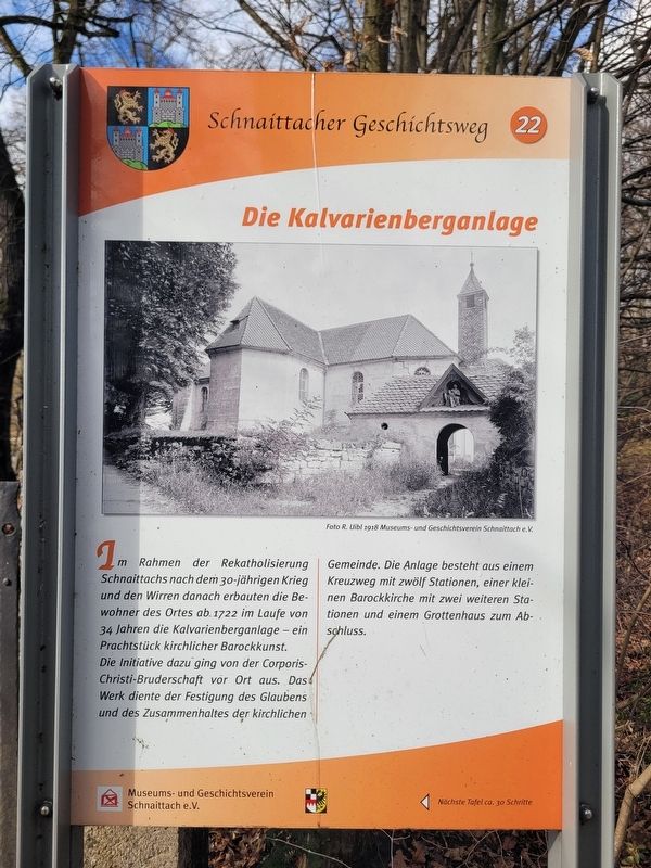
Im Rahmen der Rekatholisierung Schnaittachs nach dem 30-jährigen Krieg und den Wirren danach erbauten die Bewohner des Ortes ab 1722 im Laufe von 34 Jahren die Kalvarienberganlage - ein Prachtstück kirchlicher Barockkunst.
Die Initiative dazu ging von der Corporis-Christi-Bruderschaft vor Ort aus. Das Werk diente der Festigung des Glaubens und des Zusammenhaltes der kirchlichen Gemeinde. Die Anlage besteht aus einem Kreuzweg mit zwölf Stationen, einer kleinen Barockkirche mit zwei weiteren Stationen und einem Grottenhaus zum Abschluss.
Foto R. Uibl 1918 Museums- und Geschichtsverein Schnaittach e. V.
As part of the recatholicization of Schnaittach after the Thirty Years’ War and the turmoil that followed, the inhabitants of the town began in 1722 to build the Calvary complex, completing it over a period of 34 years. It is a splendid example of ecclesiastical Baroque art.
The initiative came from the local Corpus Christi confraternity. The project served to strengthen the faith and unity of the church community. The complex consists of a Way of the Cross with twelve stations,
this page online
Photo by R. Uibl, 1918 Museum and Historical Society of Schnaittach (registered association)
Erected 2011 by Museum and Historical Society of Schnaittach (registered association). (Marker Number 22.)
Topics. This historical marker is listed in these topic lists: Arts, Letters, Music • Religion & Religious Structures. A significant historical year for this entry is 1722.
Location. 49° 33.643′ N, 11° 20.086′ E. Marker is in Schnaittach, Bayern (Bavaria), in Nürnberger Land. It is at the intersection of Erlanger Str. and Badstraße, on the right when traveling west on Erlanger Str.. Touch for map. Marker is in this post office area: Schnaittach BY 91220, Germany. Touch for directions.

Regionally, this marker is in German Franconia. Globally, it is in Europe, the European Union, Atlantic Europe, Central Europe, the Schengen Area, Western Europe, and the Western World. Historically, it finds itself in what was once the Holy Roman Empire and also the former West Germany.
Other nearby markers. At least 8 other markers are within walking
Photographed by James Hulse, February 24, 2026
2. Die Kalvarienberganlage / Calvary Hill Complex Marker
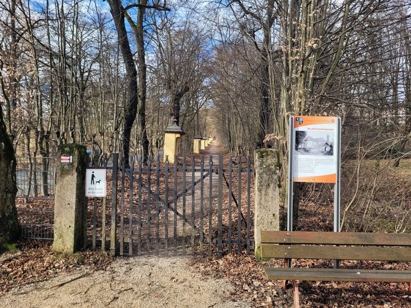
The entrance gate to the pathway up the hill to the Calvary Hill Complex.
Photographed by James Hulse, February 24, 2026
3. Die Kalvarienberganlage / Calvary Hill Complex Marker
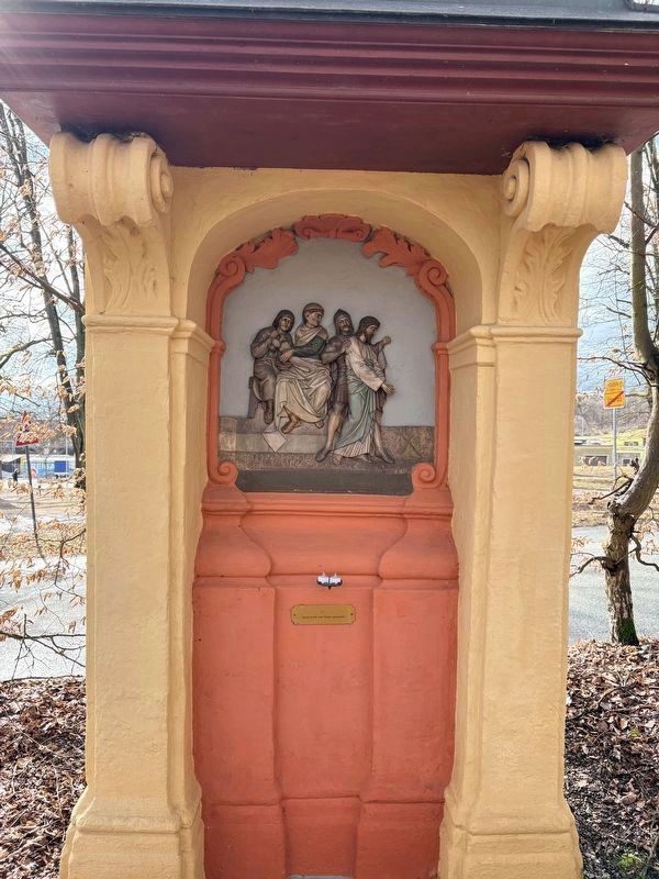
One of the “Way of the Cross” stations along the pathway. There are twelve of the stations along the pathway up the hill.
Photographed by James Hulse, February 24, 2026
4. Die Kalvarienberganlage / Calvary Hill Complex Marker
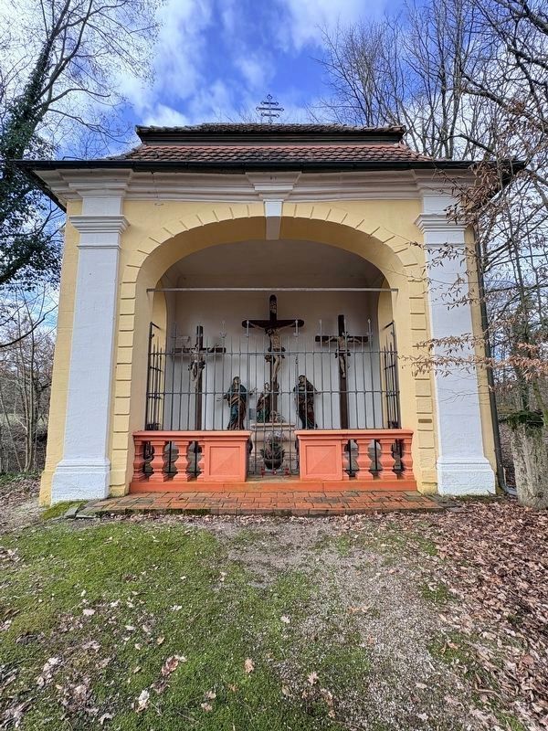
Small chapel with the Cross at the top of the hill.
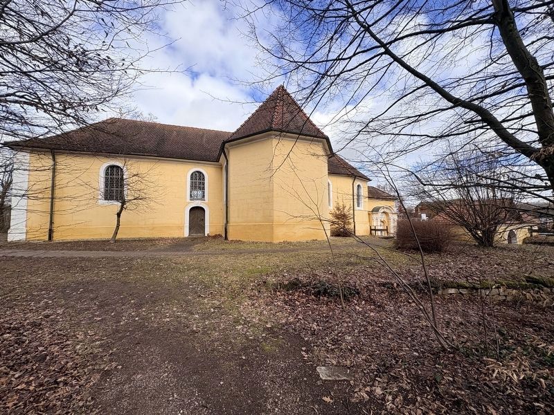
Photographed by James Hulse, February 24, 2026
5. Calvary Church
The church at the top of the hill.
Credits. This page was last revised on March 9, 2026. It was originally submitted on March 7, 2026, by James Hulse of Medina, Texas. This page has been viewed 6 times since then. Photos: 1, 2, 3, 4, 5. submitted on March 9, 2026, by James Hulse of Medina, Texas.
