Schnaittach in Nürnberger Land, Bavaria, Germany — Central Europe
Das Kriegerdenkmal
Schnaittacher Geschichtsweg
⎯⎯⎯
The War Memorial
Schnaittach Historical Trail
Photographed by James Hulse, February 24, 2026
1. Das Kriegerdenkmal / The War Memorial

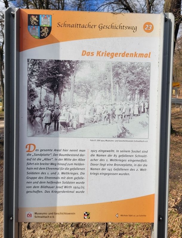
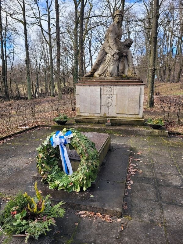
Das gesamte Areal hier nennt man die „Sandplatte“. Der Baumbestand darauf ist die „Allee". In der Mitte der Allee führt ein breiter Weg hinauf zum Heldenhain mit dem Ehrenmal für die gefallenen Soldaten des 1. und 2. Weltkrieges. Die Gruppe des Ehrenmals mit dem gefallenen und dem helfenden Soldaten wurde von dem Bildhauer Josef Wirth 1924/25 geschaffen. Das Kriegerdenkmal wurde 1925 eingeweiht. In seinem Sockel sind die Namen der 85 gefallenen Schnaittacher des 1. Weltkrieges eingemeißelt. Davor liegt eine Bronzeplatte, in der die Namen der 145 Gefallenen des 2. Weltkriegs eingegossen wurden.
Foto R. Uibl 1925 Museums- und Geschichtsverein Schnaittach e. V.
The entire area here is called the “Sandplatte.” The trees growing there are known as the “Allee.” In the middle of the avenue, a broad path leads up to the “Heldenhain” (heroes’ grove) with the memorial for the soldiers who fell in the First and Second World Wars. The memorial group with the fallen soldier and the soldier helping him was created by the sculptor Josef Wirth in 1924/25. The war memorial was inaugurated in 1925. In its base are carved the names of the 85 men from Schnaittach who fell in the First World War. In front of it lies a bronze plate bearing the names of the 145 soldiers who fell in the Second World War.
Photo by R. Uibl, 1925 Museum and Historical Society of Schnaittach (registered association)
Erected 2011 by Museum and Historical Society of Schnaittach (registered association). (Marker Number 23.)
Topics. This historical marker and memorial is listed in this topic list: Military. A significant historical year for this entry is 1925.
Location. 49° 33.64′ N,
this page online

Regionally, this marker and memorial is in German Franconia. Globally, it is in Europe, the European Union, Atlantic Europe, Central Europe, the Schengen Area, Western Europe, and the Western World. Historically, it finds itself in what was once the Holy Roman Empire and also the former West Germany.
Other nearby markers. At least 8 other markers are within walking distance of this marker: Die Kalvarienberganlage / Calvary Hill Complex (a few steps from this marker); Das alte Gemeindekrankenhaus / The Old Municipal Hospital (within shouting distance of this marker); Die evangelische Kirche / The Protestant Church (about 90 meters away, measured in a direct line); Das ehemalige Kreiskrankenhaus / The Former District Hospital (about 120 meters away); Kriegerdenkmal / World War II War Memorial (about 150 meters away); Der Markt Schnaittach seinen Helden / The Market Town of Schnaittach, its Heroes (about 150 meters away); Die Schulen / The Schools (about 180 meters away); Der Rothenberg / Fortress Hill (about 180 meters away). Touch for a list and map of all markers in Schnaittach.
Photographed by James Hulse, February 24, 2026
2. Das Kriegerdenkmal / The War Memorial
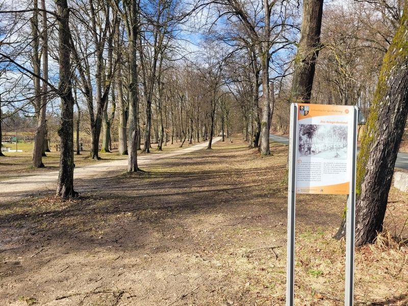
The marker at the beginning of the walkway to the memorial.
Photographed by James Hulse, February 24, 2026
3. Das Kriegerdenkmal / The War Memorial
The closeup view of the war memorial.
Credits. This page was last revised on March 9, 2026. It was originally submitted on March 7, 2026, by James Hulse of Medina, Texas. This page has been viewed 11 times since then. Photos: 1, 2, 3. submitted on March 9, 2026, by James Hulse of Medina, Texas.
