Schnaittach in Nürnberger Land, Bavaria, Germany — Central Europe
Die evangelische Kirche
Schnaittacher Geschichtsweg
⎯⎯⎯
The Protestant Church
Schnaittach Historical Trail
Photographed by James Hulse, February 24, 2026
1. Die evangelische Kirche / The Protestant Church Marker

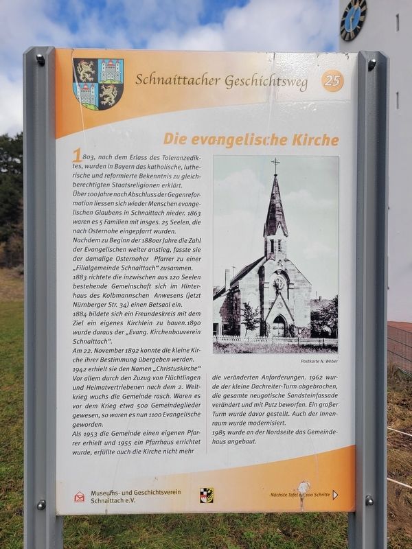
1803, nach dem Erlass des Toleranzediktes, wurden in Bayern das katholische, lutherische und reformierte Bekenntnis zu gleichberechtigten Staatsreligionen erklärt.
Über 100 Jahre nach Abschluss der Gegenreformation ließen sich wieder Menschen evangelischen Glaubens in Schnaittach nieder. 1863 waren es 5 Familien mit insgesamt 25 Seelen, die nach Osternohe eingepfarrt wurden. Nachdem zu Beginn der 1880er Jahre die Zahl der Evangelischen weiter anstieg, fasste sie der damalige Osternoher Pfarrer zu einer „Filialgemeinde Schnaittach“ zusammen. 1883 richtete die inzwischen aus 120 Seelen bestehende Gemeinschaft sich im Hinterhaus des Kolbmannschen Anwesens (jetzt Nürnberger Str. 34) einen Betsaal ein. 1884 bildete sich ein Freundeskreis mit dem Ziel, ein eigenes Kirchlein zu bauen. 1890 wurde daraus der „Evang. Kirchenbauverein Schnaittach“.
Am 22. November 1892 konnte die kleine Kirche ihrer Bestimmung übergeben werden. 1942 erhielt sie den Namen „Christuskirche“. Vor allem durch den Zuzug von Flüchtlingen und Heimatvertriebenen nach dem 2. Weltkrieg wuchs die Gemeinde rasch. Waren es vor dem Krieg etwa 500
this page online
Als 1953 die Gemeinde einen eigenen Pfarrer erhielt und 1955 ein Pfarrhaus errichtet wurde, erfüllte auch die Kirche nicht mehr die veränderten Anforderungen. 1962 wurde der kleine Dachreiter-Turm abgebrochen, die gesamte neugotische Sandsteinfassade verändert und mit Putz überzogen. Ein großer Turm wurde davor gestellt. Auch der Innenraum wurde modernisiert.
1985 wurde an der Nordseite das Gemeindehaus angebaut.
Postkarte N. Weber
In 1803, after the issuance of the Edict of Toleration, the Catholic, Lutheran, and Reformed confessions were declared equal state religions in Bavaria.
More than 100 years after the end of the Counter-Reformation, people of Protestant faith began settling again in Schnaittach. In 1863 there were five families with a total of 25 members who belonged to the parish of Osternohe. As the number of Protestants increased in the early 1880s, the pastor of Osternohe organized them into a “daughter congregation of Schnaittach.” In 1883 the community, which had grown to 120 members, established a prayer room in the rear
Photographed by James Hulse, February 24, 2026
2. The Protestant Church and Marker
On November 22, 1892, the small church was dedicated. In 1942 it received the name “Christ Church.” Especially through the arrival of refugees and expellees after the Second World War, the congregation grew rapidly. Before the war there had been about 500 members; afterward there were 1,100 Protestants.
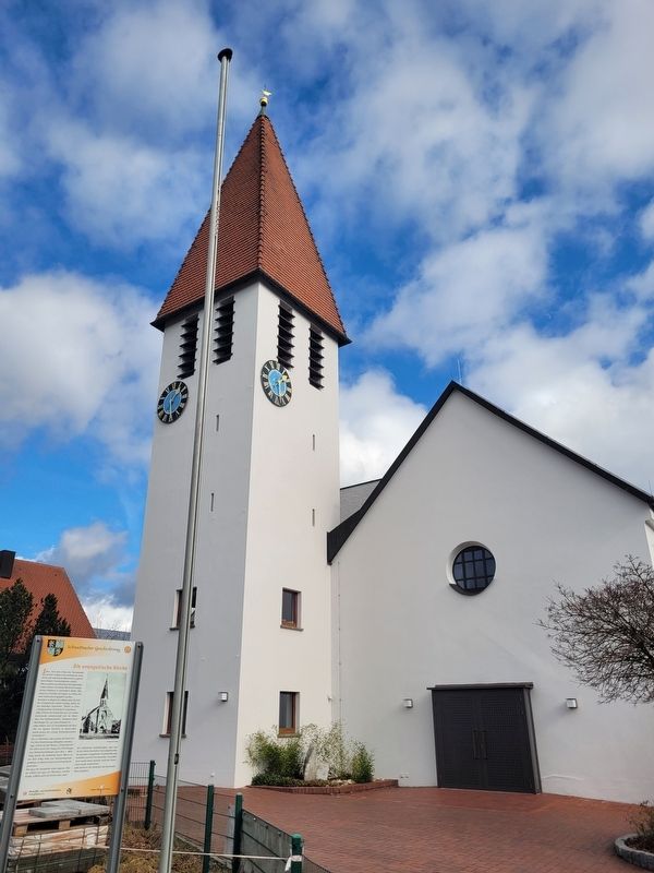
When the congregation received its own pastor in 1953 and a parsonage was built in 1955, the church no longer met the changed needs. In 1962 the small roof turret was removed, the entire neo-Gothic sandstone façade was altered and covered with plaster, and a large tower was erected in front. The interior was also modernized.
In 1985 a parish hall was added on the north side.
Postcard by N. Weber
Erected 2011 by Museum and Historical Society of Schnaittach (registered association). (Marker Number 25.)
Topics. This historical marker is listed in this topic list: Religion & Religious Structures. A significant historical date for this entry is November 22, 1892.
Location. 49° 33.615′ N,
Photographed by James Hulse, February 24, 2026
3. Die evangelische Kirche / The Protestant Church Marker
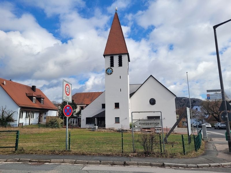
The front side view of the church.

Regionally, this marker is in German Franconia. Globally, it is in Europe, the European Union, Atlantic Europe, Central Europe, the Schengen Area, Western Europe, and the Western World. Historically, it finds itself in what was once the Holy Roman Empire and also the former West Germany.
Other nearby markers. At least 8 other markers are within walking distance of this marker: Das alte Gemeindekrankenhaus / The Old Municipal Hospital (within shouting distance of this marker); Die Schulen / The Schools (within shouting distance of this marker); Die Kalvarienberganlage / Calvary Hill Complex (about 90 meters away, measured in a direct line); Das Kriegerdenkmal / The War Memorial (about 90 meters away); Das ehemalige Kreiskrankenhaus / The Former District Hospital (about 120 meters away); Der Rothenberg / Fortress Hill (about 150 meters away); Das Scheunenviertel / The Barn Quarter (about 150 meters away); Landjüdische Spuren auf den Friedhöfen in Schnaittach (about 150 meters away). Touch for a list and map of all markers in Schnaittach.
Credits. This page was last revised on March 9, 2026. It was originally submitted on March 7, 2026, by James Hulse of Medina, Texas. This page has been viewed 8 times since then. Photos: 1, 2, 3. submitted on March 9, 2026, by James Hulse of Medina, Texas.
