Hopelawn in Perth Amboy in Middlesex County, New Jersey — The American Northeast (Mid-Atlantic)
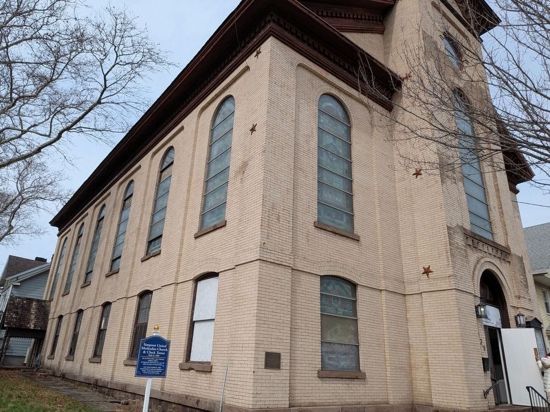
Simpson United Methodist Church
Photographed by Seva Zaslavsky, March 8, 2026
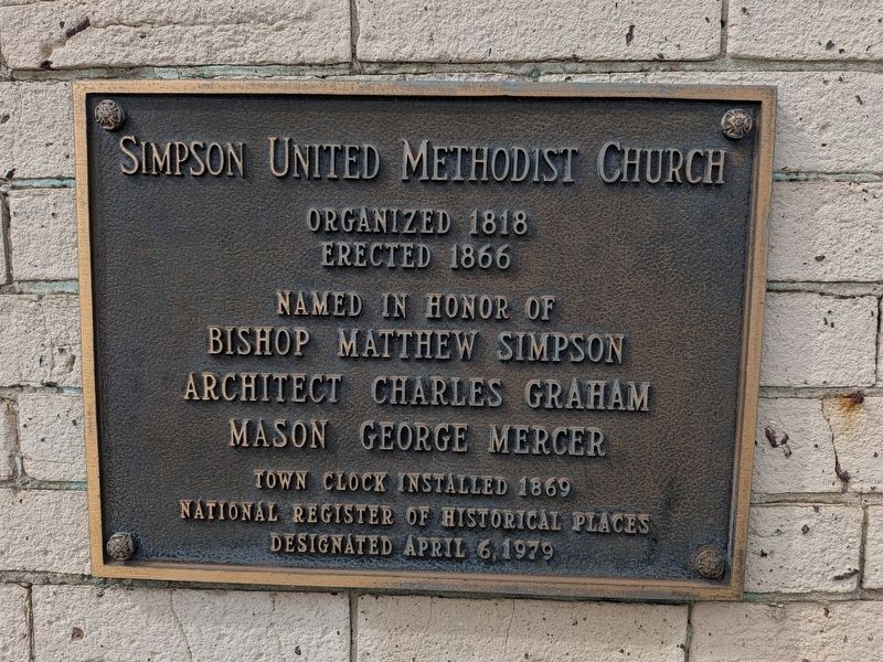
1. Simpson United Methodist Church Marker
( bronze plaque )
Erected 1866
Named in honor of
Bishop Matthew Simpson
Architect Charles Graham
Mason George Mercer
Town Clock Installed 1869
National Register of Historical Places
Designated April 6, 1979
( blue marker )
& Clock Tower
Built in 1866
Town Clock installed in 1869. Monumental in scale and simplistic in design. Owned and maintained by the City of Perth Amboy.
Erected 1979.
Topics. This historical marker is listed in these topic lists: Architecture • Religion & Religious Structures. A significant historical year for this entry is 1866.
Location. 40° 30.529′ N, 74° 15.905′ W. Marker is in Perth Amboy, New Jersey, in Middlesex County. It is in Hopelawn. It is at the intersection of High Street and Jefferson Street, on the right when traveling east on High Street. Touch for map. Marker is at or near this postal address: 329 High Street, Perth Amboy NJ 08861, United States of America. Touch for directions.

Regionally,
this page online
Other nearby markers. At least 8 other markers are within walking distance of this marker: Ye Town Tavern (about 300 feet away, measured in a direct line); Surveyor General's Office (approx. 0.2 miles away); Record Office (approx. 0.2 miles away); a different marker also named Surveyor General's Office (approx. 0.2 miles away); Board of Proprietors of the Eastern Division of New Jersey (approx. 0.2 miles away); George Washington (approx. 0.2 miles away); Market Square (approx. 0.2 miles away); The Earl of Perth (approx. 0.2 miles away). Touch for a list and map of all markers in Perth Amboy.

Photographed by Seva Zaslavsky, March 8, 2026
2. Simpson United Methodist Church Marker
Photographed by Seva Zaslavsky, March 8, 2026
3. Simpson United Methodist Church

Photographed by Seva Zaslavsky, March 8, 2026
4. Simpson United Methodist Church

Photographed by Seva Zaslavsky, March 8, 2026
5. Simpson United Methodist Church
Credits. This page was last revised on March 17, 2026. It was originally submitted on March 8, 2026, by Seva Zaslavsky of Maplewood, New Jersey. This page has been viewed 14 times since then. Photos: 1, 2, 3, 4, 5. submitted on March 8, 2026, by Seva Zaslavsky of Maplewood, New Jersey. • Michael Herrick was the editor who published this page.
