
Dundalk in Baltimore County, Maryland — The American Northeast (Mid-Atlantic)
Squeeze Tactic
Star Spangled Banner National Historic Trail
| — | National Park Service, U.S. Department of the Interior | — |
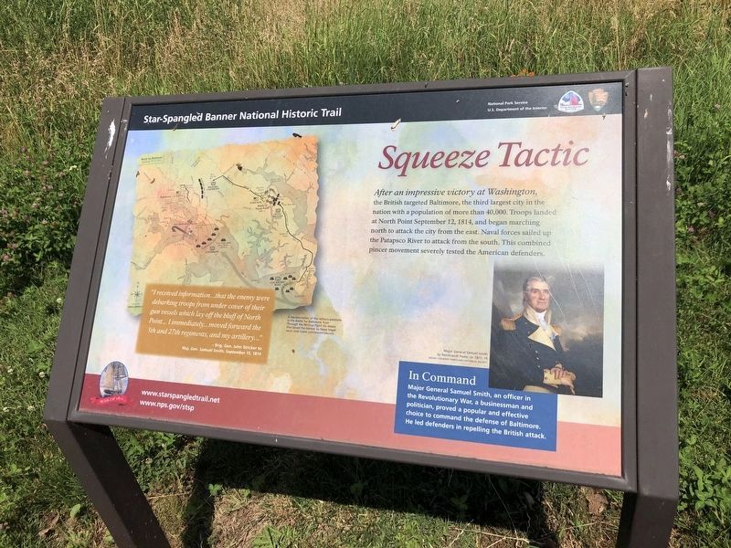
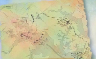
After an impressive victory at Washington, the British targeted Baltimore, the third largest city in the nation with a population of more than 40,000. Troops landed at North Point September 12, 1814, and began marching north to attack the city from the east. Naval forces sailed up the Patapsco River to attack from the south. This combined pincer movement severely tested the American defenders.
“I received information…that the enemy were debarking troops from under cover of their gun vessels which lay off the bluff of North Point…I immediately…moved forward the 5th and 27th regiments, and my artillery…”
Brig. Gen. John Stricker to Maj. Gen. Samuel Smith, September 15, 1814.
In Command
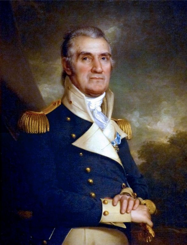
Major General Samuel Smith, an officer in the Revolutionary War, a businessman and politician, proved a popular and effective choice to command the defense of Baltimore. He led defenders in repelling the British attack.
Erected by National Park Service, U.S. Department of the Interior.
Topics and series. This historical marker is listed in this topic list: War of 1812. In addition, it is included in the Star-Spangled Banner National Historic Trail
this page online
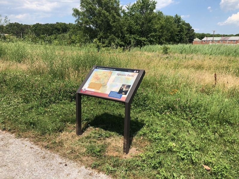
Location. 39° 16.751′ N, 76° 29.219′ W. Marker is in Dundalk, Maryland, in Baltimore County. It is on North Point Road west of Kimberly Road, on the right when traveling west. The marker is located in North Point State Park Battlefield. Touch for map. Marker is at or near this postal address: 2878 North Point Rd, Dundalk MD 21222, United States of America. Touch for directions.

Regionally, this marker is in the Baltimore Metro Region and in Central Maryland. It is also in the American Mid-Atlantic, in the Chesapeake Bay Region, and on the Eastern Seaboard. Globally, it is in the North Atlantic Region, North America, the Western Hemisphere, the Western World, and the Anglosphere. Historically, it finds itself in what was once one of the original Thirteen Colonies and also the Antebellum South.
Other nearby markers. At least 8 other markers are within walking distance of this marker: Delay Tactic (within shouting distance of this marker); Witness to Battle (within shouting distance of this marker); Proud of Our Stand (within shouting distance of this marker); Hitting Home
Photographed by Allen C. Browne, September 5, 2015
3. Samuel Smith
This 1817 Portrait of Samuel Smith by Rembrandt Peale hangs in the Maryland Historical Society Museum in Baltimore, Maryland. It was commissioned by the Baltimore City Council in 1816. Samuel Smith was a Revolutionary War officer, Commander-in-Chief at the Defense of Baltimore in 1814 and Mayor of Baltimore 1835-38.
"Samuel Smith (1752–1839) was among the most important leaders in early America. Born in Carlisle, Pennsylvania, but raised in Baltimore, Smith distinguished himself during the American Revolution. At age 25, he commanded a fort that successfully defended Philadelphia from the British, winning accolades from the Continental Congress for his bravery.
After the revolution, Smith became a powerful trader in Baltimore’s shipping industry and served as a US congressman and senator almost continuously from 1793 to 1833.
As major general, Smith was the ranking officer of Baltimore’s militia at the time of the War of 1812. He took charge of the defenses of the city and is largely credited with mobilizing the militia and preparing the fortifications to fend off a British attack. By the time the enemy arrived in September 1814, Smith had assembled such a formidable force of 10–15,000 men that the British withdrew without completing the planned assault.
After the war, Smith continued to be an important force in Congress and then, at age 81, Smith served as mayor of Baltimore from 1833 to 1835." -- SSB National Historic Trail
"Samuel Smith (1752–1839) was among the most important leaders in early America. Born in Carlisle, Pennsylvania, but raised in Baltimore, Smith distinguished himself during the American Revolution. At age 25, he commanded a fort that successfully defended Philadelphia from the British, winning accolades from the Continental Congress for his bravery.
After the revolution, Smith became a powerful trader in Baltimore’s shipping industry and served as a US congressman and senator almost continuously from 1793 to 1833.
As major general, Smith was the ranking officer of Baltimore’s militia at the time of the War of 1812. He took charge of the defenses of the city and is largely credited with mobilizing the militia and preparing the fortifications to fend off a British attack. By the time the enemy arrived in September 1814, Smith had assembled such a formidable force of 10–15,000 men that the British withdrew without completing the planned assault.
After the war, Smith continued to be an important force in Congress and then, at age 81, Smith served as mayor of Baltimore from 1833 to 1835." -- SSB National Historic Trail
Photographed by Don Morfe, May 3, 2015
4. Close up of the map on the Squeeze Tactic Marker
(Inscription beside the map) A representation of the military positions in the Battle of Baltimore, from Through the Perilous Fight: Six Weeks that Saved the Nation, by Steve Vogel. Image/Gene Thorpe, Cartongraphic Concepts.
Credits. This page was last revised on March 9, 2026. It was originally submitted on May 6, 2015, by Don Morfe of Baltimore, Maryland. This page has been viewed 913 times since then and 32 times this year. Last updated on March 8, 2026, by Evan Dwyer of Richmond, Virginia. Photos: 1, 2. submitted on June 26, 2020, by Devry Becker Jones of Washington, District of Columbia. 3. submitted on December 26, 2016, by Allen C. Browne of Silver Spring, Maryland. 4. submitted on May 6, 2015, by Don Morfe of Baltimore, Maryland. • Devry Becker Jones was the editor who published this page.
