Near Beeville in Bee County, Texas — The American South (West South Central)
Cadiz Baptist Church
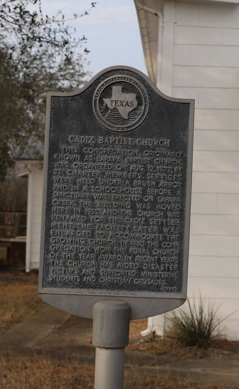
Photographed by Dave W, March 8, 2026
1. Cadiz Baptist Church Marker
This congregation, orginally known as Lapara Baptist Church, was organized on Aug. 12, 1877, by 32 charter members. Services were held under a brush arbor and in a schoolhouse before a sanctuary was erected on Lapara Creek. The building was moved here in 1920, and the church was renamed for the Cadiz settlement. The facility later was enlarged to accommodate the growing church. In 1960 the congregation won the Rural Church of the Year award. In recent years the church has aided disaster victims and supported ministerial students and Christian crusades.
Incise on base: In Memory of Cpl George I. Tindol Son of Mr. & Mrs. B. K. Tindol
Erected 1983 by Texas Historical Commission. (Marker Number 619.)
Topics. This historical marker is listed in this topic list: Religion & Religious Structures. A significant historical date for this entry is August 12, 1877.
Location. 28° 25.652′ N, 97° 56.371′ W. Marker is near Beeville, Texas, in Bee County. It is at the intersection of Farm to Market Road 799 and County Road 347, on the right when traveling west on Farm to Market Road 799. Touch for map. Marker is at or near this postal address: 7054 FM799, Beeville TX 78102, United States of America. Touch for directions.

Regionally, this marker is in South Texas. It is also in the American South. Globally, it is in North America, a Gulf of Mexico state, the Western Hemisphere, the Western World, and the Anglosphere. Historically, it finds itself in what was once New Spain, the Republic of Texas, and one of the Confederate States of America.
Other nearby markers. At least 8 other markers are within 11 miles of this marker, measured as the crow flies: Live Oak County Jail (approx. 10 miles away); Town of Oakville (approx. 10 miles away); Oakville Post Office (approx. 10 miles away); Gussettville (approx. 10.4 miles away);
this page online
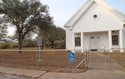
Photographed by Dave W, March 8, 2026
2. Cadiz Baptist Church Marker
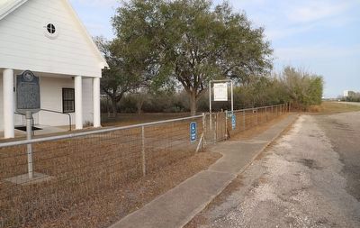
Photographed by Dave W, March 8, 2026
3. Cadiz Baptist Church Marker
Looking east along FM 799.
Credits. This page was last revised on March 9, 2026. It was originally submitted on March 8, 2026, by Dave W of Co, Colorado. This page has been viewed 14 times since then. Photos: 1, 2, 3. submitted on March 8, 2026, by Dave W of Co, Colorado. • James Hulse was the editor who published this page.
