Florence in Fremont County, Colorado — The American Mountains (Southwest)
John Charles Fremont
January 21, 1814 — July 13, 1890
Photographed by Cosmos Mariner, July 25, 2025
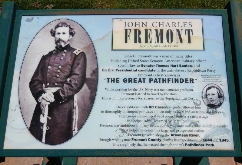
1. John Charles Fremont Marker (left panel)
This is the leftmost of two interpretive panels overlooking the John Charles Fremont sculpture.
[left panel]
John C. Fremont was a man of many titles, including United States Senator, American military officer, son-in-law to Senator Thomas Hart Benton, and the first Presidential candidate of the anti-slavery Republican Party.
Fremont is best known as “The Great Pathfinder”. While working for the U.S. Navy as a mathematics professor, Fremont learned to travel by the stars. This set him on a course for a career in the Topographical Corps.
His expeditions, with Kit Carson as guide, allowed him to thoroughly document pathways known only by local Indian tribes and trappers. These maps allowed westward bound settlers a safe passage and helped advance America’s Manifest Destiny.
Fremont was ambitious in many fields, but he was most successful in defining paths that helped to create this large and prosperous nation. Fremont traveled along the Arkansas River, through what is now Fremont County, during his expeditions of 1844 and 1845. It is very likely that he passed through today's Pathfinder Park.
[photo caption] Kit Carson guided Fremont’s three Western expeditions 1842-1846, drawing on his experience as a fur trapper and
this page online
[right panel]
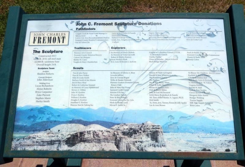
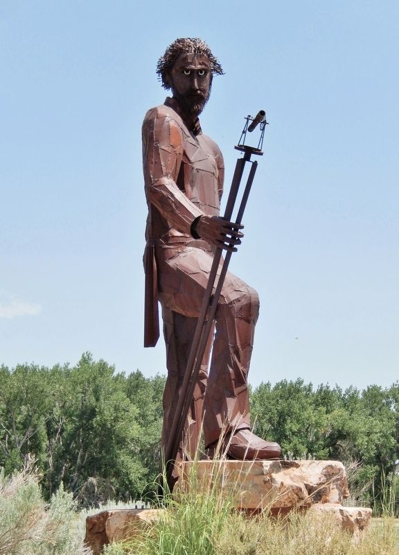
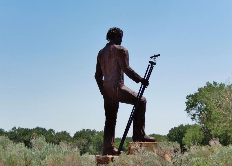
The Sculpture
Constructed 2013; 4,000 lb.; 20 ft. tall steel man; 32,000 lb. sandstone base;
Overall height 24 ft.
Sculpture Team
Sculptor
Sheldon Roberts
Concept Designer
John Alderman
Welding Crew
Lucas Richardson • Alyjus Roberts • Bryce Carpenter • Zake Pierson • Stephen Mann • Harley Smith
Erected 2013.
Topics. This historical marker is listed in this topic list: Exploration. A significant historical year for this entry is 1844.
Location. 38° 24.399′ N, 105° 8.742′ W. Marker is in Florence, Colorado, in Fremont County. It is on Cedar Avenue (State Highway 115) 0.6 miles east of Brewster Lane, on the left when traveling east. The marker and sculpture are located at the Pathfinder Regional Park entrance. Touch for map. Marker is at or near this postal address: 6639 Cedar Avenue, Florence CO 81226, United States of America. Touch for directions.

Regionally, this marker is in Colorado’s Arkansas River Valley and in Pikes Peak Region. It is also in the American Mountain West. Globally, it is in North America, the Rocky Mountains, the Western Hemisphere, the Western World, and the Anglosphere.
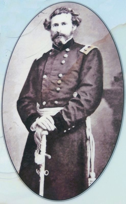
2. Marker detail: John Charles Fremont
Other nearby markers. At least 8 other markers are within 2 miles of this marker, measured as the crow flies: Oldest Oil Field In The West (approx. 1½ miles away); The City of Florence (approx. 1.6 miles away); Florence High School (approx. 1.7 miles away); First Presbyterian Church (approx. 1.8 miles away); The Santa Fe Building (approx. 1.8 miles away); Lovell Block (approx. 1.8 miles away); Wilson Block & Wilson Annex (approx. 1.8 miles away); Lt. Zebulon Pike's Southwestern Expedition (approx. 1.8 miles away). Touch for a list and map of all markers in Florence.
Also see . . . Major-General John Charles Frémont (Wikipedia).
Excerpt: United States Army officer, explorer, and politician. He was a United States senator from California and was the first Republican nominee for president of the U.S. in 1856 and founder of the California Republican Party upon being nominated. Frémont lost the election to Democrat James Buchanan.(Submitted on March 14, 2026, by Cosmos Mariner of Cape Canaveral, Florida.)Frémont, who would later be known as The Pathfinder, carried on the tradition of Western overland
exploration, building on and adding to the work of earlier pathfinders to expand knowledge of the American West. Frémont's talent lay in his scientific documentation, publications, and maps made based on his expeditions, making the American West accessible for many Americans. Beginning in 1842, Frémont led five western expeditions. Frémont's initial explorations – specifically, his timely scientific reports (co-authored by his wife Jessie) and their romantic writing style – encouraged Americans to travel West. A series of seven maps produced from his findings, published by the Senate in 1846, served as a guide for thousands of American emigrants, depicting the entire length of the Oregon Trail.Photographed by Cosmos Mariner, July 25, 20253. John Charles Fremont Marker (right panel)This is the rightmost of two interpretive panels overlooking the John Charles Fremont sculpture. Sculpture donors are not transcribed.
Photographed by Cosmos Mariner, July 25, 2025
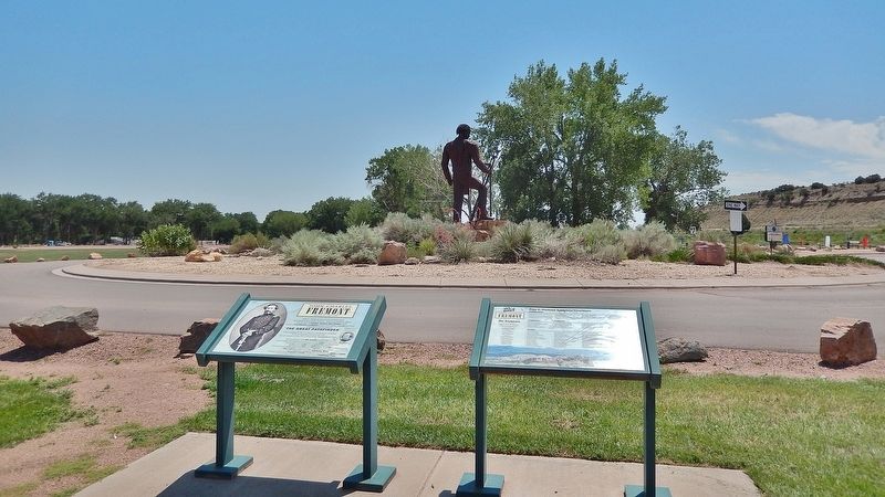
4. John Charles Fremont Marker
Looking east from the Pathfinder Regional Park parking lot. The John Charles Fremont sculpture is in the background.
Photographed by Cosmos Mariner, July 25, 2025
5. John Charles Fremont Sculpture
Photographed by Cosmos Mariner, July 25, 2025
6. John Charles Fremont Sculpture
Credits. This page was last revised on March 14, 2026. It was originally submitted on March 11, 2026, by Cosmos Mariner of Cape Canaveral, Florida. This page has been viewed 21 times since then. Photos: 1. submitted on March 13, 2026, by Cosmos Mariner of Cape Canaveral, Florida. 2, 3, 4, 5, 6. submitted on March 14, 2026, by Cosmos Mariner of Cape Canaveral, Florida.
