Maple in Vaughan in York Region, Ontario — Central Canada (North America)
Teston
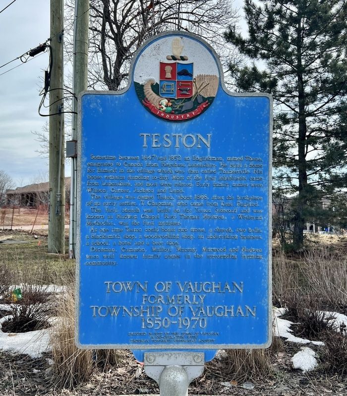
Photographed by Tim Boyd, March 9, 2026
1. Teston Marker
Town of Vaughn
Formerly Township of Vaughn
1850-1970
Sometime between 1847 and 1852 an Englishman, named Thane, emigrated to Canada from Heyshaw, Lancashire. He built a home for himself in the village which was then called Thanesville. His house remains standing to-day. Most of the First inhabitants came from Lancashire, and most were related. Early family names were Wilson, Garner, Jackson and Lund.
The village was named Teston, about 1868, after the birthplace of an early settler, T. Chapman, who came from Kent, England. The first church was built on the Teston Sideroad and was known as Hadwen Chapel Rev. Thomas Hadwen, a Wesleyan Methodist was me first minister.
At one time Teston could boast two stores, a church, two halls, a blacksmith shop, a woodworking shop, an undertaking business a school, a hotel and a beer shop.
Diceman, Cameron, Malloy, Murray Marwood and Hadwen were well known family names in surrounding farming community.
Erected 1977 by Town of Vaughn, Vaughan Township Historical Society.
Topics. This historical marker is listed in this topic list: Settlements & Settlers. A significant historical year for this entry is 1868.
Location. 43° 52.099′ N,
this page online

Regionally, this marker is in Greater Toronto, specifically on the Golden Horseshoe, in the York, Durham and Headwaters Area, and in the Toronto Metropolitan Area. It is also in Central Canada. Globally, it is in North America, the Western Hemisphere, the Western World, and the Anglosphere. Historically, it finds itself in what was once a British colony, the Viceroyalty of New France, the Haudenosaunee (Iroquois) Confederacy, and Rupert’s Land.
Other nearby markers. At least 8 other markers are within 6 kilometers of this marker, measured as the crow flies: Lord Beaverbrook 1879-1964 (approx. 2.8 kilometers away); 9980 Keele Street (approx. 2.8 kilometers away); St. Andrew’s Church (approx. 3 kilometers away); Antique Carrousel (approx. 3.1 kilometers away); The Mighty Canadian Minebuster (approx. 3.2 kilometers away);

Photographed by Tim Boyd, March 9, 2026
2. Teston Marker

3. Teston, Shown on a map of Vaughn Township in 1877
Source: McGill University (public domain)
Credits. This page was last revised on March 13, 2026. It was originally submitted on March 12, 2026, by Tim Boyd of Hamilton, Ontario. This page has been viewed 16 times since then. Photos: 1, 2, 3. submitted on March 12, 2026, by Tim Boyd of Hamilton, Ontario. • Andrew Ruppenstein was the editor who published this page.
