King City in York Region, Ontario — Central Canada (North America)
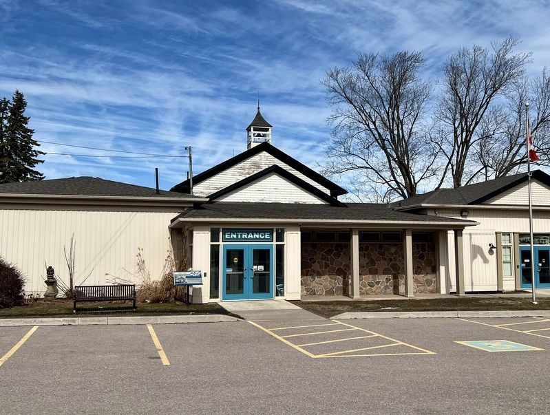
Kinghorn School

Photographed by Tim Boyd, March 9, 2026
1. Kinghorn School Marker
In 1861, Kinghorn S.S. 23, a new one-room frame schoolhouse, was built on land purchased from James Burns. The new building replaced a log cabin, known as the "squatter's school", that had provided a space for lessons since 1847. Kinghorn was one of many one-room schoolhouses that served small communities across King Township.
Over the years Kinghorn School was expanded and improvements were made. By 1916, the school was moved about 30 feet 10 metres onto a new foundation; a furnace was installed, the school was painted and new toilets were built behind the building. Electricity was added in 1937. Additions made in 1963 enlarged the building into a 3-room schoolhouse. The Kinghorn School closed in 1974 as smaller schools merged with larger ones and children were bused to school.
In 1979, the site was purchased by the Township of King for a museum which opened its doors three years later under the stewardship of the King Township Historical Society (KTHS). The site is now run by the Township of King and is known as the King Heritage & Cultural Centre. Visitors can learn about the history of the Township in the renovated
this page online
Erected by Township of King.
Topics. This historical marker is listed in this topic list: Education. A significant historical year for this entry is 1861.
Location. 43° 55.425′ N, 79° 33.072′ W. Marker is in King City, Ontario, in York Region. It is on King Road 0.1 kilometers east of James Street, on the left when traveling east. Touch for map. Marker is at or near this postal address: 2920 King Road, King City ON L7B 1L6, Canada. Touch for directions.

Regionally, this marker is in Greater Toronto, specifically on the Golden Horseshoe, in the York, Durham and Headwaters Area, and in the Toronto Metropolitan Area. It is also in Central Canada. Globally, it is in North America, the Western Hemisphere, the Western World, and the Anglosphere. Historically, it finds itself in what was once a British colony, the Viceroyalty of New France, the Haudenosaunee (Iroquois) Confederacy, and Rupert’s Land.
Other nearby markers. At least 8 other markers are within 10 kilometers of this marker, measured as the crow flies: Laskay Hall (within
Photographed by Tim Boyd, March 9, 2026
2. Kinghorn School Marker
At the left of the entrance, the original schoolhouse is visible behind
Credits. This page was last revised on March 13, 2026. It was originally submitted on March 12, 2026, by Tim Boyd of Hamilton, Ontario. This page has been viewed 12 times since then. Photos: 1, 2. submitted on March 12, 2026, by Tim Boyd of Hamilton, Ontario. • Andrew Ruppenstein was the editor who published this page.
