Groveport in Franklin County, Ohio — The American Midwest (Great Lakes)
Historic Downtown Groveport
Historical Views of Groveport
Photographed by William Fischer, Jr., March 12, 2026
1. Historic Downtown Groveport Marker
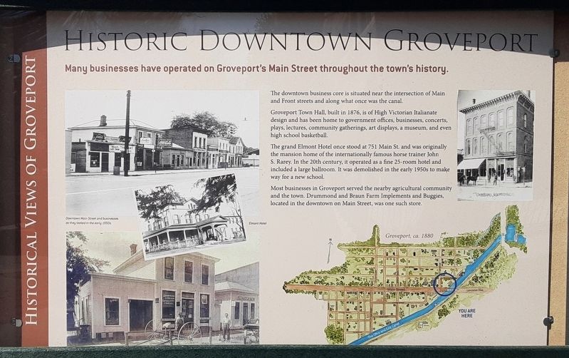
Many businesses have operated on Groveport's Main Street throughout the town's history.
The downtown business core is situated near the intersection of Main and Front streets and along what once was the canal.
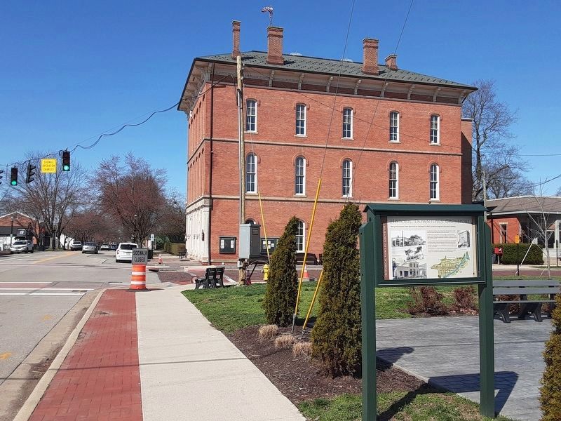
Groveport Town Hall, built in 1876, is of High Victorian Italianate design and has been home to government offices, businesses, concerts, plays, lectures, community gatherings, art displays, a museum, and even high school basketball.
The grand Elmont Hotel once stood at 751 Main St. and was originally the mansion home of the internationally famous horse trainer John S. Rarey. In the 20th century, it operated as a fine 25-room hotel and included a large ballroom. It was demolished in the early 1950s to make way for a new school.
Most businesses in Groveport served the nearby agricultural community and the town. Drummond and Braun Farm Implements and Buggies, located in the downtown on Main Street, was one such store.
[Photo captions]
• [Left top] Downtown Main Street and businesses as they looked in the early 1950s.
• [Left center] Elmont Hotel
• [Left bottom shows Drummond and Braun Farm Implements and
this page online
• [Right top shows the Town Hall]
• [Right bottom map] Groveport, ca. 1880
Topics. This historical marker is listed in these topic lists: Animals • Industry & Commerce • Settlements & Settlers. A significant historical year for this entry is 1876.
Location. 39° 51.075′ N, 82° 52.923′ W. Marker is in Groveport, Ohio, in Franklin County. It is at the intersection of Main Street and Front Street, on the right when traveling west on Main Street. Marker is in a pocket park at the intersection. Touch for map. Marker is in this post office area: Groveport OH 43125, United States of America. Touch for directions.

Regionally, this marker is in the Scioto Valley and in the Columbus Metropolitan Area. It is also in the American Midwest and in the Corn Belt. Globally, it is in North America, the Western Hemisphere, the Western World, and the Anglosphere. Historically, it finds itself in what was once the Haudenosaunee (Iroquois) Confederacy, the territory of the Mississippian Culture, and the Northwest Territory.
Other nearby markers. At least 8 other markers are within walking distance of this marker: Ohio Canal in the Heart of Town
Photographed by William Fischer, Jr., March 12, 2026
2. Historic Downtown Groveport Marker
Credits. This page was last revised on March 15, 2026. It was originally submitted on March 15, 2026, by William Fischer, Jr. of Reynoldsburg, Ohio. This page has been viewed 19 times since then. Photos: 1, 2. submitted on March 15, 2026, by William Fischer, Jr. of Reynoldsburg, Ohio.
