Seaholm District in Austin in Travis County, Texas — The American South (West South Central)
Seaholm Power Plant
Photographed by Keith Peterson, April 4, 2010
1. Seaholm Power Plant Marker
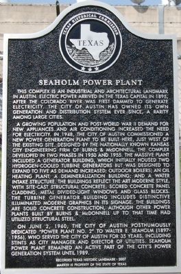
This complex is an industrial and architectural landmark in Austin. Electric power arrived in the Texas capital in 1895, after the Colorado River was first dammed to generate electricity. The city of Austin has owned its own generation and distribution system ever since, a rarity among large cities.
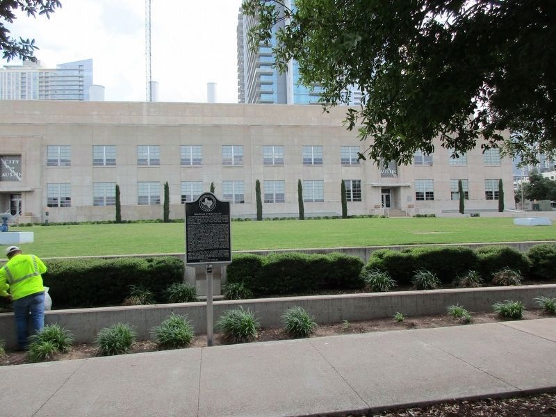
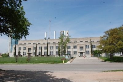
A growing population and post-World War II demand for new appliances and air conditioning increased the need for electricity. In 1948, the city of Austin commissioned a new power generation plant to be built here, just west of the existing site. Designed by the nationally known Kansas City engineering firm of Burns & McDonnell, the complex developed in two phases in 1950 and 1955. The massive plant included a generator building, which initially housed two hydrogen-cooled turbine generators but was designed to expand to five as demand increased; outdoor boilers; an oil heating plant; a demineralization building; and a water intake structure. The buildings reflect the Art Moderne style, with site-cast structural concrete, scored concrete panel cladding, metal divided-light windows and glass blocks. The turbine generator building includes distinctive illuminated Moderne graphics in its signage. The buildings are solid concrete construction, although other power plants built by Burns & McDonnell up to that time had utilized structural steel.
On June 2, 1960, the city of Austin posthumously dedicated “Power Plant No. 2” to Walter E. Seaholm (1897-1956), who served the city of Austin for 35 years, including stints as City Manager and Director of Utilities. Seaholm Power Plant remained an active part of the city’s power generation system until 1989.
Recorded Texas Historic Landmark - 2007
Erected 2007 by Texas Historical Commission. (Marker Number 13974.)
Topics. This historical marker is listed
this page online
Location. 30° 15.957′ N, 97° 45.182′ W. Marker is in Austin, Texas, in Travis County. It is in the Seaholm District. It is on West Cesar Chavez Street (State Highway 343) east of West Avenue, on the right when traveling west. Touch for map. Marker is at or near this postal address: 800 West Cesar Chavez Street, Austin TX 78703, United States of America. Touch for directions.

Regionally, this marker is in Central Texas. It is also in the American South. Globally, it is in North America, a Gulf of Mexico state, the Western Hemisphere, the Western World, and the Anglosphere. Historically, it finds itself in what was once New Spain, the Republic of Texas, one of the Confederate States of America, and the Antebellum South.
Other nearby markers. At least 8 other markers are within walking distance of this marker: Shoal Creek (about 600 feet away, measured in a direct line); Margaret Moser Plaza (approx. 0.2 miles away); Michael Paggi House (approx. ¼ mile away); J.P. Schneider Store (approx. 0.3 miles away); Wood Street Settlement at Shoal Creek
Photographed by Jeff Leichsenring, May 8, 2023
2. Seaholm Power Plant Marker
Photographed by Keith Peterson, April 4, 2010
3. Seaholm Power Plant
Photographed by Keith Peterson, April 4, 2010
4. Old Power Plant
Credits. This page was last revised on May 9, 2023. It was originally submitted on April 5, 2010, by Keith Peterson of Cedar Park, Texas. This page has been viewed 1,571 times since then and 69 times this year. Photos: 1. submitted on April 5, 2010, by Keith Peterson of Cedar Park, Texas. 2. submitted on May 9, 2023, by Jeff Leichsenring of Garland, Texas. 3, 4. submitted on April 5, 2010, by Keith Peterson of Cedar Park, Texas. • Syd Whittle was the editor who published this page.
