San Mateo in San Mateo County, California — The American West (Pacific Coastal)
San Mateo’s First Residents
There are few traces left of
San Mateo’s First Residents
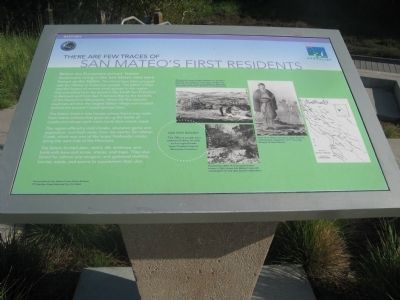
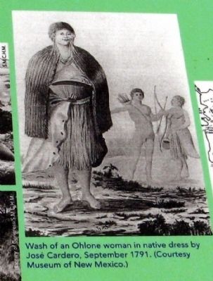
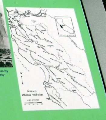
Before the Europeans arrived, Native Americans living in the San Mateo area were known as the Salson. The Salson have been grouped with the Ohlone or Costanoan people. The Salson triblet was the largest of several small groups in the region that stretched from the present-day South San Francisco to Belmont and from San Francisco Bay to the foothills of the Santa Cruz Mountains. When the first Spanish explorers arrived, the largest Salson village was located behind the present Crystal Springs Dam.
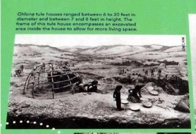
The Salson lived in tule houses whose frame was made from native willows that grew along the banks of creeks and whose roofs were made from marsh reeds.
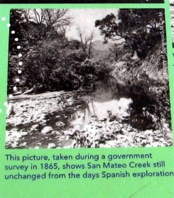
The region offered a mild climate, abundant game and vegetation, and fresh water from the nearby San Mateo Creek, which was one of the larger freshwater creeks along the west side of the Peninsula.
The Salson hunted deer, rabbit, elk, antelope, and birds with bow and arrow, snares, and traps. They also fished for salmon and sturgeon and gathered shellfish, berries, seeds, and acorns to supplement their diet.
Topics. This historical marker is listed in these topic lists: Native Americans • Natural Resources • Notable Places.
Location. 37° 34.518′ N, 122° 18.413′ W. Marker is in San Mateo, California, in San Mateo County. Marker is on J. Hart Clinton Drive. Marker is located at Ryder Park near the children's play structure. Touch for map. Marker is at or near this postal address: 1801 J Hart Clinton Drive, San Mateo CA 94401, United States of America. Touch for directions.
Other nearby markers. At least 8 other markers are within 2 miles of this marker, measured as the crow flies. History of San Mateo’s Bridges (approx. 0.3 miles away); Morse’s Corners (approx. 1.1 miles away); Central Park Veterans Memorial – Japanese American Combat Team (approx. 1.2 miles away); The Amelia Voller House (approx. 1.2 miles away); Central Park Veterans Memorial (approx. 1.2 miles away); Central Park Veterans Memorial - Screaming Eagles Grove (approx. 1.3 miles away); Central Park and The Kohl Pumphouse (approx. 1.3 miles away); Central Park Veterans Memorial – World War I (approx. 1.3 miles away). Touch for a list and map of all markers in San Mateo.
Regarding San Mateo’s First Residents. Appearing on the marker is the question:
Did You Know?
The Ohlone people once numbered about 10,000 and occupied lands from Contra Costa to Monterey Counties.
Also see . . . The Ohlones. General information on the Ohlone tribelets in Northern California. (Submitted on April 6, 2010.)
Credits. This page was last revised on June 16, 2016. It was originally submitted on April 6, 2010, by Syd Whittle of Mesa, Arizona. This page has been viewed 1,235 times since then and 52 times this year. Photos: 1, 2, 3, 4, 5, 6. submitted on April 6, 2010, by Syd Whittle of Mesa, Arizona.
