
Hezekiah Dunham House
• 1832 •
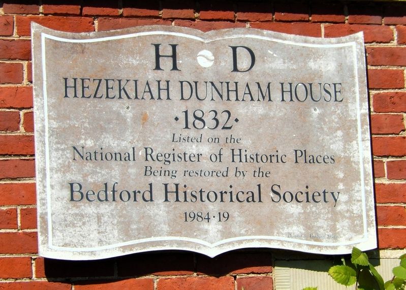
National Register of Historic Places
Being restored by the
Bedford Historical Society
1984 • 19
Erected by Bedford Historical Society.
Topics and series. This historical marker is listed in these topic lists: Architecture • Notable Buildings • Settlements & Settlers. In addition, it is included in the National Register of Historic Places (NRHP) series list. A significant historical year for this entry is 1832.
Location. 41° 23.448′ N, 81° 32.063′ W. Marker is in Bedford, Ohio, in Cuyahoga County. It is at the intersection of Broadway Avenue (State Highway 14) and North Park Street, on the right when traveling west on Broadway Avenue. The marker is mounted on the right side of the Hezekiah Dunham House front entrance. Touch for map. Marker is at or near this postal address: 729 Broadway Avenue, Bedford OH 44146, United States of America. Touch for directions.

Regionally, this marker is in Greater Cleveland, on the Lake Erie Shore, and in the Western Reserve. It is also in the American Midwest. Globally, it is in North America, on the Great Lakes, in the Western Hemisphere, in the Western
this page online
Other nearby markers. At least 8 other markers are within walking distance of this marker: Bedford Historic Business District (within shouting distance of this marker); Archibald M. Willard, 1836-1918 (within shouting distance of this marker); Benjamin Franklin Fitch (within shouting distance of this marker); Bradford WWII Veterans Memorial (within shouting distance of this marker); Bedford Civil War Memorial (within shouting distance of this marker); In Remembrance Veterans of World War I (within shouting distance of this marker); Elmer Harrison Flick (within shouting distance of this marker); Bedford Township Hall (about 300 feet away, measured in a direct line). Touch for a list and map of all markers in Bedford.
Regarding Hezekiah Dunham House. National Register of Historic Places № 75001352.
From the National Register Nomination prepared by Eric Johannesen, 11/1974:Also a contributing property in Bedford Historic District, National Register of Historic Places № 04000712.
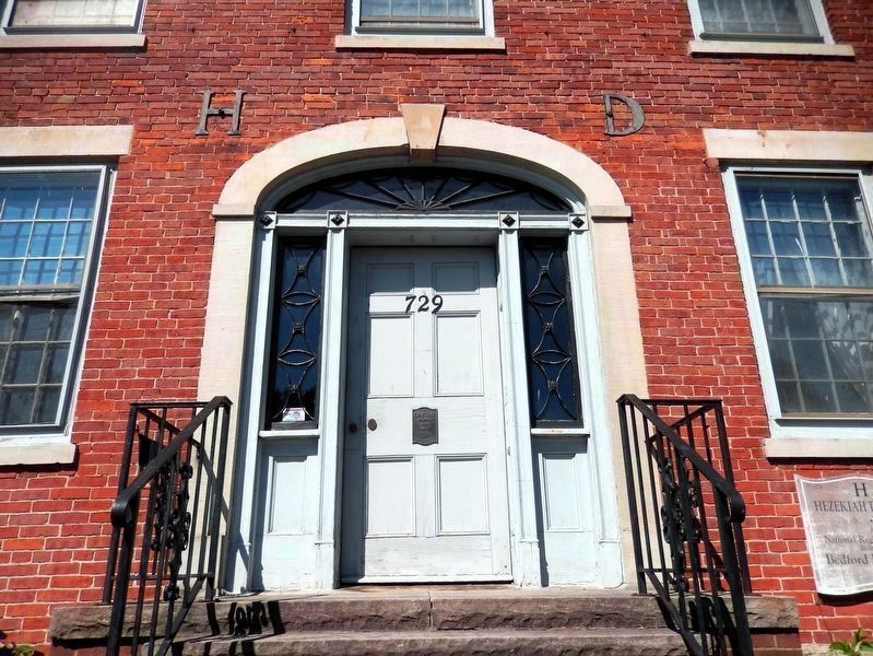
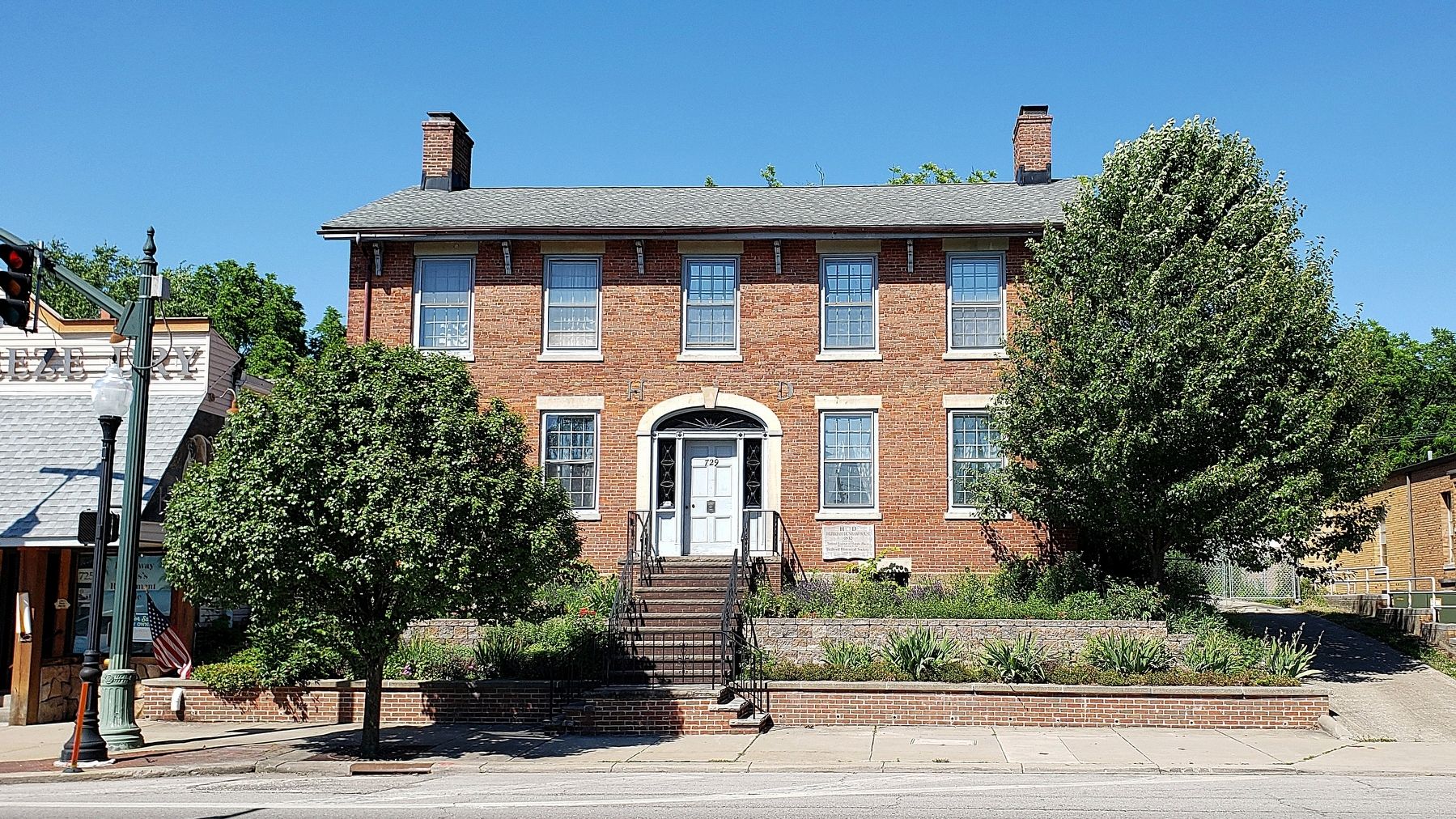
This is a two-story brick house in the late Adam style,with an attached wing of frame construction and late nineteenth century additions. The five-bay facade has a center entrance with a semi-elliptical fanlight and sidelights. Some of the second story windows have original twelve-light sash. The porch extending across the front was added after 1872, as were the Italianate brackets under the eaves.Photographed by Cosmos Mariner, June 17, 20212. Century Home MarkerCentury Home
Built 1832
Bedford Historical Society
The one-story wing projecting to the rear (northeast) appears to be an older structure to which the brick house was added. Its exterior has been sheathed with asphalt imitation brick. There is a full cellar under the entire building except for the last ten feet of the wing. The cellar walls are of random sandstone construction. The substructure makes it clear that the frame and brick sections were built at different times. Some of the joists in the wing are unfinished logs, but the joists in the brick section are sawn timbers.
On the first story interior, the center hall runs the width of the house. The original stairway has an elegant baluster-type post and an unusually low rail. There were originally two rooms on each floor. The fireplaces have been closed, but the mantel pieces remain. Thehouse stands on a narrow lot a dozen steps above the sidewalk level. The street was widened and lowered in the 1890s, leaving the house perched on its present site.Photographed by Cosmos Mariner, June 17, 20213. Hezekiah Dunham House MarkerThe Century Home marker is mounted at the center of the front door. The National Register marker is partially visible on the right side of the front entrance. The metal initials "H D" lie above and on either side of the arched entrance.The Dunham house was the home of the most important early citizen of Bedford, is a rare survival on a densely commercial street, and is a good example of early nineteenth century construction. Hezekiah Dunham was responsible for the town plat of the present center of Bedford. The first settler arrived in 1813, and the post office was established in 1826. Dunham arrived in 1830 or 1831. In 1834 he had a large tract of land northeast of Tinker's Creek surveyed for a village. He had lots set aside for a public square, which is directly opposite the house, a town hall and school. This was not entirely disinterested. He caused the main street to run in front of his house, and it took business away from the older road.
The town of Bedford was incorporated in 1837. Hezekiah's son David opened the first store in the township in 1831. Eight years later he moved to a new stone store north of the Dunham house. It was destroyed by fire in 1878. Johnson's history states that David Dunham,
who continued to live in the house after his father's death, had a business of $100,000 a year for several years. Hezekiah died in 1872 and David died in 1887.Photographed by Cosmos Mariner, June 17, 20214. Hezekiah Dunham House

From the National Register Nomination prepared by Deanna L. Bremer, 4/15/2003:
The south side of Broadway contains the oldest resource in the district, the home of early Bedford settlers, Hezekiah and Clarissa Dunham. They lived in a three-room frame house on a sandstone foundation upon their arrival in Bedford in 1830 (demolished in 2002 due to termite damage). In 1832, they added a two-story Federal Style brick addition to their home on the Bedford Turnpike Road. The restored Dunham House is listed separately in the National Register and is contributing to the district.The metal initials "H D" lie on either side of the arched entranceway of the brick mansion, and stone steps lead down to street level. The simple lines of the Federal-Style Dunham House reflect the town's origins as a rural postal route. The Dunhams had bought 100 acres of land in the center of Bedford
Township from the Connecticut Land Company for two dollars an acre. They built their home in the middle of their holdings and then began to strategically donate sites for public use, thus assuring that the village would be developed in their area. In 1836, the Dunhams deeded just less than three acres of land located just across the turnpike from their home to be kept forever as a public square.
Credits. This page was last revised on March 20, 2026. It was originally submitted on March 19, 2026, by Cosmos Mariner of Cape Canaveral, Florida. This page has been viewed 31 times since then. Photos: 1, 2, 3, 4. submitted on March 20, 2026, by Cosmos Mariner of Cape Canaveral, Florida.
