Northeast Side in Schertz in Guadalupe County, Texas — The American South (West South Central)
Schertz Historic Site
Schertz Railroad History
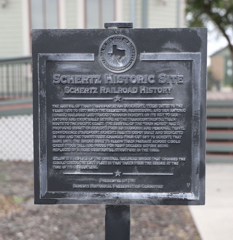
Photographed by Dave W, March 7, 2026
1. Schertz Historic Site Marker
The arrival of train transportation in Schertz, Texas dates to the years 1876 to 1877 when the Galveston, Harrisburg, and San Antonio (GH&SA) Railroad laid tracks through Schertz on its way to San Antonio and eventually beyond as the transcontinental train route to the Pacific coast. The arrival of the "Iron Horse" had a profound impact on Schertz from an economic and personal travel convenience standpoint. Schertz had its depot built and dedicated in 1899 and the town's name changed from cut off to Schertz that same date. The bridge built to allow train passage across Cibolo Creek stood tall and proud for many decades before being replaced by a more substantial structure in the 1980s.
Below is a replica of the original railroad bridge that crossed the Cibolo Creek. The date plate is that taken from the bridge at the time of its dismantling.
Erected by Schertz Historical Preservation Committee.
Topics. This historical marker is listed in these topic lists: Industry & Commerce • Railroads & Streetcars. A significant historical year for this entry is 1877.
Location. 29° 34.056′ N, 98° 16.288′ W. Marker is in Schertz,
this page online

Regionally, this marker is in the Hill Country and in the San Antonio Metropolitan Area. It is also in the American South. Globally, it is in North America, a Gulf of Mexico state, the Western Hemisphere, the Western World, and the Anglosphere. Historically, it finds itself in what was once New Spain, the Republic of Texas, and one of the Confederate States of America.
Other nearby markers. At least 8 other markers are within 3 miles of this marker, measured as the crow flies: Schertz (here, next to this marker); Edens Cemetery (approx. 2 miles away); House and Ownership (approx. 2.1 miles away); Garden (approx. 2.1 miles away); The Smoke House (approx. 2.1 miles away); Cane Press and Fire Pit (approx. 2.1 miles away); Barn (approx. 2.1 miles away); The Harrison House (approx. 2.1 miles away).

Photographed by Dave W, March 7, 2026
2. Schertz Historic Site Marker
Credits. This page was last revised on March 20, 2026. It was originally submitted on March 19, 2026, by Dave W of Co, Colorado. This page has been viewed 33 times since then. Photos: 1, 2. submitted on March 19, 2026, by Dave W of Co, Colorado. • James Hulse was the editor who published this page.
