
Schomberg in York Region, Ontario — Central Canada (North America)
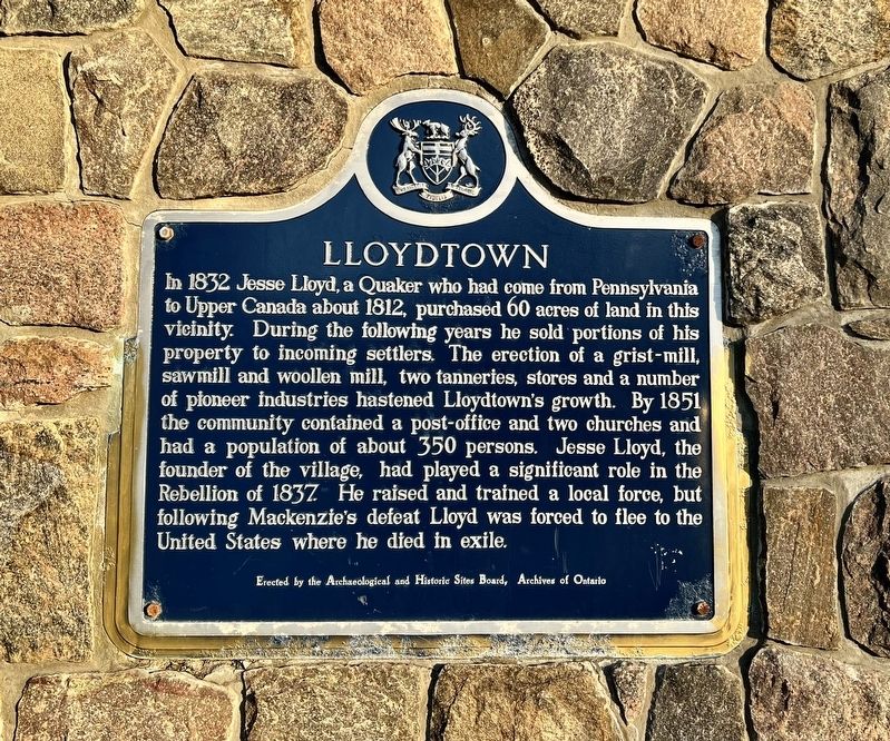
Lloydtown
Photographed by Tim Boyd, March 9, 2026
1. Lloydtown Marker
Erected by Ontario Archaeological and Historic Sites Board.
Topics and series. This historical marker is listed in this topic list: Settlements & Settlers. In addition, it is included in the Canada, Ontario Heritage Trust series list. A significant historical year for this entry is 1832.
Location. 43° 59.407′ N, 79° 41.73′ W. Marker is in Schomberg, Ontario, in York Region. It is at the intersection of Rebellion Way and Little Rebel
this page online

Regionally, this marker is in Greater Toronto, specifically on the Golden Horseshoe, in the York, Durham and Headwaters Area, and in the Toronto Metropolitan Area. It is also in Central Canada. Globally, it is in North America, the Western Hemisphere, the Western World, and the Anglosphere. Historically, it finds itself in what was once a British colony, the Viceroyalty of New France, the Haudenosaunee (Iroquois) Confederacy, and Rupert’s Land.
Other nearby markers. At least 8 other markers are within 14 kilometers of this marker, measured as the crow flies: St. Margaret of Scotland, Tuam (approx. 3.8 kilometers away); Turner Park (approx. 8.6 kilometers away); Sir William Mulock (approx. 11 kilometers away); Sir William Osler (approx. 11 kilometers away); Masonic Arms Hotel (approx. 12.8 kilometers away); The Scotch Settlement (approx. 12.8 kilometers away); Kinghorn School (approx. 13.7 kilometers away); Laskay Hall (approx. 13.8

Photographed by Tim Boyd, March 9, 2026
2. Lloydtown Marker
Also see . . . Rebellion in Upper Canada. The Canadian Encyclopedia website entry:
After the War of 1812, there was growing discontent in Upper Canada with the elite clique of politicians and officials known as the Family Compact. The Compact dominated the running of the government. They controlled the system of patronage throughout the colony and used political office and influence to further their own business interests. There was also popular opposition to land-granting practices. These policies favoured recent emigrants from Britain and the Church of England and its supporters over other Protestant groups. The disapproval of this was strongest among the so-called late Loyalists and their descendants.(Submitted on March 20, 2026, by Tim Boyd of Hamilton, Ontario.)
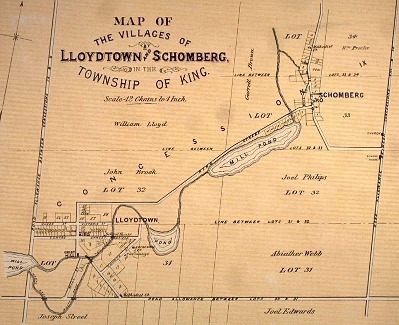
3. Lloydtown in 1878
Wikimedia Commons (public domain)

Photographed by Tim Boyd, March 9, 2026
4. “The Rebel”
A statue, in the park across the road from the marker, dedicated to Lloyd and others who participated in the 1837 Rebellion.
Credits. This page was last revised on July 5, 2026. It was originally submitted on March 20, 2026, by Tim Boyd of Hamilton, Ontario. This page has been viewed 9 times since then. Photos: 1, 2, 3, 4. submitted on March 20, 2026, by Tim Boyd of Hamilton, Ontario. • Andrew Ruppenstein was the editor who published this page.
